Country:

 City:


By car on the D315, which runs along the right bank of the Rhône and connects Pierre Bénite to Vernaison, park in the car-share car park situated between the junctions of Avenue Charles de Gaulle to the south and Côte Carmagnac to the north. Head towards the latter.
(S/E) At the Rond Point Bernard Clavel signpost, turn right towards Île Tabard. Cross the D315 with care and walk down Rue de la Halte. Cross the level crossing to reach a junction.
(1) At the Île Tabard sign, turn right onto the road towards Lône Ciselande. At the end of the road, go through the barrier and continue straight on. You will reach a junction of paths.
(2) At the sign (unlabelled), turn left towards Lône Ciselande. On the right, ignore the first path (not shown on maps) and take the second one, which runs alongside a small Rhône diversion canal. Walk past some Lônes.
(3) At the Lône Ciselande sign, head up the short, steep slope on the right towards Bernard Clavel. At the top, keep to the left and walk through the woods to reach a crossroads. Turn right, cross a footbridge and you’ll come out onto Rue Port Puys.
(4) At the Bernard Clavel sign, turn left towards the Bassin de Joutes. Go under the bridge and take the path to the right of the statue of the jousters.
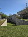
(5) At the ‘Bassin de Joutes’ sign, head towards Les Berges. Walk alongside the Bassin de Joutes, then stay on the marked path closest to the bank until you reach a junction.
(6) At the ‘Les Berges’ sign, continue straight ahead towards Claudius Delorme Station. Turn right to go round the pumping station’s canal. Head back up towards the railway line.
(7) At the ‘Station Claudius Delorme’ sign, do not cross the level crossing; instead, carry straight on following the sign for ‘Pile de Traille’. The path moves away from the railway line and shortly afterwards reaches a fork. Ignore the path on the right and continue along the marked path opposite, which runs alongside the Rhône. At the fork in the road near Grigny station, head away from the riverbank along the most obvious path. You’ll emerge at a developed area; follow its access path uphill and go through a gate. Opposite, you’ll reach a junction in front of a stone tower.
(8) At the ‘Pile de Traille’ sign, ignore its directions. Cross the level crossing and head up Rue Adrien Dutartre. Cross the D315 with care, follow it to the left and, immediately at the Fork in the road, turn right onto Rue Pierre Semard. After 120 m, turn right onto Rue Jean Sellier and continue to the road known as Chemin des Cazardes.
(9) At the ‘Les Cazardes’ sign, climb the steps opposite towards Montmelipe. Cross Avenue de la Colombe and climb the steep Chemin de la Côte Perelle opposite, which ends at a large rock standing in the middle of the path.
(10) At the ‘Montmelipe’ sign, turn left towards Le Plateau. Immediately at the junction, take the D117E on the right, then 200 metres further on, turn onto the path on the left (closed to vehicles). At the crossroads near a small cottage in the fields, keep slightly to the right and join a road, Chemin du Cimetière.
(11) At the sign for Le Plateau, turn right towards Les Brosses. Ignore the first road on the right and, 30 metres further on, take the road on the left, Le Chemin des Bosses. In a bend, you’ll come to a junction with footpaths.
(12) At the ‘Les Brosses’ sign, ignore its directions. Stay on the descending road, ignoring one turn-off on the right and then another on the left, and follow a wall until you reach a crossroads.
(13) At the ‘Les Charmes’ sign, follow ‘Les Vallières’ to the right via the Chemin de Châteaubourg. At the top of a short hill, you’ll come to a Fork in the road
(14) At the ‘Les Vallières’ sign, head towards Châteaubourg straight ahead. Follow the disused railway line, then leave it behind as you climb a hill. You’ll reach a junction in front of a business park.
(15) At the sign for Châteaubourg, head towards La Sauvagère, keeping to the same road on the right. Cross the D117 with care and continue along the path opposite until you reach a junction.
(16) At the sign for La Sauvagère, take the path on the right up towards L’Étang. Continue along Rue Ninon Vallin until you reach a junction.
(17) At the sign for L’Étang, head down Chemin de l’Étang towards Les Mouilles. After a right-hand bend, at the next bend on the left, ignore the road on the right and the one after that. After a short climb, you’ll reach a junction. Ignore the road opposite and head down Chemin de la Côte Rouge, going against the flow of traffic to the left. At the bottom, join Chemin de Gravignon; follow it to the right for 20 metres, then keep to the path on the left.
(18) This path runs between the road on the right and a barrier on the left, which surrounds a nature reserve centred on a lake fed by the Garonne in a former quarry. About 100 metres after a left-hand bend, behind a wooden gate, you’ll come to a junction of roads on the right. Take the road opposite and, 50 metres further on, you’ll reach a Fork in the road near a small country cottage.
(19) At the ‘Les Mouilles’ sign, continue straight on towards the old station along the small road known as the Chemin des Mouilles. You will come out onto Rue de Coutois; turn left onto this road and follow it to a junction.
(20) Follow the D36, Route de Charly, to the right for 100 metres and, at the Fork in the road, keep left onto the Chemin des Cailloux. After a climb, you’ll reach a junction.
(21) At the ‘Les Cailloux’ sign, turn left up Rue J-B Mermet towards Bois Vert and, 50 metres further on, you’ll reach a junction.
(22) At the ‘Bois Vert’ sign, follow the sign for Champin-Jaillet to the right. In front of a farm, the road continues as a track veering slightly to the right. Pass a left-hand bend, then, after a right-left combination of bends, turn onto the path on the right. You’ll reach Route de la Rumeyère; follow it to the left for 200 m to reach a junction.
(23) At the Champin-Jaillet sign, head up to the right towards Champemin. Pass a track on your right and make your way to a high point flanked by an aerial. Turn left, take a left-right bend and proceed to the junction with a track.
(24) At the sign for Champemin, head right towards Les Vergers. Turn onto the first path on the left, just before the sign for Les Vergers. Join a road, the Chemin des Grabelières. Follow it to the right and, at the top of the hill, you’ll reach a junction.
(25) At the ‘Le Haut de Rivoire’ sign, head straight on towards Le Virieux.
(26) At the ‘Le Virieux’ sign, carry on straight ahead towards Le Biar. At the roundabout, take the Route de Vourles straight ahead. Ignore the various side paths, go through a copse and, at the top of a hillock, you’ll come to a crossroads.
(27) At the sign for Le Biar, head straight down towards Champvillard and you’ll come to Rue de Boutan.
(28) At the sign for Champvillard, turn right onto the Rue de Boutan towards La Combe. Go round a right-hand bend and you’ll reach a junction.
(29) At the ‘La Combe’ sign, continue straight ahead along the road towards the Chemin du Pavillon. At the stop sign, carry on straight ahead and, 50 metres further on, turn right onto the Chemin des Flaches to reach a junction.
(30) At the ‘Chemin du Pavillon’ sign, follow the sign for ‘Les Sélettes’ to the left. Pass through a barrier and stay on the main track, ignoring the side tracks. The track continues as a road and leads to a junction with the Chemin des Hauts de Sélettes.
(31) At the ‘Les Sélettes’ sign, carry on straight ahead towards Carmagnac. Walk past the Gilbert Billon school and, at the roundabout, take the road straight ahead – the Chemin de Vénières, which is closed to vehicles. At the top, you’ll reach a junction.
(32) At the ‘Carmagnac’ sign, go down the street on the right towards the Bernard Clavel roundabout (S/E).
 Visorando Member
 Moderate


 Easy

 Association / Club / Walk leader