Country:
 City:


Park in Neydens, in the car park of the nursery on Chemin Neuf.
(S/E) Take the path at the corner of the car park, on the campsite side, cross the playground and continue along the path which goes round the campsite to reach the ‘l’Épine’ signpost.
(1) Follow the disused tarmac road to the right for about 600 metres, crossing the bridge over the Ruisseau de Chosal.
(2) A sign invites you to take the path down to the right. Continue down the slope, cross the small bridge over the Nant de Ternier stream: note the stepping stones created in the Middle Ages to cross the stream (information board). Then follow the tarmac road, which climbs steeply to the hamlet of L’Épine and then more gently towards the hamlet of Pernin, which you pass through on the right. Go through the tunnel under the county road.
(3) Immediately head up the road to the left, towards Les Éplanes. Walk alongside the wall of the recycling centre, then take the path on the right and pass the skate park.
(4) At the junction, head down the path on the right towards La Selle. A few dozen metres further on, turn right again to follow the track through the trees. After about 200 metres, continue along the path between a fence on your right and the Aire stream on your left.
(5) Cross the metal footbridge under the A41 viaduct and follow the path uphill to the plateau to reach La Selle.
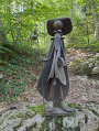
(6) Take the road on the left, which descends steeply into the hamlet: as you pass, note an old stone basin fed by a natural spring and a carved tree. The road continues as a track, which you follow for about 200 m.
(7) Turn sharply left (90°) down into the field, cross the footbridge over the Ruisseau l’Aire and take the steps cut into the embankment. At the other end, cross the meadow for 50 m then walk along its edge, turning right onto the Chemin du Crottay. Before entering the woods, a sign on your right invites you to take a short round trip to see a remarkable monolith by the stream.
(8) Return to Chemin du Crottay, which leads you to the “RD37” signpost.
(9) Turn right onto the D37 and head down to the village of Feigères. Turn right at the roundabout at the village entrance and continue down to the Lavoir du Tir, a former wash house and nature reserve. The path then descends to the left. At the bottom, you’ll come to the Ruisseau l’Aire; cross the footbridge and, on the other side, you’ll reachthe renovated former Moulin Desborne building. Walk round this building to reach an iron staircase to the left of the path.
(10) Take these steps and follow the path uphill. Then follow the stony track to the left as far as the hamlet known as ‘Sur le Moulin’.
(11) Turn left between the houses. After 300 metres, on your left, you’ll find the ‘Chapelle Notre-Dame de la Salette’: there’s an information sign.
(12) Retrace your steps and walk down the road to the left for about 200 m. Then take the path on the right down to the road below. Do not take this road; simply go round the ravine to the right, then climb up the wooden steps through the forest, turn left and finally head back down to the road.
(13) This time, take this road, keeping to the right-hand side; go through the tunnel under the motorway, walk uphill for about 200 m until you reach the sign indicating you should take the path on the right. A few dozen metres further on, follow the path on the left into the woods, which will lead you to the ‘wetland’ sign.
(14) Turn left towards the Moulin des Mouilles: there is an information sign for the wetland on the left-hand side.
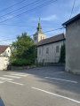
(15) After about 500 m, following the signs, take the small tunnel on the right under the D1201. On the other side, go straight on (north-east) along the Route de Neydens. Turn right after the school and walk past the church. You’ll soon reach the car park for the local nursery (S/E).
 Visorando Member

 Moderate
 Difficult