Country:
 City:


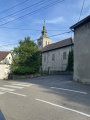
Parking is available at the municipal nursery car park in Neydens, near the church.
(S/E) Take the path at the corner of the car park on the campsite side, cross the playground and continue along the path which goes round the campsite to reach the hamlet of L’épine.
(1) Follow the disused tarmac road to the right for about 600 metres and cross the Ruisseau de Chosal.
(2) A sign invites you to take the path down to the right. Continue down the slope, cross the small bridge over the Nant de Ternier stream: note the stepping stones created in the Middle Ages to cross the stream (information board). Then follow the tarmac road, which climbs steeply to the hamlet of ‘L’Épine’ and then more gently towards the hamlet of Pernin, which you pass through on the right. Go through the tunnel under the county road to reach the hamlet of Pernin.
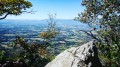
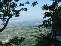
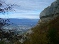
(3) Turn right towards Énex. Cross the bridge over the motorway (beautiful view of the Geneva Basin). At the hamlet of Énex, turn right towards Sur le Moulin along a descending path that crosses farmland.
(4) Go round the first house on the right, following the sign for “Tunnel A41”.
(5) Take a detour to the left to quickly reach the Notre-Dame de la Salette Chapel (information sign).
(6) Retrace your steps.
(5) Continue along the road (to the left as you return from the chapel) for about 200 m. Then take the path on the right down to the road below. Do not take this road; simply go round the ravine to the right, climb up the wooden steps into the forest, then turn left to finally come back down onto the road.
(7) This time, take this road, keeping to the right-hand side; go through the tunnel under the motorway, walk uphill for about 200 m until you reach the sign indicating you should take the path on the right. A few dozen metres further on, follow the path on the left into the woods, which will lead you to the ‘wetland’ sign.
(8) Turn left, towards the Moulin des Mouilles (information sign for the wetland on the left-hand side).
(9) After about 500 m, following the signs, take the small tunnel on the right under the D1201. On the other side, go straight on (north-east) along the Route de Neydens. Turn right after the school and walk past the church. You’ll soon reach the car park for the local nursery (S/E).
 Visorando Member
 Moderate

 Difficult