Country:
 City:
City:


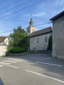
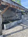
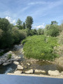
The route starts in the village of Saint-Julien-en-Genevois. For those arriving by car, you can park in the car park opposite the “Les Célestines” residential complex on Chemin de Certoux (a cul-de-sac). There’s always space as this is the complex with the most parking spaces.
(S/E) Walk a few steps northwards and you’ll come to a tarmac path that winds through a forest on a gentle downward slope. A stone in the middle of the path prevents cars from passing. This is where the walk begins. Carry on straight ahead and you’ll reach the Chemin des Crottes – which is ‘crotté’ (meaning ‘muddy’) in name only – and which descends steeply to the old Certoux customs house, which is now a private residence (I presume; Swiss friends, please feel free to correct me if I’m wrong).
(1) At the junction, with the old customs house on your right, turn left and follow the road. The footpath has been worn into the grass by walkers; stick to this rather than the road, which can be busy. Return to the road for a few metres, cross a small bridge over a dry riverbed, and continue straight on until you reach the metal bridge over the Aire.
(2) Do not cross the bridge, but turn right and follow the banks of the Aire to another bridge.
(3) Cross this wooden-decked bridge and enjoy the lovely views over the River Aire.
Turn right after the bridge. Follow the Chemin des Bullets, a white track, keeping the river on your right – be careful, as the river is there but you may not necessarily be able to see it. You’ll soon pass under a bridge and arrive at the Promenade de l’Aire. Follow it for almost its entire length – about 1.5 km – until the dirt track splits in two at a three-way junction.
(4) Take the path on the left, which will soon head towards Confignon, and follow it until you reach a tarmac section that climbs quite steeply, though its pretty name will make you forget the incline (Promenade des Rêveries). Walk alongside the town hall wall until you reach a crossroads
(5) Cross the road; you’ll see a covered fountain on your right, then climb a flight of steps which brings you within sight of Confignon Church.
(6) Leave the church on your right as you continue along the road; when you reach a three-way junction, take the right-hand branch. Carry on straight ahead, following the cemetery wall, then take the first left.
(7) At the junction, carry on along the Chemin de la Charroyette, then the Ranchée, veering slightly to the left. It’s a bit of a maze, but as long as it’s going uphill, you’re on the right track.
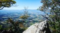
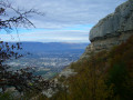
(8) Take the opportunity to admire the lovely houses on Chemin des Failles and Chemin des Côtes. You’ll reach the ridge line, where the view opens up, allowing you to admire the Geneva countryside and its vineyards, with Saint-Julien a little further on against the backdrop of the Salève. Carry on along the ridge line followed by Chemin des Côtes.
(9) You’ll pass a cross marking a mission from 1850. Carry straight on along the Chemin des Muscadelles; on your right, you’ll see the Colline du Signal. This is the highest point in the canton of Geneva, at 510 m. Turn right, then left to reach it. Take the opportunity to climb up to the top; an orientation table will help you identify the surrounding peaks. A lovely view in fine weather.
(10) Head back down to rejoin the Chemin des Muscadelles, which you left earlier. Go round the buildings along the Chemin de Bozard for about a hundred metres, then turn left onto the Chemin de Champ Devant, which leads to the village of Sezenove. On your left is a charming little house – I believe it’s home to a painter – with a tree decorated with fairy lights (which might inspire the children). Carry on straight ahead to the covered fountain in Sezenove.
(11) Take the Chemin des Grands Buissons opposite and follow it to the Route de Pré Lauret. Cross the road and carry on straight ahead along the same path. You’ll then walk alongside a wetland area, the ‘bois noirs’, on a good stony path. When you reach a fork, turn left onto the Chemin de la Douane. Carry on along this path, passing a fantastic caravan on your right; there are sometimes sheep there, but I didn’t see any on my last visit. Carry on straight ahead until you reach… you’ve guessed it… a customs post… don’t worry, it’s not Bardonnex; it’s a pretty house that must still be in use given its general condition, although I still wonder why there was ever a customs post at this spot.
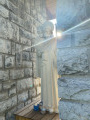
(12) With the customs post ahead of you, turn right onto a grassy track – which gets quite muddy when it rains – known as the Chemin de la Feuillée, which winds up the hill towards the Laconnex vineyards. Carry on straight ahead, then turn left onto the Route du Coteau. Carry on straight ahead, cross the Route de Soral, then take the path opposite. You’ll then be back on French territory. Carry on straight ahead until you reach the first houses in Thairy and a pretty statue of Notre-Dame-des-Champs.
(13) Carry on straight ahead, then turn into the first street on the left until you reach the cemetery wall; after a few metres, turn right and you’ll come out onto the Place de Thairy with its pretty church, war memorial and lovely school. Once you’ve left the square, with the church in front of you, turn left along the school wall and follow Rue Louis Martel (with Thairy’s fortified house on your left), which descends steeply towards the fields below. Carry on straight ahead, crossing the Route de Norcier
(14) To see the sports ground, you need to walk a few metres straight on, leaving the children’s playground behind you. As far as we’re concerned, leave the playground on your right then take a clearly visible path on the left which heads into and runs alongside the woods. Follow this path as it begins to climb, until you come out onto a tarmac road. It’s a path that’s ‘Crotte’ in name only. Turn right, walk for about a hundred metres; a stone in the middle of the path prevents cars from passing. You’ve arrived at the car park opposite the “Les Célestines” residential complex (S/E).

 Local authority

 Visorando Member
 Easy
Easy 
 Difficult