Country:

 City:


Park in Neydens, in the nursery car park on Chemin Neuf.
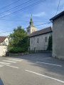
(S/E) Head towards the church and take Route de Neydens on the left.
(1) In the hamlet of Les Mouilles, turn left twice to head up Route des Mouilles.
(2) After the junction with Chemin de l’Épine, Route des Mouilles is closed to vehicles: follow it to the end to reach the D1201, then take the roundabout on the left at the entrance to the village of Le Chable. Keep to the left at the roundabout and take Route d’Annemasse on the left for about 60 metres.
(3) Take the tarmac section on the right for 100 metres to find a path running alongside a stream, the Nant du Comptant. Then join the Route de la Croisette, which you should follow to the right for 80 metres. Next, take the path that climbs to the left up to the Route du Salève, near the Beaumont cemetery. Follow the road to the left for 200 metres to reach the church.
(4) Go round the church on the left, then keep to the right onto the Chemin de la Thuile. After 100 metres, take the path on the left known as ‘Sous le Château’, which leads onto a track in the middle of a field that you climb up. Go round the copse on the left to reach the hamlet known as ‘le Château’.
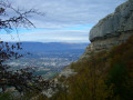
(5) Walk along the left-hand edge of the woodland. Enjoy the view over the Genevois plain and join the Route des Pitons, which you follow to the right for about 40 metres before heading down to the left and crossing the wooden footbridge.
(6) Take the path leading uphill to the right, then turn right again about a hundred metres further on; after 100 metres, turn slightly right once more to reach Chez Marmoux.
(7) Follow the road to the left, then turn left in front of the chalet. The road turns into a steep track and enters the woods. Continue straight on and go through a metal gate, using the pedestrian gate to the right of it. After 100 metres, you’ll reach a junction at the edge of the woodland.
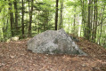
(8) Head down the path to the left through the hedge, go through the metal gate and follow the path as it descends quite steeply into the woods: on your left, at the start of the descent, you’ll see the monolith known as the ‘Pierre des Trois Communes’.
(9) At a place known as Les Teppes de Verrières, continue down the path, following the sign for “Carrière de molasse”. The path curves to the left before turning sharply to the right and heading due north.
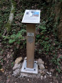
(10) At the crossroads, take the path on the right uphill to pass in front of the old molasse quarry: look out for the information board. Use the steps to make your way back down to the upper part of Verrières.
(11) Head down opposite towards the village of Verrières. Walk through the village, keeping in the same direction, to reach the Route de la Croisette (D145). Take the road on the left and, at the junction, head down to the right along the Chemin de Verrières (tarmac): whilst you’re there, stop at the Verrières chapel to read the information there. At the bottom of the descent, take care when crossing the narrow ‘S’ bend in the road at the entrance to Moisin.
(12) Turn left and walk straight through the hamlet, heading south-west. At the last houses, turn right downhill, cross the D18 with care, and turn onto the Chemin des Mulets almost directly opposite. Go round the campsite on the left, cross the playground and follow the campsite fence to the nursery car park (S/E).
 Association / Club / Walk leader
 Easy

 Visorando Member
 Difficult