


Pascalstbo

 Visorando Member
 Premium user
Sign up:
Published route(s)
 Circular family walk around Saint-Beaulize
 1.43 mi
 +285 ft
 -289 ft
 0h 55
 Easy
 Departure from Saint-Beaulize (Aveyron)
Situated on the south-western slope of the Larzac plateau at an altitude of 530 metres, the village of Saint-Beaulize is dominated by a cirque formed by high limestone cliffs (reaching 860 metres). In the Middle Ages, the village was known as Saint-Beaulize-de-l’Irondel. It was donated by the Bishop of Rodez to Lodève Abbey, which in turn transferred it to Nonenque Abbeyin the13th century.
Plo de l’Imbernas circular walk from Saint-Beaulize
4.72 mi
+774 ft
-768 ft
2h 50
 Moderate
Departure from Saint-Beaulize (Aveyron)
The Plo de l’Imbernas (or Imbernas plateau), situated in the commune of Saint-Beaulize, is geologically characterised by its location within the Larzac’s ‘avant-Causses’. Unlike the arid limestone massif of the Larzac (the Grands Causses), the Plo de l’Imbernas lies on the lower sedimentary edge. It is a sloping plateau that forms the transition to the surrounding valleys (the Sorgue valley). Dry grasslands and natural meadows alternate with pastureland, cultivated fields, copses and shrub hedgerows, all of which create an environment particularly favourable to pastoralism but also to the presence of exceptional biodiversity: birds of prey, orchids, etc.
The Corniches of the Cirque de Saint-Beaulize
 3.25 mi
+830 ft
-837 ft
2h 15
Moderate
Departure from Saint-Beaulize (Aveyron)
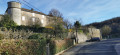
Located on the south-western slope of the Larzac Plateau at an altitude of 530 m, the village of Saint-Beaulize is dominated by a cirque formed by high limestone cliffs (reaching 860 m) commonly known as molaires.