


 Country:

 City:


Park in the walkers’ car park on the village square.
(S/E) Walk down Rue des Remparts.
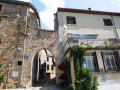
(1) At the end, take Rue de l’Église on the right. Walk past the town hall, the war memorial and then the church. Continue straight on along Rue du Four (a covered passageway between two houses). Carry on along Rue de l’Ancienne École and head down to the departmental road (D93) via a flight of wide steps.
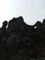
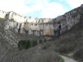
(2) Turn right towards Fondamente for a few dozen metres, then take the road that climbs to the right and ends in a cul-de-sac in front of a house. Then take the path that climbs to the right, heading south-south-west. During this climb, admire the views to the north over the Saint-Beaulize cirque. After about 400 m, you’ll come to a lovely path which you take on your left, continuing uphill. Follow this path for another 400 m, then leave it to take a track that branches off to your left: cairn.
(3) This path runs alongside a dry stream on its left bank (which may fill with water during storms) for about a hundred metres before veering sharply to the left, crossing the stream and reaching a wooded area bordering a very large field. Continue through this wooded area for another hundred metres or so before emerging onto a track at the edge of the field.
(4) Take this track on your right, heading south-south-west. After about 600 metres, the track reaches a very large field, which it follows along the edge of the woodland before reaching a junction.
(5) Take the track on the right to continue skirting the field and reach the buildings of the Imbernas farm, just before a large agricultural shed.
(6) Ignore the tarmac road branching off to the right and follow the track to the left. Pass under the power line and stay on this track, which bends to the right and joins the access track to the Plo del Montal wind turbines.
(7) Leave this track on your left and continue straight on for about 600 m.
(8) Turn right to cross a winding field. At the end of the field, the shaded track begins to descend. Follow this track for about one kilometre, passing under the power line again, until you come out onto a tarmac road.
(9) Cross the road and rejoin the track opposite, continuing until you reach a small tarmac road.
(10) Turn left, cross the railway line at the level crossing and head down Rue du Barry to the right.
(1) Turn right just before the town hall to return to the car park (S/E).
 Visorando Member

 Easy
 Very difficult

