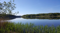
Circular path and switchbacks from Meaulne to Urçay

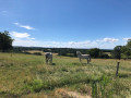
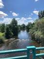
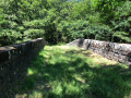
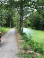
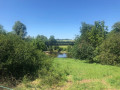
This long walk will take you through unexpected and sometimes surprising landscapes. It is an extended version of circular walks already on offer, such as: La Boucle du Vernet and La Boucle d’Urçay. The greenway, recently upgraded with cycle and footpaths, forms part of the route and lends a very special atmosphere to the end of the walk.

Details

3425168
Creation:
Last update:
Last review:
  • Walking
    Activity: Walking
  • ↔
    Distance: 9.73 mi
  • ◔
    Average duration: 4h 55 
  • ▲
    Difficulty: Moderate

  • ⚐
    Back to start: Yes
  • ↗
    Ascent: + 531 ft
  • ↘
    Descent: - 558 ft

  • ▲
    Highest point: 771 ft
  • ▼
    Lowest point: 522 ft
  • ⚐ Country: France
  • ⚐ City: Meaulne (03360)
  • ⚑
    Start/End: N 46.606494° / E 2.586936°
  • ❏
    IGN map(s): Ref. 2426SB, 2427SB
  • Hour-by-hour weather

Photos

Description of the walk

Park near the D312 junction in the hamlet of La Chapelle.

(S/E) Head up to the right along the Route de la Chapelle and join theGR®41; see the note in the ‘Practical Information’ section.

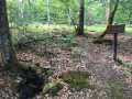
(1) Set off straight ahead onto theGR®41, following the red and white markings. You’ll reach the junction with the path leading to Montbout.

(2) Carry on to the right along theGR®, and you’ll soon come to a small pond. Walk past it and you’ll immediately come to a crossroads of footpaths.

(3) Leave theGR®, take the path on the right, carry on, cross the road and enter Pontoux. Continue straight ahead, crossing another road. Cross the railway line and reach the riverside path.

(4) Turn left onto it and carry on to the level crossing. Turn right and you’ll come to a four-way junction straight away.

(5) Head straight on along Rue de la Gare until you reach the junction with Rue du Commerce.

(6) Turn left onto this street to reach the church. At the end of the street, continue along the footpath and cross the D445. Follow the Chemin des Combles to reach the hamlet of Les Pics.

(7) At the end of the street, opposite the farm, turn right onto Chemin de Vaux.

(8) Here, make a zigzag turn to take the path that runs alongside the field and descends steeply. Cross the Ruisseau du Bignon. Then begin an easy climb that ends at the junction with the Route du Stade.

(9) Turn right onto this road until you reach the junction with the D2144.

(10) Cross the road, facing the junction, and turn left onto the path running parallel to this road. Continue along a path that widens and join a four-way junction with roads running at right angles.

(11) Turn right onto Rue Le Vernet. You’ll reach the hamlet of Le Verner at the junction with the D312, just before the bridge.

(12) Turn right onto the path running alongside the River Cher. Carry on and pass through the Tizais neighbourhood. After the town hall, turn left onto the Route Nationale, then turn left at the next junction to reach the junction with Rue de la Gare, which you passed on the way there.

(6) Follow the route back in the opposite direction to reach the level crossing junction.

(5) Just before this junction, turn left to follow the canal along the newly developed greenway. Continue on to reach the car park at the Hameau de la Chapelle (S/E).

Waypoints

  1. S/E : mi 0 - alt. 558 ft - Crossroads at the Hameau de la Chapelle
  2. 1 : mi 0.46 - alt. 692 ft - GR41
  3. 2 : mi 1.55 - alt. 722 ft - GR41 Montbout
  4. 3 : mi 2.09 - alt. 692 ft - Pontoux crossroads
  5. 4 : mi 3.03 - alt. 538 ft - Path along the riverbank
  6. 5 : mi 3.42 - alt. 551 ft - Crossroads with level crossing - Gare d'Urçay
  7. 6 : mi 3.64 - alt. 548 ft - Urçay
  8. 7 : mi 4.31 - alt. 768 ft - Les Pics
  9. 8 : mi 4.54 - alt. 682 ft - Path
  10. 9 : mi 4.89 - alt. 656 ft - Route du Stade
  11. 10 : mi 5.21 - alt. 600 ft - Path along the Route Nationale
  12. 11 : mi 6.02 - alt. 646 ft - Route du Vernet
  13. 12 : mi 6.34 - alt. 558 ft - Path before Pont du - Le Cher
  14. S/E : mi 9.73 - alt. 558 ft - Crossroads at the hamlet of La Chapelle

Notes

(S/E) Note: for safety reasons, avoid theGR® 41 at the hamlet of Valigny, in the commune of Meaulne, as a dog may occasionally behave erratically here.
Toilets and a water point are located near the church.

Always be cautious and plan ahead when you're outdoors. Visorando and the author of this route cannot be held responsible for any accidents occurring on this route.

The GR® and PR® markings are the intellectual property of the Fédération Française de Randonnée Pédestre.

Reviews and comments

5 / 5
Based on 2 reviews

Reliability of the description
5 / 5
Ease of following the route
5 / 5
Route interest
5 / 5
koalex
koalex

Overall rating : 5 / 5

Date of your route : Mar 24, 2024
Reliability of the description : ★★★★★ Very good
Ease of following the route : ★★★★★ Very good
Route interest : ★★★★★ Very good
Very busy route : No

A really lovely walk.
Done on horseback and by bike.
Thank you

Machine-translated

yparmantier
yparmantier

Overall rating : 5 / 5

Date of your route : Nov 05, 2022
Reliability of the description : ★★★★★ Very good
Ease of following the route : ★★★★★ Very good
Route interest : ★★★★★ Very good
Very busy route : No

A lovely walk with a wide variety of scenery, beautiful views and a completely unexpected return journey

Machine-translated

Other walks in the area

For more walks, use our search engine .

The GPS track and description are the property of this route's author. Please do not copy them without permission.