Urçay circular starting from Le Vernet

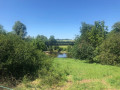
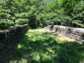
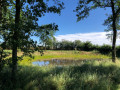
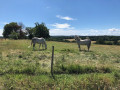
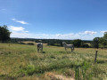
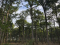
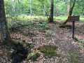
This circular walk will take you along hidden paths and through secluded hamlets – real hidden gems – in the communes of Meaulne, La Perche and Urçay.

Details

3398219
Creation:
Last update:
Last review:
  • Walking
    Activity: Walking
  • ↔
    Distance: 6.84 mi
  • ◔
    Average duration: 3h 35 
  • ▲
    Difficulty: Moderate

  • ⚐
    Back to start: Yes
  • ↗
    Ascent: + 472 ft
  • ↘
    Descent: - 453 ft

  • ▲
    Highest point: 771 ft
  • ▼
    Lowest point: 522 ft
  • ⚐ Country: France
  • ⚐ City: Meaulne (03360)
  • ⚑
    Start/End: N 46.606211° / E 2.595867°
  • ❏
    IGN map(s): Ref. 2426SB, 2427SB
  • Hour-by-hour weather

Photos

Description of the walk

Car park at the glass recycling point near the Vernet bridge in Meaulne

(S/E) From the car park, head towards La Perche by crossing the bridge. You are now on theGR®41, marked in red and white. Cross the Canal du Berry, then the railway line, until you reach the junction with a path on the left.

(1) You are now at a place called La Chapelle. Continue straight on uphill, leaving theGR® for a few hundred metres. See Practical Information.
A few hundred metres further on, rejoin theGR® directly ahead of you.

(2) At the crossroads, continue along the@GR®, turning right and leaving the farm and its buildings behind you. Carry on to the Fork in the road.

(3) Leave theGR® and follow the path on your right towards the hamlet of Pontoux. Walk through Pontoux to reach the junction with the Route de Beuvron.

(4) Cross the road and continue along the path, passing over a bridge spanning the railway line.

(5) At the end of the path, go round the Berry Canal basin on the right.

(6) Once on the bridge over the Cher, turn right towards the centre of Urçay, along Rue de la Gare, until you reach thefirst streeton the left.

(7) Turn left and cross Rue du Commerce until you reach the Route Nationale. Follow it a few metres to the left and cross carefully to head towards the church. Carry on straight ahead and climb the path (watch out, it’s a steep climb!) towards the hamlet of Les Combles.

(8) Cross the junction, continue straight ahead uphill towards the hamlet of Les Pics. Take the right-hand bend onto the track opposite the farm gate. Carry on to the crossroads.

(9) After a few metres, turn left, cross the Route de Vaux and take the path directly opposite you, heading due south.

(10) Cross the Bignon and, at the end of the track, turn right onto the Route du Stade. Head downhill to the A-road.

(11) Cross the A-road carefully and head towards the path running parallel to it. With the A-road on your left, continue until you reach the junction with the Route du Vernet.

(12) Turn right at the junction, go down the local road, and you’ve arrived (S/E).

Waypoints

  1. S/E : mi 0 - alt. 554 ft - Le Vernet recycling centre - Le Cher
  2. 1 : mi 0.6 - alt. 597 ft - The hamlet of La Chapelle
  3. 2 : mi 2 - alt. 722 ft - Monbout
  4. 3 : mi 2.55 - alt. 692 ft - Exit from the GR®41
  5. 4 : mi 3.18 - alt. 636 ft - Route de Beuvron
  6. 5 : mi 3.47 - alt. 535 ft - La Perche – Berry Canal Basin
  7. 6 : mi 3.94 - alt. 551 ft - Urçay – Pont du Cher
  8. 7 : mi 4.13 - alt. 548 ft - Rue du Commerce
  9. 8 : mi 4.62 - alt. 719 ft - Chemin des Pics
  10. 9 : mi 5.04 - alt. 682 ft - Trail
  11. 10 : mi 5.38 - alt. 656 ft - Route du Stade
  12. 11 : mi 5.67 - alt. 600 ft - Path along the Route Nationale
  13. 12 : mi 6.5 - alt. 646 ft - Route du Vernet
  14. S/E : mi 6.84 - alt. 558 ft - Le Vernet recycling centre - Le Cher

Notes

(1) From the hamlet of La Chapelle, theGR® passes through the hamlet of Valigny, which is guarded by dogs that are sometimes off the lead.

As you approach the church, you’ll pass some public toilets.
Make sure you bring insect repellent to ward off ticks. There’s no shortage of these little creatures in the area...

Worth a visit

- The River Cher and its bridges
- The Berry Canal
- The Pontoux Bridge
- TheGR®@41 and its lovely scenery
- The panoramic view from the hamlet of Les Pics

Always be cautious and plan ahead when you're outdoors. Visorando and the author of this route cannot be held responsible for any accidents occurring on this route.

The GR® and PR® markings are the intellectual property of the Fédération Française de Randonnée Pédestre.

Reviews and comments

4.8 / 5
Based on 2 reviews

Reliability of the description
5 / 5
Ease of following the route
5 / 5
Route interest
4.5 / 5
CEMILIA18
CEMILIA18

Overall rating : 4.7 / 5

Date of your route : Aug 18, 2024
Reliability of the description : ★★★★★ Very good
Ease of following the route : ★★★★★ Very good
Route interest : ★★★★☆ Good
Very busy route : No

As I live in Saint Amand, about 15 km from the start of the walk, I was delighted to discover some lovely grassy paths, pleasant views over the Tronçais Forest and charming hamlets that I hadn’t known about before. It’s a route I’d love to do again on a mountain bike – the paths are largely accessible, although there’s one section near Point 2 that could do with a bit of maintenance? A lovely and interesting ride!!!

Machine-translated

xantho
xantho

Overall rating : 5 / 5

Date of your route : Jul 08, 2020
Reliability of the description : ★★★★★ Very good
Ease of following the route : ★★★★★ Very good
Route interest : ★★★★★ Very good
Very busy route : No

A really interesting little ride near where I live. I didn’t know these paths. Coming from Vallon-en-Sully, I took the greenway to reach the ‘start’. 27 km. Completed on an electric hybrid bike in 1 hour 45 minutes. A few steep climbs, some of which I had to tackle on foot, and a few lovely surprises. Well worth exploring.

Machine-translated

Other walks in the area

For more walks, use our search engine .

The GPS track and description are the property of this route's author. Please do not copy them without permission.