Country:

 City:
City:


The walk starts from the hamlet of Les Gouttes, but as the route is circular and passes through the roundabout, it can also be started from in front of the state school.
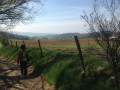
(S/E) From the Route de Rampôt, take the Chemin des Gouttes. Tarmac-surfaced at the start, it quickly becomes a track that winds down between the fields.
(1) Turn right through the small gate to enter the field. Take care: it is easy to miss. The yellow markings to follow at this point may help.
(2) A second gate leads out of the field to the hamlet of La Protière. Continue along a short stretch of road which soon turns back into a path and crosses the Ruisseau du Pont Lyonnais, taking you into the department of the Loire.
The stream marks the border between the Rhône and Loire departments.
Follow the Chemin du Toinon to the left, which passes beneath the hamlet of the same name until it reaches the road to Virigneux at a crossroads, near a large Yellow Cross.
(3) Cross the main road and, from the cross, take the small road that climbs to the right, then turn right again towards the hamlet of Le Bœuf. Pass the first path on the right and take the second path on the right towards the hamlet of A Foix (Foix on the IGN map).
(4) Once you reach the hamlet, turn right twice to reach Saint-Martin-Lestra via the Chemin du Vernay.
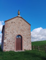
(5) Once in Saint-Martin-Lestra, follow theGR® to the right, which runs alongside the D89 for about 150 m at this point. Continue on theGR®, turning left towards the cemetery. Follow the Chemin des Sirènes to the hamlet of Le Fay, where you will find the calvary.
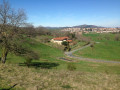
The calvary consists of three crosses. From here, you have a beautiful view of the Monts du Lyonnais, the Monts du Forez and the Plaine du Forez.
(6) Continue along theGR® to Pergerand on a small road. Cross the D116 (still following theGR®) and head down the Chemin du Pont Lyonnais. Cross the Ruisseau du Pont Lyonnais, thus returning to the Rhône department.
(7) When you reach the road (Chemin de Bouchalat), leave theGR® and continue straight on along the road. Cross the D489 with care; the road is quite busy and cars travel fast. Fortunately, visibility is good. After the junction, take the old road branching off to the left.
(8) Head up to the right along the Chemin des Prébendes (or Chemin du Forez on OpenStreetMap) to the Place de la Bourrie, then turn right towards the state school.
Head up Rue de Rampot to Chemin du Goutte, thus returning to the starting point (S/E).

 Visorando Member
 Easy
Easy 
 Difficult