The circular route of the Three Steeples in the Monts du Lyonnais

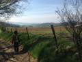
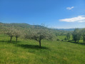
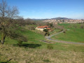
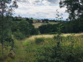
A walk in the Monts du Lyonnais, best enjoyed on a fine spring or autumn day as the route is quite exposed. There are no particular technical difficulties, but you should allow a full day. The route is described starting from Saint-Clément-les-Places. You can set off from any of the three villages along the way.

Details

1971626
Creation:
Last update:
Last review:
  • Walking
    Activity: Walking
  • ↔
    Distance: 13.27 mi
  • ◔
    Average duration: 7h 15 
  • ▲
    Difficulty: Difficult

  • ⚐
    Back to start: Yes
  • ↗
    Ascent: + 1,273 ft
  • ↘
    Descent: - 1,280 ft

  • ▲
    Highest point: 2,241 ft
  • ▼
    Lowest point: 1,795 ft

Photos

Description of the walk

Introduction: As this walk, starting from Saint-Clément-les-Places, does not appear in any guidebook, the signposting on the ground may coincidentally correspond to a section of the route, but that is all.
Important: all places of interest listed in “quotation marks” are signposted on the ground.

Park in the car park at Place des Tilleuls, on the corner by the bar ‘Chez Joëlle’.

(S/E) From the Place des Tilleuls, take the street between the inn and the church which leads down to the “foyer rural” via the “Chemin du Lavoir”, after passing the town hall and the school.

(1) Turn right onto “Chemin des Primevères”, which is tarmac at first and then stony, heading towards “Vers le Grand Vial”.

(2) At the hamlet of Laprat, turn left immediately onto the “Chemin du Grand Robert”, which is slightly undulating. Leave the hamlet and continue, ignoring the road that branches off to the right at the “Grand Robert” farm, and follow the correct path leading to the junction withthe GRP® “Le Tour des Monts du Lyonnais”.

(3) Turn right and follow theGRP® marked in yellow and red, which runs alongside the “Grand Vial” farm and continues along a barely visible grassy track that passes between a vegetable patch and a pond. The track then joins the D4, which you should follow along the verge. Cross the junction at the hamlet known as “Chevaleron”.

(4) A little further on, theGRP® branches off to the right onto a dirt track. Follow it for a good distance:
Please note that it is a little confusing at the junction by the “Chapelle Saint-Bonnet”; follow the VTT 109 signpost on the left.

(5) At the Croix Grand-Borne, cross the D81 and continue straight ahead, still following theGRP® due south. Cross a first road (crossroads) then a second, and you’ll arrive at a horse farm.

(6) Leave theGRP®, which turns left at the junction with a road right next to a horse farm. Carry on straight ahead along a good farm track until you reach a quiet road. Follow it to the right for about a hundred metres.

(7) Turn right onto ‘Impasse Jambost’ and, almost immediately, turn right again onto a grassy track which heads due north at first and then west before crossing a stream to reach ‘Le Noyer’.

(8) Follow the road to the left, which ends in a cul-de-sac at a house. The path then passes to the right and above the house. Follow it to the Tourville manor house (guesthouse).

(9) Turn left onto the path that descends gently alongside Tourville Manor. Continue to “Les Halles”, entering via the “Chemin des Vergers”. Cross the village via the “Route de Saint-Laurent” and the “Rue des Enfants”, then join the D89 via the “Place de l’Étang”. Follow the D89 for a few dozen metres.

(10) Cross it and turn left onto the barely visible “Chemin des Rapaces”, which winds down through the meadows. Follow it to the tarmac track “Chemin des Pierres Blanches”, which you should follow to the right before turning left onto the “Chemin des Mayères” as far as the Christ de la Croix Mayon.

(11) Turn off onto the path on the right, the “Chemin des Caillets”.

(12) Leave this path and take a track that branches off to the right at the bend. Pass through Le Caillet and then La Toranche.

(13) Follow the VTT 111 signposting to Haute-Rivoire. Cross the village, turning immediately right onto “Rue des Grands Jardins”, then onto “Place du Foirail”, and continue along “Grande Rue”, which leads to a crossroads. Turn right onto the Route de Feurs and pass in front of the school.

(14) Leave the Route de Feurs shortly afterwards by turning right onto “Chemin de la Bourrie”, which you should leave by turning left onto “Place de la Bourrie”. Continue along “Chemin de la Garenne”, which leads to the hamlet of “Brondeau” and the D489.

(15) Follow the D489 for a few metres on the left before crossing it and taking the “Chemin des Vernes”, which leads to a small road and theGR®89.

(16) Follow it to the right, heading north-east, until you reach the junction with “Chemin Henry” on the left.

(17) Then follow the very faint yellow markings and local signposts to climb up to Saint-Clément-les-Places.

(18) Turn right before a ford and follow the path (not shown on the IGN map). Join a road near the hamlet of Chez Batton and continue to the hamlet of “Blanc Parron”.

(19) Turn left and follow the path which climbs gently and ends at the hamlet of “Chez Presle”, where you’ll join a small road which you should follow.
Head down to the right along the “Montée du Charron” to reach the car park at “Place des Tilleuls” (S/E).

Waypoints

  1. S/E : mi 0 - alt. 2,083 ft - Place des Tilleuls
  2. 1 : mi 0.25 - alt. 1,975 ft - Foyer rural
  3. 2 : mi 0.54 - alt. 2,093 ft - The hamlet of Laprat
  4. 3 : mi 1.3 - alt. 2,224 ft - Towards the Grand Vial
  5. 4 : mi 2.06 - alt. 2,198 ft - Chevaleron
  6. 5 : mi 3.03 - alt. 2,133 ft - D81 Croix Grand-Borne
  7. 6 : mi 4.28 - alt. 2,119 ft - Horse breeding
  8. 7 : mi 4.67 - alt. 2,037 ft - Impasse Jambost
  9. 8 : mi 5.2 - alt. 2,054 ft - A place known as Le Noyer
  10. 9 : mi 5.76 - alt. 2,021 ft - Manoir de Tourville
  11. 10 : mi 6.61 - alt. 2,005 ft - Chemin des Rapaces. Near the source of the - Combron (cours d'eau) - Affluent de la Brévenne
  12. 11 : mi 7.27 - alt. 2,133 ft - Christ de la Croix Mayon
  13. 12 : mi 7.5 - alt. 2,064 ft - Chemin des Caillets
  14. 13 : mi 8.03 - alt. 1,854 ft - Toranche (rivière) - Affluent de la Loire
  15. 14 : mi 8.85 - alt. 1,949 ft - Chemin de la Bourrie
  16. 15 : mi 9.66 - alt. 2,005 ft - Brondeau
  17. 16 : mi 10.22 - alt. 1,795 ft - GR 89
  18. 17 : mi 11.27 - alt. 1,972 ft - Chemin Henry
  19. 18 : mi 11.87 - alt. 1,870 ft - Path on the right
  20. 19 : mi 12.5 - alt. 2,090 ft - Blanc Parron
  21. S/E : mi 13.27 - alt. 2,073 ft - Place des Tilleuls

Notes

The route is described starting from Saint-Clément-les-Places, but the circular route can be completed equally easily starting from either of the other two villages. Food is available in all three villages, and there are public toilets open all year round.
Please note: the elevation gain is calculated automatically by the Visorando software; whilst in mountainous terrain the contour lines are sufficient to estimate it accurately, I am much more cautious when it comes to flat land or hilly terrain. Allow for an increase of 20% to 30% on the elevation gains indicated.
Map No. 12, ‘Les sentiers du Rhône’, based on IGN data and published by the Department, is the ideal guide for this walk as it includes all the signposting found on the ground and in this description.

Worth a visit

Close to the route: the Saint-Bonnet Chapel, where Montaigne is said to have stopped. Panoramic views of the Monts du Lyonnais and the Forez ridges.

Always be cautious and plan ahead when you're outdoors. Visorando and the author of this route cannot be held responsible for any accidents occurring on this route.

The GR® and PR® markings are the intellectual property of the Fédération Française de Randonnée Pédestre.

Reviews and comments

4.8 / 5
Based on 2 reviews

Reliability of the description
5 / 5
Ease of following the route
5 / 5
Route interest
4.5 / 5
Mike42
Mike42

Overall rating : 5 / 5

Date of your route : Apr 28, 2022
Reliability of the description : ★★★★★ Very good
Ease of following the route : ★★★★★ Very good
Route interest : ★★★★★ Very good
Very busy route : No

A lovely walk in fine spring weather.
Note: to avoid the “Grand Vial”, which is now closed, you need to turn right before point 3. Walk alongside the “Grand Robert”, continue along the path and then the road that leads to point 4.
Thanks for the route map.

Machine-translated

Michel lacroix
Michel lacroix

Overall rating : 4.7 / 5

Date of your route : Sep 05, 2020
Reliability of the description : ★★★★★ Very good
Ease of following the route : ★★★★★ Very good
Route interest : ★★★★☆ Good
Very busy route : No

A lovely route with no major difficulties. It could be classified as moderate were it not for its length, which may put some walkers off. The route offers unobstructed views throughout.
At point 3, the path running between the vegetable patch and the small pond is private and blocked by electric wires. The owner did, however, give us permission to use it.
The only downside is that there’s too much tarmac, which is somewhat to be expected when passing through three villages, but it’s a bit of a shame.
Best done in spring or autumn to avoid the heat, as there are few shaded areas.
Thanks to the author

Machine-translated

Other walks in the area

For more walks, use our search engine .

The GPS track and description are the property of this route's author. Please do not copy them without permission.