Country:

 City:
City:


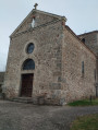
Park in the car park behind the church.
(S/E) Walk past the church, then cross Rue de Paris (D89) and continue straight ahead. After about 100 metres, take the street on the right, then turn left when you reach the T-junction. Walk alongside the pond.
(1) Carry on straight ahead through the woods, then take the path on the left and rejoin the road.
(2) Turn right, continue along the path and walk through the hamlet of Foix until you reach the junction.
(3) Turn right, go straight on at the crossroads and cross the bridge over the Ruisseau de Foix.
(4) About 300 m after the bridge, take the path on the right. Carry on straight ahead until you reach the crossroads with a cross.
(5) Follow the road to the right. Carry on straight ahead, passing an old path on your right which is now blocked by the gate to a private property.
(6) Turn onto the path on the right and head down towards the woods. Carry on straight ahead, passing a path on your right, then go straight across a junction of paths. Continue down the slope to the bridge over the stream.
(7) Continue along the path as it winds its way uphill. Pass the houses at La Combe, take the road on the left, then the path on the right at the bend. Once you reach the hamlet of Bessolle, follow the road to the right, then turn left at the junction.
(8) Take the path on the right before the farm. Follow this path, cross a stream and carry on straight ahead to the edge of the forest. Keep to the right, leaving the path leading to the houses on your left, enter the woods again and reach the opposite edge.
(9) Carry on straight ahead, ignoring a path on your right. Continue to the right along the path leading uphill through open ground and join the road (D89).
(10) Turn right and follow the road carefully for about 200 metres, then take the path on the left. Keep left at the junction and then take the path on the right at the cross to reach Moulin Goubier.
(11) Cross the bridge and continue uphill to the left. Take thefirst path on the right into the woods.
(12) At the junction, turn right. Walk alongside the farm, cross the RD103 and continue straight ahead to reach another road. Carry on to the right.
(13) Keep to the right at the three-way junction, follow the road for about 200 m, then take the path on the right before the bridge. Join a road, turn left to cross the bridge and, at the next junction, take the path straight ahead to join another road.
(14) Continue to the right until you reach the crossroads with a cross (D103). Cross carefully to take the path straight ahead and slightly to the right. Head back up to the village and go straight on to the car park behind the church (S/E).

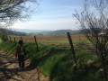
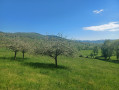
 A lovely walk, perfectly signposted. There were about ten of us on 11 February 2024; the weather was rather gloomy but mild, with clear spells at times offering lovely views of the Monts du Lyonnais.
 Visorando Member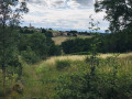
 Easy
Easy 
 Moderate