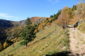
Schallern Circular Loop

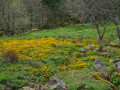
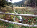
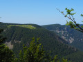
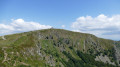
A pleasant walk that allows you to familiarise yourself with and discover the mountains. It starts and ends in the forest. In between, the landscape opens up as you cross the ski runs, offering beautiful panoramic views of the valley.

Details

n°2179443
Creation:
Last update:
Last review:
  • Walking
    Activity: Walking
  • ↔
    Distance: 1.68 mi
  • ◔
    Average duration: 1h 10 
  • ▲
    Difficulty: Easy

  • ⚐
    Back to start: Yes
  • ↗
    Ascent: + 472 ft
  • ↘
    Descent: - 449 ft

  • ▲
    Highest point: 3,602 ft
  • ▼
    Lowest point: 3,159 ft

Description of the walk

Park in the car park at the Gaschney ski resort.

(S/E) Head towards the welcome signs below the ski slopes, go round them on the right to take a well-marked path that passes between buildings and enters the forest.

(1) At the first junction, take the almost flat path on the left. This is a pleasant route (GR®531Blue Rectangle) that runs almost entirely through the forest, except where it crosses a ski run.

(2) At the junction with a wide forest track, take this track uphill, leaving theGR®531. After a hairpin bend and a few hundred metres through the forest, you’ll reach the ski runs. Continue along this track until you reach the Auberge du Schallern, which you’ll go round at the bottom.

(3) Below the Auberge’s terrace, a path marked with a Red Triangle leads downhill back to the car park. Take this somewhat steep and stony path to return to the car park at the Gaschney ski resort (S/E).

Waypoints

  1. S/E : mi 0 - alt. 3,261 ft - Gaschney resort car park
  2. 1 : mi 0.11 - alt. 3,163 ft - Entrance to the forest
  3. 2 : mi 0.68 - alt. 3,228 ft - Forest track
  4. 3 : mi 1.29 - alt. 3,602 ft - Auberge du Schallern
  5. S/E : mi 1.68 - alt. 3,264 ft - Gaschney resort car park

Worth a visit

You can take part in a ‘sport and nature discovery’ activity using the Nat’Mouv app. It combines physical activity with natural elements and nature discovery.
It is free for participants as it is funded by the Ballons des Vosges Regional Nature Park and the Grand-Est Region

Always be cautious and plan ahead when you're outdoors. Visorando and the author of this route cannot be held responsible for any accidents occurring on this route.

The GR® and PR® markings are the intellectual property of the Fédération Française de Randonnée Pédestre.

Reviews and comments

5 / 5
Based on 1 review

Reliability of the description
5 / 5
Ease of following the route
5 / 5
Route interest
5 / 5
User 24747230

Overall rating : 5 / 5

Date of your route : May 11, 2026
Reliability of the description : ★★★★★ Very good
Ease of following the route : ★★★★★ Very good
Route interest : ★★★★★ Very good
Very busy route : No

Great hike!!🏔

Machine-translated

Other walks in the area

For more walks, use our search engine .

The GPS track and description are the property of this route's author. Please do not copy them without permission.