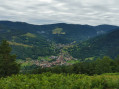
Walk to the Gaschneyried

A short walk to explore a peat bog and the remains of the First World War.

Details

2178155
Creation:
Last update:
Last review:
  • Walking
    Activity: Walking
  • ↔
    Distance: 1.38 mi
  • ◔
    Average duration: 0h 50 
  • ▲
    Difficulty: Easy

  • ⚐
    Back to start: Yes
  • ↗
    Ascent: + 197 ft
  • ↘
    Descent: - 197 ft

  • ▲
    Highest point: 3,268 ft
  • ▼
    Lowest point: 3,068 ft

Photos

Description of the walk

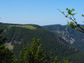
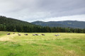
(S/E) From the Gaschney car park, head away from the ski slopes towards the large meadow that forms a clearing in the mountain forest. The section is marked “Red Rectangle/White Rectangle/Red Rectangle”.

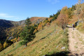
(1) After entering the forest, a few hundred metres further on, take the wide forest path that descends to your left, still signposted “Red Rectangle/White Rectangle/Red Rectangle”.

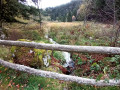
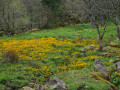
(2) At the lowest point of the path, you’ll come to a damp clearing: the Gaschneyried bog. Leave the main path to your left and walk alongside the bog.
After a few hundred metres, take the wooden steps on your left.

(3) After the steps and a winding path, you’ll come across a wide path on the crest of the hill; follow this to the right to return to the starting point, continuing straight ahead until you reach the Gaschney car park (S/E).

Waypoints

  1. S/E : mi 0 - alt. 3,264 ft - Gaschney car park
  2. 1 : mi 0.61 - alt. 3,120 ft - Junction of forest tracks
  3. 2 : mi 1.1 - alt. 3,068 ft - Gaschneyried peat bog
  4. 3 : mi 1.23 - alt. 3,163 ft - Ridge of the hill
  5. S/E : mi 1.38 - alt. 3,264 ft - Gaschney car park

Worth a visit

Memorial to the Alpine Hunters: a few hundred metres from the start

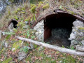
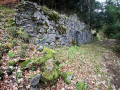
Remains of a military hospital from the 1914–18 war: marked by a sign by the side of the path

Gaschneyried peat bog: information board by the side of the path.

Option to take part in a ‘sports & nature discovery’ activity using the Nat’Mouv app. It combines physical activity with the natural environment and nature discovery.
It is free for participants as it is funded by the Ballons des Vosges Regional Nature Park and the Grand-Est Region

Reviews and comments

4.5 / 5
Based on 2 reviews

Reliability of the description
5 / 5
Ease of following the route
4 / 5
Route interest
4.5 / 5
Maimaran
Maimaran

Overall rating : 4.3 / 5

Date of your route : Aug 18, 2026
Reliability of the description : ★★★★★ Very good
Ease of following the route : ★★★★☆ Good
Route interest : ★★★★☆ Good
Very busy route : Yes

Thanks to Visorando, I was able to find the right route. Thank you

Machine-translated

Le randonneur2
Le randonneur2

Overall rating : 4.7 / 5

Date of your route : Nov 11, 2023
Reliability of the description : ★★★★★ Very good
Ease of following the route : ★★★★☆ Good
Route interest : ★★★★★ Very good
Very busy route : No

A pleasant one-hour walk featuring World War I relics and a beautiful wetland area.

Machine-translated

Other walks in the area

For more walks, use our search engine .

The GPS track and description are the property of this route's author. Please do not copy them without permission.