Circular Mont Né path via the Pic de Montious and Lac de Bareilles

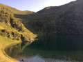
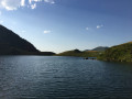
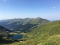
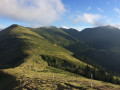
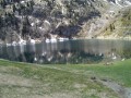
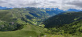
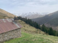
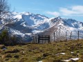
The Mont Né circular route from the Port de Balès offers breathtaking views of the Pyrenean peaks: from the Ariège peaks to the summits of Néouvielle and the Pic du Midi de Bigorre. The route then continues along the Crêtes de Pal, passing through the Port de Pierrefite and the Pic du Lion to reach the summit of the Pic du Montious, the highest point of the hike. The descent to Lac de Bareilles is a chance to relax. On the way back, you’ll come across cows and goats along the path.

Details

9300792
Creation:
Last update:
Last review:
  • Walking
    Activity: Walking
  • ↔
    Distance: 10.98 mi
  • ◔
    Average duration: 7h 55 
  • ▲
    Difficulty: Difficult

  • ⚐
    Back to start: Yes
  • ↗
    Ascent: + 3,264 ft
  • ↘
    Descent: - 3,248 ft

  • ▲
    Highest point: 7,119 ft
  • ▼
    Lowest point: 5,705 ft

Photos

Description of the walk

Park in the car park at the Port de Balès.

(S/E) From the Port de Balès, start the hike on a tarmac track heading north-west for about 600 metres until you reach a fork.

(1) Leave the track and take a dirt path that climbs to the left, alongside the fence.

(2) Follow the path. After a few hairpin bends, ignore a path on the left and continue north-west to the foot of the Sommet de Cournudère at elevation 2026.

(3) Turn sharply left to climb the Crête de la Pale, heading due south, and reach Mont Né (elevation 2147).

(4) Descend the ridge, heading south-south-west, to reach the Port de Pierrefite.

(5) Continue due south, ascending via the Crête de Téchouède, then the Crête de la Coume du Lion, to reach the Pic du Lion (elevation 2102) after a series of ascents and descents.

(6) Descend north-westwards to reach the Col du Lion (elevation 2031).

(7) “Here, you can descend to the right, heading north, via theGRP®, to reach Lac de Bareilles.
To continue the main circular loop, head back up the opposite slope to the north-west along a steep path for a few hundred metres until you reach a fork.

(8) ‘Here too, there are options to descend to the right, heading east, to reach Lac de Bareilles.
To continue the hike described, carry on straight ahead, north-west, towards the Pic du Montious (elevation 2173).

(9) From the Pic du Montious, marked by a metal triangulation point, retrace your steps back to the previous junction.

(8) Descend to the left down the valley to Lac de Bordères or Lac de Bareilles.

(10) Follow the path (GRP®) which climbs eastwards towards the Port de Pierrefite. Ignore the first path on the right.

(5) Back at Port de Pierrefite, take the tarmac track heading north-east.

(11) Instead of continuing along the tarmac track towards the road, take a path on the left to return to the Port de Balès car park (S/E).

Waypoints

  1. S/E : mi 0 - alt. 5,764 ft - Car park at the - Port de Balès
  2. 1 : mi 0.36 - alt. 5,705 ft - Dirt track to the left
  3. 2 : mi 1.17 - alt. 6,138 ft - Hairpin bend
  4. 3 : mi 2.34 - alt. 6,644 ft - Crête de la Pale – South
  5. 4 : mi 3.17 - alt. 7,034 ft - Mont Né
  6. 5 : mi 3.88 - alt. 6,093 ft - Cromlech du Port de Pierrefite
  7. 6 : mi 5.36 - alt. 6,900 ft - Pic du Lion
  8. 7 : mi 5.49 - alt. 6,657 ft - Col du Lion
  9. 8 : mi 6.44 - alt. 6,867 ft - Junction – Towards Montious
  10. 9 : mi 6.8 - alt. 7,106 ft - Pic du Montious
  11. 10 : mi 8 - alt. 5,784 ft - Lac de Bareilles or - Lac de Bordères
  12. 11 : mi 10.73 - alt. 5,758 ft - Path on the left towards the Port de Balès
  13. S/E : mi 10.98 - alt. 5,764 ft - Car park at the - Port de Balès

Notes

The hike isn’t very difficult, but it is quite long; allow 6–8 hours depending on breaks, and a little less if you’re an experienced hiker.

There are a few steep and technical sections where you’ll need to use your hands on the descent after the Pic du Lion (6) and on the ascent before the Pic du Montious (8).

Check access to the Port de Balès, as the pass is closed in winter.

Worth a visit

At the junction at the Port de Pierrefite (5), you can:
- shorten the circular route by taking the tarmac track that leads directly to the Port de Balès (a short circular route of 3 hours 30 minutes from Mont Né).
- head straight to Lac de Bareilles (10) via a return trip.

From Mont Né (4), you can see the Hautes-Pyrénées to the west: the Pic du Midi de Bigorre, the Louron and the Pic de Schrader. To the south lies the Luchonnais massif, with the Aneto further to the east.

Lake Bareilles (10) is visible in the distance from the Crêtes de Pal ski lift. The view is splendid from the Pic du Lion (6), where you can also see the whole of the Oueil and Louron valleys.

But the most beautiful view is from the Pic du Montious (9).

Reviews and comments

4.6 / 5
Based on 3 reviews

Reliability of the description
4.7 / 5
Ease of following the route
4.7 / 5
Route interest
4.3 / 5
Amaria
Amaria
• Edited:

Overall rating : 4 / 5

Date of your route : Nov 12, 2024
Reliability of the description : ★★★★☆ Good
Ease of following the route : ★★★★☆ Good
Route interest : ★★★★☆ Good
Very busy route : No

A lovely walk, even in rather mixed weather; it was a bit misty at the start, but it was well worth it. I wasn’t disappointed – the view of the Pyrenean peaks was breathtaking. I’ll definitely do it again when the weather’s fine.

Machine-translated

chafrise
chafrise

Overall rating : 4.7 / 5

Date of your route : Oct 24, 2022
Reliability of the description : ★★★★★ Very good
Ease of following the route : ★★★★★ Very good
Route interest : ★★★★☆ Good
Very busy route : No

A lovely route, which I did outside the flowering season – what a shame!

Machine-translated

fdpb
fdpb

Overall rating : 5 / 5

Date of your route : Jul 19, 2021
Reliability of the description : ★★★★★ Very good
Ease of following the route : ★★★★★ Very good
Route interest : ★★★★★ Very good
Very busy route : No

A superb hike offering exceptional panoramic views of the Central Pyrenees – practically the whole way – with the climbs and descents well spaced out throughout the day. Well done!

Machine-translated

Other walks in the area

For more walks, use our search engine .

The GPS track and description are the property of this route's author. Please do not copy them without permission.