Circular route from the Cabanes des Conques to Jurvielle

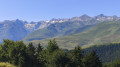
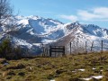
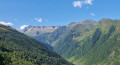
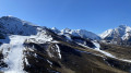
A circular route in the Jurvielle Valley that will take you effortlessly to an altitude of 1,634 metres and then, on the return journey, throughout the descent, offer you a panoramic balcony-like view of the Pyrenees mountain range, particularly Pic Perdiguère.

Details

47743183
Creation:
Last update:
Last review:
  • Walking
    Activity: Walking
  • ↔
    Distance: 3.99 mi
  • ◔
    Average duration: 2h 55 
  • ▲
    Difficulty: Moderate

  • ⚐
    Back to start: Yes
  • ↗
    Ascent: + 1,243 ft
  • ↘
    Descent: - 1,240 ft

  • ▲
    Highest point: 5,358 ft
  • ▼
    Lowest point: 4,134 ft

Photos

Description of the walk

From Bagnères-de-Luchon, take the D619. Access to the village by car via the D76a. Car park behind Jurvielle Town Hall (10 spaces).

(S/E) From the municipal car park, cross the main street towards a steep, sloping lane that zigzags down to the bottom of the village, to the banks of the Ruisseau du Portet.

(1) Cross the Portet bridge and continue straight on until you reach a small sunken track which climbs to the right up the hillside to the junction with the forest track signposted for theGRP® Tour d’Oueil Larboust (yellow/red markings).

(2) Follow this track to the right, climbing at a steady gradient, passing through alternating pine and hornbeam woods. After the Gouardes stream, the path turns north; continue along the forest track until you reach a junction.

(3) Leave the forest track to the left and follow the yellow/red markings along a steeper path leading to the Labach stream.

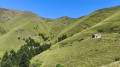
(4) Follow the stream northwards; further on, the path veers to the right to climb a steeper slope, zigzagging through a forest of fir trees. As you emerge from the forest, you’ll notice a hut 100 metres away, perched on a cliff to the left. Head towards it.

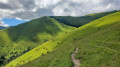
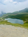
(5) Cabanes des Conques, the highest point of the route. Leave the GPR markings. The descent begins southwards along the wide alpine track, below the hut. It continues steadily down to the village. There are no markings, but simply follow the track.

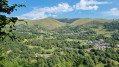
(6) View of the village below. Continue along the track to reach the centre of the village and the municipal car park (S/E).


Waypoints

  1. S/E : mi 0 - alt. 4,203 ft - Car park, town hall
  2. 1 : mi 0.14 - alt. 4,144 ft - Pont du Portet
  3. 2 : mi 0.26 - alt. 4,295 ft - Junction with the GPR
  4. 3 : mi 1.42 - alt. 4,839 ft - Crossroads between track and path
  5. 4 : mi 1.88 - alt. 4,948 ft - Labach Stream
  6. 5 : mi 2.2 - alt. 5,354 ft - Cabanes des Conques
  7. 6 : mi 3.06 - alt. 4,823 ft - Viewpoint
  8. S/E : mi 3.99 - alt. 4,203 ft - Car park, town hall

Notes

There are no drinking water points along the route.
Make sure you bring enough, as the descent takes over an hour in full sun with no shade.

Worth a visit

I recommend not walking the route in the opposite direction.
This ensures a very gradual ascent and, above all, offers panoramic views of much of the Pyrenees mountain range on the way back and throughout the descent.

Reviews and comments

4.3 / 5
Based on 3 reviews

Reliability of the description
4.3 / 5
Ease of following the route
4.3 / 5
Route interest
4.3 / 5
Fred Pessac
Fred Pessac

Overall rating : 5 / 5

Date of your route : Jul 05, 2026
Reliability of the description : ★★★★★ Very good
Ease of following the route : ★★★★★ Very good
Route interest : ★★★★★ Very good
Very busy route : No

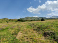
A very pleasant walk. The ascent takes place under the canopy of the forest, in the shade, which is very welcome in hot weather. Once you reach the Cabane des Conques, you’re treated to a lovely view of the surrounding mountain pastures, and then, during the descent, a stunning view of the peaks of the Luchon area. No particular difficulties.

Machine-translated

ldominique 66420
ldominique 66420

Overall rating : 4 / 5

Date of your route : Sep 09, 2024
Reliability of the description : ★★★★☆ Good
Ease of following the route : ★★★★☆ Good
Route interest : ★★★★☆ Good
Very busy route : No

A lovely walk – we didn’t come across a single other walker on this beautiful Sunday in September
A stunning view on the way back.

Machine-translated

flam78
flam78

That’s right, at point (3) you need to take the path on the left. The error has been corrected in the description.

Machine-translated

PATRICE31800
PATRICE31800

Overall rating : 4 / 5

Date of your route : May 11, 2024
Reliability of the description : ★★★★☆ Good
Ease of following the route : ★★★★☆ Good
Route interest : ★★★★☆ Good
Very busy route : No

Hello everyone.
We went on this hike in lovely weather – a lovely mid-mountain route with stunning panoramic views of the 3,000-metre peaks in the Luchon area. Just one small thing to note: at point 3, you need to take the path on the left, as the one on the right is impassable. In fact, you need to follow the yellow and red markings all the way to the Conques hut. Thanks for sharing.

Machine-translated

Other walks in the area

For more walks, use our search engine .

The GPS track and description are the property of this route's author. Please do not copy them without permission.