Circular route from Lac de Plate Taille to Les Grands Prés and the Clairière du Lac

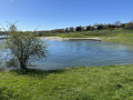
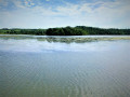
A pleasant walk along Lac de la Plate Taille to the edge of the Bois du Four and back via the Grands Prés, the Clairière du Lac and the Ferme du Renard. The route initially offers beautiful views of the lake and the Plate Taille dam, before taking you through the countryside, between woodland and farmland, in the second half.

Details

n°34874562
Creation:
Last update:
Last review:
  • Walking
    Activity: Walking
  • ↔
    Distance: 4.26 mi
  • ◔
    Average duration: 2h 05 
  • ▲
    Difficulty: Easy

  • ⚐
    Back to start: Yes
  • ↗
    Ascent: + 157 ft
  • ↘
    Descent: - 174 ft

  • ▲
    Highest point: 909 ft
  • ▼
    Lowest point: 787 ft

Photos

Description of the walk

Park along the Route de la Plate Taille (N589a) south of the Ferme du Bois Renard, near a path leading southwards to the lakeside. You can park on the grass verge along the road, taking care not to obstruct traffic. Take care as the road curves slightly and visibility is reduced.

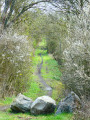
/A:: Leave the car park and take the path leading towards the lake through a wooded area. The path reaches the edge of the woods and leads to a tree-top adventure park. Cross the clearing heading south to join the path running alongside the lake.

(1) Turn right onto this path, which forms part ofthe GRP® 125 Tour de l’Entre Sambre et Meuse and is shared by several routes, such as the Balade du Rossignol and the circular Boucle de la Plate Taille. It offers lovely views of the Plate Taille dam and the lake of the same name. Carry on straight ahead. The path passes beneath the Golden Lakes Village, then beneath a large holiday centre. Turn left onto a footbridge to avoid having to go round a small ria and continue for a few metres along the lake.

(2) Turn sharply to the right – north-west – moving away from the lakeshore. When you reach the edge of the Bois du Four, turn right onto the gently ascending track leading to the RN589a.

(3) Move off to the right by about ten metres before crossing carefully and taking the path opposite. At the crossroads immediately afterwards, take the path opposite, known as the Chemin du Chevreuil, which heads towards the Bois des Grands Prés. Shortly afterwards, it runs briefly along the northern edge of the Clairière du Lac housing estate on your right, before crossing a section of the Bois des Grands Prés and arriving at the Y-junction at the edge of the woods.

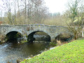
(4) Take the path on the right, which passes through farmland and joins the Route du Pont de Pierre.

(5) Follow it to the right, heading south. Cross a small wooded area until you reach a fork in the path.

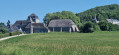
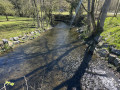
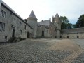
(6) Turn left at a right angle onto a path which crosses a small stream and then passes through a wood before joining a path called Hameau de Falemprise. Continue straight on until you reach the Ferme du Renard: the owners allow walkers to pass through provided they stay on the road. Carry on until you reach the RN589a. Cross it carefully, turn right to follow the road and return to the car park (S/E).

Waypoints

  1. S/E : mi 0 - alt. 856 ft - Stop on the N589a south of the Ferme du Renard
  2. 1 : mi 0.17 - alt. 830 ft - Lakeside
  3. 2 : mi 1.68 - alt. 827 ft - Junction
  4. 3 : mi 2.04 - alt. 873 ft - N589a, Route de Plate Taille
  5. 4 : mi 2.45 - alt. 827 ft - Y-junction
  6. 5 : mi 2.77 - alt. 794 ft - Route du Pont de Pierre
  7. 6 : mi 3.24 - alt. 860 ft - Junction
  8. S/E : mi 4.26 - alt. 856 ft - Stop on the N589a south of the Ferme du Renard

Notes

This walk across varied terrain requires suitable footwear.

This walk does not present any real difficulties in terms of navigation. Starting from point (2), it follows in turn theGRP® 125 Tour de l’Entre Sambre et Meuse – shared with the Balade du Rossignol and the Boucle de la Plate Taille – until the junction with the Route de la Plate Taille (N589a) at point (3), then the Circuit du Chevreuil to point (6), and finally the Balade du Rossignol.
In addition, it is advisable to follow the directions in the description and on the map, whilst paying close attention to the landscape. Street names also help you to find your way around. The waypoints (with their GPS coordinates and the distance from the starting point) are useful aids for walkers exploring the route for the first time.

Hike completed by the author of this guide on 9 June 2023

Worth a visit

Reviews and comments

5 / 5
Based on 1 review

Reliability of the description
5 / 5
Ease of following the route
5 / 5
Route interest
5 / 5
Fimg77
Fimg77

Overall rating : 5 / 5

Date of your route : Oct 08, 2023
Reliability of the description : ★★★★★ Very good
Ease of following the route : ★★★★★ Very good
Route interest : ★★★★★ Very good
Very busy route : No

Not very busy out of season; a pleasant, easy (flat) and varied route

Machine-translated

Other walks in the area

For more walks, use our search engine .

The GPS track and description are the property of this route's author. Please do not copy them without permission.