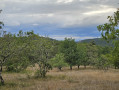
Circular walk from the Causse de Coly to Coly

This route will take you past Coly Castle, a wash house and a well. You’ll pass close to one of the most beautiful villages in France: a short detour to Saint-Amand-de-Coly is a must.

Details

41453247
Creation:
Last update:
Last review:
  • Walking
    Activity: Walking
  • ↔
    Distance: 7.20 mi
  • ◔
    Average duration: 4h 00 
  • ▲
    Difficulty: Moderate

  • ⚐
    Back to start: Yes
  • ↗
    Ascent: + 768 ft
  • ↘
    Descent: - 761 ft

  • ▲
    Highest point: 837 ft
  • ▼
    Lowest point: 367 ft
  • ⚐ Country: France
  • ⚐
    Area: Périgord
  • ⚐ City: Coly (24120)
  • ⚑
    Start/End: N 45.085738° / E 1.26816°
  • ❏
    IGN map(s): Ref. 2035E, 2035O
  • Hour-by-hour weather

Description of the walk

Park in the car park near Coly church.

(S/E) Leave the car park by turning right onto Route du Gatinou, towards the church. Follow the sign for “Circular route on the causse de Coly”. Walk past the church, then turn left onto Rue de la Brasserie and continue to the dead end at Route du Polissoir.

(1) Turn right onto this road and follow it for about 300 m, then take the path on the left at the last house. Continue to the next junction.

(2) Turn left and carry on straight ahead until you reach the hamlet of Mortefond. Walk through the hamlet on the right-hand side until you reach the end, where you’ll come to a crossroads.

(3) Turn left onto the path. At the first junction, turn left towards Clos de Veysset.

(4) Once past the hamlet, continue along the path to the right, join a road and follow it to the right until you reach the hamlet of La Sedayne. Continue towards the village of Saint-Amand-de-Coly, walk past the abbey and carry on towards the town hall.

(5) Turn right onto Rue de l’Hôpital, cross the village keeping to the left, then take Route de Mortefond on the left to come out onto Route du Gatinou.

(6) Take the Route du Gatinou on the right and follow it until the next junction.

(7) Turn left and, immediately, take the path on the right, leading up to Pech de la Fourche. Turn left and, immediately, right. Continue to the T-junction.

(8) Turn left, towards the hamlet of Le Montant. Keep left at the three-way junction to reach the hamlet.

(9) Leave Le Montant on your left and take the path on the right.

(10) Keep to the right at the three-way junction and stay on the main path, ignoring the tracks on either side. Follow the path as it bends to the right and continue along this route, which leads back towards the village of Coly. Once you reach the first houses, carry on straight ahead to the town hall, then head back to the car park (S/E).


Waypoints

  1. S/E : mi 0 - alt. 377 ft - Car park, Coly church - Coly (cours d'eau) - affluent de la Vézère
  2. 1 : mi 0.14 - alt. 381 ft - Route du Polissoir
  3. 2 : mi 0.84 - alt. 640 ft - Turn left at the fork
  4. 3 : mi 1.78 - alt. 676 ft - Mortefond, crossroads
  5. 4 : mi 2.34 - alt. 837 ft - Turn right at the fork
  6. 5 : mi 3.08 - alt. 568 ft - Rue de l’Hôpital - Abbaye de Saint-Amand-de-Coly
  7. 6 : mi 3.2 - alt. 538 ft - Route du Gatinou
  8. 7 : mi 3.63 - alt. 469 ft - Crossroads
  9. 8 : mi 4.16 - alt. 722 ft - T-junction
  10. 9 : mi 4.87 - alt. 745 ft - Le Montant
  11. 10 : mi 5.1 - alt. 764 ft - Three-way junction, on the right
  12. S/E : mi 7.2 - alt. 377 ft - Coly Church

Worth a visit

Reviews and comments

4.7 / 5
Based on 3 reviews

Reliability of the description
4.7 / 5
Ease of following the route
4.7 / 5
Route interest
4.7 / 5
Jean. b
Jean. b

Overall rating : 4 / 5

Date of your route : Apr 26, 2026
Reliability of the description : ★★★★☆ Good
Ease of following the route : ★★★★☆ Good
Route interest : ★★★★☆ Good
Very busy route : No

a pleasant route

Machine-translated

crouzatier monique
crouzatier monique

Overall rating : 5 / 5

Date of your route : Nov 03, 2025
Reliability of the description : ★★★★★ Very good
Ease of following the route : ★★★★★ Very good
Route interest : ★★★★★ Very good
Very busy route : Yes

This magnificent hike allows us to discover a village with its abbey, beautiful residences, few roads
and sometimes slightly steep paths in the middle of very pleasant woods.
To discover

Monique

Machine-translated

Aldan24
Aldan24

Overall rating : 5 / 5

Date of your route : Jun 05, 2024
Reliability of the description : ★★★★★ Very good
Ease of following the route : ★★★★★ Very good
Route interest : ★★★★★ Very good
Very busy route : No

A lovely walk in the countryside, discovering this beautiful village. Thank you

Machine-translated

Other walks in the area

For more walks, use our search engine .

The GPS track and description are the property of this route's author. Please do not copy them without permission.