Circular Bois Monsieur from Notre-Dame d’Orient

A walk through the woods above Sermizelles and a visit to the Chapel of Notre-Dame d’Orient. The walk takes place mainly through woodland. A few vantage points higher up offer views of the surrounding area. The area is particularly peaceful and easily accessible. Only two points come close to the departmental road. There are no signposts or markings to follow on this walk, which can easily be extended or shortened. The elevation gain is spread over four ascents along the route. 

Details

n°62334656
Creation:
Last update:
Last review:
  • Walking
    Activity: Walking
  • ↔
    Distance: 8.92 mi
  • ◔
    Average duration: 5h 15 
  • ▲
    Difficulty: Moderate

  • ⚐
    Back to start: Yes
  • ↗
    Ascent: + 1,283 ft
  • ↘
    Descent: - 1,270 ft

  • ▲
    Highest point: 909 ft
  • ▼
    Lowest point: 436 ft

Photos

Description of the walk

Parking is available next to the town hall; there are often a few spaces free. 

(S/E) Leave the car park heading east. The Malakoff Tower is immediately visible. Turn right, cross the level crossing and head towards the road.

(1) Cross the county road. The path is on the left, hidden by vegetation, just before the gate to a private property. Walk uphill until you reach the tower and the chapel. Continue along the only possible path, in the same direction as when you set off. 

(2) Carry on along the forest track, keeping to the right. 

(3) After just under 500 m, take the path on the left which leads downhill. 

(4) At the bottom of the valley, 1 km further on, follow the path that opens up to the right. (A sign nearby indicates the presence of CCTV cameras.) A few hundred metres after the end of the second climb, the route joins a forest track.

(5) Turn left. 300 m further on, take the path leading down to the left

(6) At the end of the path, keep to the left and wind your way through the narrow, steep-sided valley. 

(7) Turn left again when the opportunity arises. 

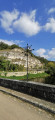
(8) A few metres from the main road, take the path on the left which leads back into the forest. 100 metres further on, turn onto the small path on the right. This spot offers a view of the river, with the village of Sermizelles in the distance. 

(9) After 1 km, including a climb of over 200 m, take a path that opens up on the right. An old stone wall (covered in moss) marks its location. 

(10) At the end of the path, turn right. 

(11) Once back on a track suitable for vehicles, turn left to walk alongside the fields and back into the forest. After one kilometre, the track splits in two. Take the track on the right to quickly return to the forest road taken at the start of the walk.

(2) Follow the outward route in the opposite direction to return to the car park (S/E).

Waypoints

  1. S/E : mi 0 - alt. 436 ft - Town hall car park - Cure (la)
  2. 1 : mi 0.21 - alt. 459 ft - Departmental road. Towards the - Chapelle Notre Dame d'Orient (Sermizelles)
  3. 2 : mi 0.93 - alt. 702 ft - Crossroads at the end of the circular loop
  4. 3 : mi 1.24 - alt. 732 ft - Crossroads
  5. 4 : mi 1.86 - alt. 541 ft - Crossroads
  6. 5 : mi 3 - alt. 869 ft - junction at a place called La Cave
  7. 6 : mi 4.09 - alt. 696 ft - Crossroads at the bottom of the valley
  8. 7 : mi 4.8 - alt. 636 ft - Crossroads
  9. 8 : mi 5.74 - alt. 499 ft - Vaulliot Valley
  10. 9 : mi 6.47 - alt. 801 ft - Vaulot Massay hamlet
  11. 10 : mi 6.8 - alt. 735 ft - Crossroads
  12. 11 : mi 7.29 - alt. 449 ft - Crossroads
  13. S/E : mi 8.92 - alt. 436 ft - Town hall car park - Tour Malakoff (Sermizelles)

Worth a visit

The village of Sermizelles lies along the River La Cure, a tributary of the River Yonne.

Reviews and comments

3.4 / 5
Based on 3 reviews

Reliability of the description
3.3 / 5
Ease of following the route
3.3 / 5
Route interest
3.7 / 5
Pierrot M.
Pierrot M.

Overall rating : 1.3 / 5

Date of your route : Apr 29, 2026
Reliability of the description : ★☆☆☆☆ Very disappointing
Ease of following the route : ★☆☆☆☆ Very disappointing
Route interest : ★★☆☆☆ Disappointing
Very busy route : No

The only highlight of this walk is Notre Dame D’Orient and the view over Sermizelles and the surrounding area.

It should be removed from Visorando; it’s not a hike at all – you just end up wandering aimlessly through the forest, mindlessly following the GPX track. There’s absolutely no enjoyment to be had on this hike!

Avoid at all costs!!!

Machine-translated

canto89
canto89

Overall rating : 5 / 5

Date of your route : Mar 09, 2026
Reliability of the description : ★★★★★ Very good
Ease of following the route : ★★★★★ Very good
Route interest : ★★★★★ Very good
Very busy route : No

A route to do in summer, almost entirely in the woods. Elevation gain of nearly 400 m. Magnificent tower and chapel in Orient open to visitors.
A very enjoyable day out.

Machine-translated

cuzcodom
cuzcodom

Overall rating : 4 / 5

Date of your route : Oct 19, 2025
Reliability of the description : ★★★★☆ Good
Ease of following the route : ★★★★☆ Good
Route interest : ★★★★☆ Good
Very busy route : No

Pleasant walk in the woods: the chapel is well worth a visit.
Encounter with hunters: no problem, they are friendly.
From point 9 onwards, it becomes difficult to follow the route: the GPX track does not correspond to the terrain: you have to climb higher to find the low wall. Finally, to reach point 10, follow the wide path, which is more comfortable than the suggested shortcut.
Thanks to the author.

Machine-translated

Other walks in the area

For more walks, use our search engine .

The GPS track and description are the property of this route's author. Please do not copy them without permission.