Le Trou du Diable, starting from Planquery

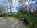
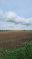
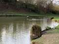
A walk that starts at the Planquery Ponds. You then follow paths through wooded countryside and lush green fields.
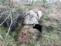
Don’t miss the Trou du Diable, a cave situated by the side of the path.

Details

46713448
Creation:
Last update:
Last review:
  • Walking
    Activity: Walking
  • ↔
    Distance: 4.75 mi
  • ◔
    Average duration: 2h 30 
  • ▲
    Difficulty: Easy

  • ⚐
    Back to start: Yes
  • ↗
    Ascent: + 354 ft
  • ↘
    Descent: - 348 ft

  • ▲
    Highest point: 384 ft
  • ▼
    Lowest point: 223 ft
  • ⚐ Country: France
  • ⚐ City: Planquery (14490)
  • ⚑
    Start/End: N 49.163142° / W 0.852987°
  • ❏
    IGN map(s): Ref. 1412OT, 1512OT
  • Hour-by-hour weather

Photos

Description of the walk

Park in the car park opposite the Planquery Ponds on the D209.

(S/E) With your back to the car park and facing the ponds, head east along this road for a few hundred metres. You will reach a crossroads leading to the hamlet of Mesnil.

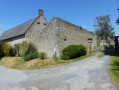
(1) Turn right, walk along the edge of the hamlet and cross the bridge over the River Soquence. Then cross a road to reach a crossroads on the edge of a wood.

(2) Turn right, walk past the hamlet of La Bouillerie, continue on and reach a four-way crossroads.

(3) Head straight ahead and then pass the path leading to Haut de Planquery on your left. Walk between the fields, then pass under the power line to reach a Y-shaped crossroads of footpaths.

(4) Turn right, continuing between the fields, until you cross the road leading to the hamlet of La Bucaille.

(5) Continue straight ahead, slightly downhill, to reach the bridge over the Drôme.

(6) Cross the bridge, pass Moulin Neuf and continue to the crossroads at the hamlet of La Briquesardière.

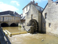
(7) Carry on slightly uphill to reach the Moulin des Essarts.

(8) Cross the stream and follow it as you turn right. Pass close to the ‘Trou du Diable’. Carry on to the confluence of several streams.

(9) Cross the stream, continue straight ahead downhill, reach the hamlet of La Nellerie, then arrive at the village of La Bazoque on the D209.

(10) Turn right onto the D209, walk past the hamlet of Haut Bacon, cross the River Drôme to return to the car park opposite the Planquery Ponds (S/E).

Waypoints

  1. S/E : mi 0 - alt. 223 ft - Car park opposite the Planquery Ponds
  2. 1 : mi 0.21 - alt. 262 ft - Le Mesnil crossroads
  3. 2 : mi 0.58 - alt. 266 ft - Crossroads at the edge of the woods
  4. 3 : mi 0.97 - alt. 302 ft - Four-way junction
  5. 4 : mi 1.65 - alt. 374 ft - Y-junction
  6. 5 : mi 2.07 - alt. 295 ft - La Bucaille crossroads
  7. 6 : mi 2.38 - alt. 233 ft - Pont and Moulin Neuf - Drome (rivière) - Affluent de l'Aure
  8. 7 : mi 2.64 - alt. 308 ft - La Briquesardière crossroads
  9. 8 : mi 2.93 - alt. 269 ft - Moulin des Essarts
  10. 9 : mi 3.49 - alt. 246 ft - Confluence of streams
  11. 10 : mi 4.01 - alt. 384 ft - D209
  12. S/E : mi 4.75 - alt. 223 ft - Car park opposite the Planquery Ponds

Notes

There are few muddy patches, even in winter.

Worth a visit

(S/E) The Planquery Ponds offer various facilities.
Between (8) and (9), Le Trou du Diable is a cave that is difficult to access.

Reviews and comments

4.6 / 5
Based on 3 reviews

Reliability of the description
4.3 / 5
Ease of following the route
4.7 / 5
Route interest
4.7 / 5
User 3914906

Overall rating : 5 / 5

Date of your route : Aug 17, 2026
Reliability of the description : ★★★★★ Very good
Ease of following the route : ★★★★★ Very good
Route interest : ★★★★★ Very good
Very busy route : No

A brilliant hike I went on with my two children. The route is a good 8 km long. The ‘Devil’s Hole’ is much more impressive than it looks in the photo. We met a lovely lady by a mill; she gave us some water (thanks 😁).

Machine-translated

marieluce
marieluce

Overall rating : 5 / 5

Date of your route : Aug 10, 2026
Reliability of the description : ★★★★★ Very good
Ease of following the route : ★★★★★ Very good
Route interest : ★★★★★ Very good
Very busy route : No

A lovely, fairly shaded nature walk. The only downside is a short stretch of road at the start and end of the route. The ‘Devil’s Hole’ is quite unusual – make sure you keep a tight hold of your children and dogs when passing it.

Machine-translated

jasy19481949
jasy19481949

Overall rating : 3.7 / 5

Date of your route : May 03, 2024
Reliability of the description : ★★★☆☆ Average
Ease of following the route : ★★★★☆ Good
Route interest : ★★★★☆ Good
Very busy route : No

We went on this walk after a spell of rain. We had to climb up a bank to get into a field and go round a section of the path that was impassable.
The duration of the walk is correct, but the length of the route is incorrect. Our pedometer showed 9.6 km, which matches the stated walking time.

Machine-translated

Other walks in the area

For more walks, use our search engine .

The GPS track and description are the property of this route's author. Please do not copy them without permission.