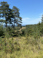
Hauteclair Circular Loop

A lovely walk around the village of Saint-Léon-sur-Vézère, listed as one of the “Most Beautiful Villages in France”, in the heart of the Vallée de l’Homme. A lovely walk to discover the landscapes of the Périgord Noir.

Details

39287145
Creation:
Last update:
Last review:
  • Walking
    Activity: Walking
  • ↔
    Distance: 6.63 mi
  • ◔
    Average duration: 3h 55 
  • ▲
    Difficulty: Moderate

  • ⚐
    Back to start: Yes
  • ↗
    Ascent: + 997 ft
  • ↘
    Descent: - 981 ft

  • ▲
    Highest point: 853 ft
  • ▼
    Lowest point: 223 ft

Description of the walk

From the village of Les Eyzies-de-Tayac, take the D706 towards Montignac as far as Saint-Léon-sur-Vézère. Then turn right to reach the village centre. The route starts at the village car park.

(S/E) Leave the car park on the village side, then take the road on the right until you reach the D706. Cross it and proceed to the junction of the circular route, opposite the Impasse des Garennes.

(1) Carry on straight ahead, then turn left onto the Chemin de Bord de Côte, which ends in a footpath. Continue straight ahead along the footpath until you reach the first fork.

(2) Turn right and head towards the hamlet of La Péchardie. Cross the hamlet, then continue straight ahead along the Chemin de la Terre Pointue until you reach the departmental road (Route des Crêtes).

(3) Follow the departmental road for 50 metres, then turn left. Continue for about 300 metres until you rejoin it.

(4) Cross it and carry on straight ahead along the Chemin du Château d’Eau until you reach the reservoirs.

(5) Turn right onto Impasse Argiller Lajarthe, pass through the hamlet of Argiller and carry on straight ahead. Ignore the path leading off to the right at the hamlet of La Jarthe, and carry on straight ahead along the path, downhill, until you reach the junction at the bottom of the valley.

(6) Take the path on the right which runs alongside the Ruisseau de Fongran until it joins the Route de Fongran; follow this road until you reach the pond on the left.

(7) Turn onto the path on the right, then continue to the left, towards the hamlet known as ‘la Fouillouse’, without actually going there.

(8) Take the path on the right, just before the hamlet, until you reach Impasse d’Engout; take the road on the left until you reach Route des Crêtes (D45). Turn left and continue to the first junction.

(9) Turn right onto Chemin Forestie, until you reach the hamlet of Hauteclair. Pass through the hamlet and carry on straight ahead along the path until you reach the mast.

(10) Take the path on the right towards the hamlet known as Les Garennes, and continue straight on along the cul-de-sac of the same name until you reach the junction where you started.

(1) Turn left and follow the outward route in the opposite direction until you reach the village car park (S/E).


Waypoints

  1. S/E : mi 0 - alt. 223 ft - Car park at Saint-Léon-sur-Vézère - Vézère (rivière)
  2. 1 : mi 0.39 - alt. 256 ft - Junction of the circular loop
  3. 2 : mi 0.86 - alt. 459 ft - Path junction
  4. 3 : mi 1.82 - alt. 719 ft - Route des Crêtes
  5. 4 : mi 2.05 - alt. 774 ft - D45
  6. 5 : mi 2.27 - alt. 853 ft - Reservoirs
  7. 6 : mi 3.2 - alt. 420 ft - Path on the right
  8. 7 : mi 3.97 - alt. 341 ft - Fondgran Ponds - Fongran (ruisseau) - Affluent du Thonac
  9. 8 : mi 4.32 - alt. 571 ft - La Fouillouse
  10. 9 : mi 4.82 - alt. 712 ft - Forest Track
  11. 10 : mi 5.91 - alt. 558 ft - Branch
  12. S/E : mi 6.63 - alt. 223 ft - Car park at Saint-Léon-sur-Vézère - Donjon et Manoir de La Salle

Worth a visit

Reviews and comments

3.9 / 5
Based on 3 reviews

Reliability of the description
4 / 5
Ease of following the route
3.7 / 5
Route interest
4 / 5
marcherin
marcherin
• Edited:

Overall rating : 4.7 / 5

Date of your route : Oct 02, 2025
Reliability of the description : ★★★★★ Very good
Ease of following the route : ★★★★★ Very good
Route interest : ★★★★☆ Good
Very busy route : No

I just did this hike on 29 September 2025, and I didn't encounter any problems with the markings. A first wooden sign near the town hall and municipal campsite indicates the direction to follow via the 4 roads. Once you reach the main road, a yellow stake invites you to continue straight ahead, crossing the main road, then a little further on the left, a second yellow marker clearly indicates that you should turn left onto the coastal path. After that, everything is perfectly signposted. The signposts and GPS app make the route very clear. Lots of undergrowth and pretty hamlets. The hills make the journey to the ponds a bit challenging. Varied and undulating landscapes. Quiet paths. A bit too much tarmac, however.

Machine-translated

cerbiato
cerbiato

Overall rating : 2.3 / 5

Date of your route : Sep 09, 2025
Reliability of the description : ★★★☆☆ Average
Ease of following the route : ★☆☆☆☆ Very disappointing
Route interest : ★★★☆☆ Average
Very busy route : No

We never found any markings for the climb, apart from a wooden sign pointing us in the right direction at the start, and then nothing. So we did the whole climb on the tarmac road. However, once we reached the top of the hill, the markings for the descent were fine.

Machine-translated

Randostéo
Randostéo

Overall rating : 5 / 5

Date of your route : Sep 09, 2024
Reliability of the description : Not used / Not applicable
Ease of following the route : ★★★★★ Very good
Route interest : ★★★★★ Very good
Very busy route : No

No problems following the GPS signal. The route is accurate.
Don’t hesitate to take a short detour to the second pond (the first is full of algae and not particularly interesting), which you’ll find by taking the little path on the left. A very pretty pond with picnic tables.

Machine-translated

Other walks in the area

For more walks, use our search engine .

The GPS track and description are the property of this route's author. Please do not copy them without permission.