Country:
 City:
City:


Park on Allée des Platanes in Juillac (at the bottom of the cemetery).
(S/E) With your back to the cemetery, head due south, in the opposite direction to the other paths, towards the road junction.
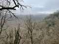
(1) At this point, turn left onto the D86 towards Le Puytinaud. Continue for 500 m and, at the sign for La Vacherie, turn right onto a path leading downhill (viewpoint).
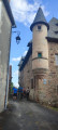
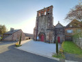
(2) Carry on and, when you reach the road, follow the signs for the village of Chabrignac to the right. Continue along Rue du Vieux Bourg and go round the church at the bottom. Continue along the route to the château.
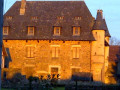
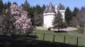
(3) Walk 50 m and turn right onto the road leading uphill for 150 m to join the D901 (enjoy the view of the castle). Cross the D901 at the pedestrian crossing to join Rue de l’École on the left.
(4) Follow this for 150 m, then join Rue de la Mairie and follow it to the right for 500 m.
(5) At the fork, keep left onto Rue du Chatenet and, at the next fork, turn right onto Rue du Stade and follow it for 200 m. Turn left onto the small road leading uphill towards the orientation table.
(6) Carry on until you reach the D39, Avenue d’Ayen, then turn right until you reach the roundabout. Go round the roundabout and carry on straight ahead along the small Rue des Miracles (one-way street).
(7) Pass the manor house and turn left onto the downhill street until you reach Grande Rue (D39).
(8) There is a remarkable tree 200 m on the left at 79 Allée du Château. Continue right onto Grande Rue, then after 300 m, turn right onto Rue de la République until you reach the squares (Juillac information sign). Cross the D901 carefully and follow it to the left, then return to the original junction.
(1) Continue straight ahead along Allée des Platanes to reach the car park (S/E).
 Association / Club / Walk leader
 Visorando Member
 Moderate