Around the Chapel of Saint-Roch

Our area is teeming with springs, rivers and streams, which explains the presence of mills that you’ll come across on this walk.

Details

1054727
Creation:
Last update:
Last review:
  • Walking
    Activity: Walking
  • ↔
    Distance: 4.73 mi
  • ◔
    Average duration: 2h 45 
  • ▲
    Difficulty: Easy

  • ⚐
    Back to start: Yes
  • ↗
    Ascent: + 636 ft
  • ↘
    Descent: - 650 ft

  • ▲
    Highest point: 1,283 ft
  • ▼
    Lowest point: 1,014 ft

Description of the walk

(S/E) From the church square, take the Route de la Mazorie southwards, towards the Chapelle Saint-Roch.

(1) At the Chapelle Saint-Roch, turn left towards Lignac. In Lignac, carry on straight on to Laugerie.

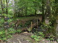
(2) At the end of the road, take the path on the left, running alongside the bamboo grove on your right.

(3) At the junction with the path running at right angles, carry on straight ahead to the next junction, then turn left onto the path leading to the bridge. Continue to the next junction.

(4) Turn right, following the signposted direction, to the ford. Cross the ford (follow the signposts), ignoring thefirst path on the left (private) and then thesecond on the right.

(5) At the end of the track, on the open area, turn left, following the signposts to reach the D7E3.

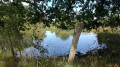
(6) Once on the road, turn left between the pond and the Moulin de la Rivière, then head up the road towards the Domaine de la Rivière, following the signposts.

(7) At the three-way junction, turn left towards Les Rouverades and pass through the hamlet.

(8) Turn left atthe fourth track and continue straight on until you reach the Moulin de Lignac. Cross the bridge and continue straight ahead to the left. After about 200 metres, at the next junction, turn right towards the hamlet of Lignac (follow the signposts).

In Lignac, turn right towards the Chapelle Saint-Roch.

(1) Turn right again towards the village to return to the church square (S/E).

Waypoints

  1. S/E : mi 0 - alt. 1,270 ft - Church Square
  2. 1 : mi 0.55 - alt. 1,283 ft - St Roch’s Chapel
  3. 2 : mi 0.86 - alt. 1,198 ft - At the edge of the village, there is a signpost.
  4. 3 : mi 0.95 - alt. 1,171 ft - At the crossroads, go straight on
  5. 4 : mi 1.46 - alt. 1,129 ft - Signpost indicating ‘Les Moulins’
  6. 5 : mi 2.01 - alt. 1,142 ft - Leave the path coming from the right
  7. 6 : mi 2.37 - alt. 1,020 ft - Finishes next to the La Rivière pond
  8. 7 : mi 2.79 - alt. 1,155 ft - Domaine de la Rivière, on the left
  9. 8 : mi 3.22 - alt. 1,250 ft - After Les Rouverades, turn left (follow the signposts)
  10. S/E : mi 4.73 - alt. 1,270 ft - Church Square

Notes

Route No. 5, entitled “Les Moulins”.

Blue signposts.

Worth a visit

In Saint-Sornin, the cruciform church is thought to date from the early 15th century. In the sacristy, there was a 17th-century reliquary containing the remains of St Radegonde of St Donat and St Modeste. In the south chapel, there is a fine statue of St Radegonde and a 15th-century wooden Pietà. The oldest bell dates from 1592. Saint Radegonde was particularly venerated in Saint-Sornin-Lavolps.

A fountain in the village is dedicated to her. Its water was said to cure scabies and skin diseases. Furthermore, all manner of miracles were attributed to the village’s patron saints. St Donat, in particular, was invoked to ward off storms.

The Chapel of Saint Roch, in the commune, is a former oratory annexed to the priory of Tulle in 1318. It was moved to its present location from the village of Boissiaux around 1820. It is thought to date from the time of a particularly severe cattle plague. Few saints were as famous in the West as Saint Roch between the 14th and 17th centuries. A contemporary of the Black Death, from which he was miraculously cured, he was often the last resort for a population decimated by the epidemic that wiped out almost half of Europe’s population. In Saint-Sornin-Lavolps, he is celebrated every weekend leading up to 15 August with a blessing of the herds. In the past, the priest would also bless a handful of ‘plague herbs’ which, when hung in the stables, were believed to ward off disease in the animals.

The racecourse hosts 11 meetings a year featuring flat and jump races – the perfect opportunity to try your hand at betting!

And fishing enthusiasts can indulge their passion at the pond situated near the village, below the Les Etoiles campsite.

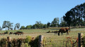
You’ll pass close to the former National Stud Farm at La Rivière, where, in the mid-19th century, Messrs Gayot and De Lespinats bred the Anglo-Arabian horse, which combines the stamina of the Arabian thoroughbred with the speed of the English thoroughbred.
All that remains of the castle’s ruins is a round tower topped with a thatched roof, which adds to the site’s unique character.
They are examples of the Flamboyant Gothic architectural period (late 14th – early 15th centuries), whilst the chapel still bears traces of its original 15th-century polychrome decoration. The site is privately owned; organised tours are held from time to time – please enquire at the tourist office.

To satisfy your appetite after the walk, you can stop for a bite to eat at the Moulin Rouge (in the hamlet of Les Maisons Rouges).

Reviews and comments

4.2 / 5
Based on 3 reviews

Reliability of the description
4.3 / 5
Ease of following the route
4 / 5
Route interest
4.3 / 5
hilaire.vachon
hilaire.vachon

Overall rating : 4 / 5

Date of your route : Sep 17, 2024
Reliability of the description : ★★★★☆ Good
Ease of following the route : ★★★☆☆ Average
Route interest : ★★★★★ Very good
Very busy route : No

Tree felling in the forest has altered the route description. At the Lignac mill, the path on the left is no longer maintained and is overgrown with scrub. When we arrived in Lignac, the farm owner let us cross the courtyard; otherwise, we would have turned left to rejoin the original path above the bamboo grove.

Machine-translated

Balaise87
Balaise87

Overall rating : 4.3 / 5

Date of your route : May 15, 2023
Reliability of the description : ★★★★☆ Good
Ease of following the route : ★★★★☆ Good
Route interest : ★★★★★ Very good
Very busy route : No

A pleasant walk. The return journey from the Chapelle Saint-Roch to Saint-Sornin-Lavolps along the tarmac road is a bit long. The route described at point (4) is unclear. As a result, we never found the esplanade mentioned at point (5) and our walk ended up being nearly a kilometre longer.

Machine-translated

Prao
Prao

Overall rating : 4.3 / 5

Date of your route : Mar 01, 2021
Reliability of the description : ★★★★★ Very good
Ease of following the route : ★★★★★ Very good
Route interest : ★★★☆☆ Average
Very busy route : Yes

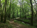
A very pleasant walk, mostly through woodland. Undertaken on one of the first days of lovely weather
The signposting is good and the route is also well described on the information sheet
A route suitable for children who enjoy walking in the woods; the paths are wide and well-maintained, with only a very short stretch on the road

Machine-translated

Other walks in the area

For more walks, use our search engine .

The GPS track and description are the property of this route's author. Please do not copy them without permission.