Country:

 City:
City:


Park in the car park opposite the cemetery at the top of the village of Dieffenthal. To get there, walk up the main street then turn left into Rue de l’Église.
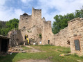
(S/E) At the top of the car park, turn left (Yellow Ring markings) and after 100 metres, at the medieval garden, take the path on the right which climbs towards Bernstein Castle.
(1) At the bandstand, take the path on the right, following the sign for “Route des Roches”. Pass a forest viewing platform and you’ll come to a junction.
(2) Leave the Yellow Ring-marked path, which heads off to the left, and take the path straight ahead uphill. At the first junction, follow the wider path to the left, pass two stone markers and reach a second junction.
(3) Continue to the right on the path marked with a Yellow Disc, which leaves the forest and runs alongside the vineyards. You’ll reach a bench with a lovely view of Dambach-la-Ville and the Alsace plain.
(4) Continue downhill following the Yellow Disc markings to the Weybach junction.
(5) Take the path on the left marked with a Yellow Cross, towards Château du Bernstein. At the first junction, carry straight on along the narrower path; at the second, turn right.
(6) Follow the small path to the right, which is steep at first but then levels out, leading to a forest track. Take the path opposite.
(7) At the next junction, follow the forest track to the left for 20 metres, then take the path that climbs to the right and joins another forest track. Head left, then keep to the right at the junction about fifty metres further on to take the climb leading to Château du Bernstein: there are plenty of picnic tables.
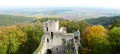
(8) At the castle, take the path marked ‘Blue Disc’ which climbs to the left and leads to Rocher Bellevue: a viewpoint overlooking Haut-Koenigsbourg and Rocher du Coucou.
(9) Continue along the path marked ‘Blue Disc’. At the junction with a forest track, take the small path opposite, following the markings until you reach the junction at a place called Stangenberg.
(10) Follow the forest track to the left, marked with a Yellow Disc, as far as Engelfelsen, where, unfortunately, the view is obscured by trees.
(11) Continue following the same markings to the Krieghurst junction.
(12) Carry on to the right along the downhill path marked with a Red Rectangle, then immediately turn left: the descent is a little slippery at the start. At the junction with the picnic table, head left. You’ll come to a three-way junction in the path.
(13) Turn slightly to the right, leaving the path marked with a Red Rectangle crossed out in white – which leads directly to Dieffenthal – on your left. Continue to follow the Red Rectangle markings and you’ll come out onto the Route Forestière des Châteaux.
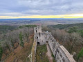
(14) Follow this road, keeping in the same direction. At a new picnic table, take the path on the right leading to Ortenbourg Castle.
(15) On leaving the castle, after the arched gate, take the path marked with a Red Triangle: the first part of the descent is stony. You’ll reach the junction with the path that descends to the right towards Scherwiller.
(16) Ignore this path and continue straight on, following the Red Triangle markings, until you come to a path that runs alongside the vineyards.
(17) Turn left, staying on the Red Triangle route.
(18) Continue downhill to the right between the vineyards and carry on straight ahead until you reach a viewpoint.
(19) Turn left to return directly to the cemetery car park (S/E).

 Tourist office

 Association / Club / Walk leader
 Visorando Member
 Very difficult
 Difficult