Country:

 City:
City:


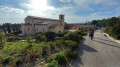
Park in the Lac du Paty car park.
(S/E) Cross the road and take the path that climbs just to the left of the no-entry sign. Then cross another road and continue climbing. When you reach a private property, turn right onto theGRP®® des Dentelles de Montmirail, marked in red and yellow. Continue to the Font Mourèle crossroads.
(1) Keep left on theGRP®®; after a short climb followed by a longer descent, you’ll reach the D938 junction.
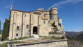
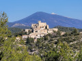
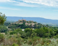
(2) Cross the road carefully and take the steps opposite. Continue along theGRP®®. Cross another road, take the steps opposite and turn left to enter the village. Follow the road uphill opposite, then take the steps on the right to reach the castle. Continue to the castle esplanade and enjoy the beautiful panoramic view from here. Return to the castle entrance, then turn right and head back down to a car park. Turn left and take a path on the right which joins a road below. Then turn left and immediately right to reach a roundabout on the outskirts of the village.
(3) Carry on straight ahead along theGRP®® to reach the Lause crossroads.
(4) Carry on until you reach the ‘Les Plantiers’ signpost and arrive at a three-way junction.
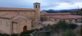
(5) Turn right onto the Chemin de Pied Gros; you’re still on theGRP®®. Head uphill to the crossroads at thefirst abbey, Sainte-Madeleine.
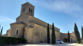
(6) Leave theGRP®® here and turn right to reach Sainte-Madeleine Abbey.
(7) Walk back in the opposite direction to the previous junction.
(6) Turn right back onto theGRP®®; after a series of short ascents and descents, you’ll reach a crossroads with four directions that are almost perpendicular to one another.
(8) Turn slightly to the right, staying on theGRP®®; this wide path leads to another crossroads with several directions.
(9) Turn left onto theGRP®®; a few hundred paces further on, you’ll reach another crossroads with four perpendicular directions.
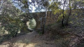
(10) Leave theGRP®® and continue straight ahead to reach the Aqueduct quickly.
(11) Take the wide path that leads down to the remaining arch of the structure. Head back up to the road and continue to the right. When you reach a junction, take the left-hand path, follow it and you’ll come to another crossroads of paths.
(12) Take the path on the left to climb steeply and reach a junction at a hairpin bend. Stay on the path on the right at the next junction. Continue climbing alongside the vineyards until you rejoin the GRP®®.
(13) Turn right onto it and continue slightly uphill to the ‘Les Issards’ signpost.
(14) Leave theGRP®® here and turn right onto theGR®®4, signposted in white and red. Complete the climb at a place called Clairier.
(15) Leave theGR®®4to the right; now walk along the descending ridge in the valley floor, climbing up the embankment. Beautiful views. Then take the path that veers slightly to the left, follow the ridge and come to a fork.
(16) Turn right and join the path below, then take it to the left. Walk alongside the woodland until you reach a crossroads with a wayside shrine.
(17) Turn right to reach thesecond abbey, Notre-Dame de l’Annonciation.
(18) Return in the opposite direction to the previous crossroads.
(17) Turn right onto Chemin Vieille Route; at the next signpost, turn left to reach the D938 at the pumping station.
(19) Cross it with great care, then take the road leading uphill opposite and continue to a new junction at a place called Pié Conieu.
(20) Continue straight ahead and head downhill to the original junction marked ‘Font Mourèle’, which you passed on the way there
(1) Carry on straight ahead and retrace your steps along the route you took on the way there to return to the Lac du Paty car park (S/E)..

 The hike went well until the Aqueduct, after which it became very confusing, the direction was not easy to find, we had to turn back, and luckily my phone beeped when I lost track. After that, we didn't get lost, which is why we always check out the hikes before doing them with a group. Very beautiful hike, magnificent landscapes and a very complete route with castles and abbeys. Thank you to the people who put these hikes together.
 Visorando Member
 Easy
Easy 
 Difficult