Country:

 City:


Turn into Rue du Liesthal, on the left, as soon as you enter the village of Obersteinbach, coming from Sturzelbronn. Park near the Chalet du Liesthal.
Red Ring markings
(S/E) Head towards the Lutzelhardt Forest House and continue to the junction with the Steinberg Forest Road.
(1) Turn right onto this track and continue to the multi-way junction.
Option 1: as shown on the map, passing through (2) (3) (4) and returning via (2)
Option 2: allows you to avoid passing through the Steinberg by going directly via the Windsteinefels rocks via (2) (Red Ring markings), and continuing on to (5).
No signposting
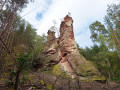
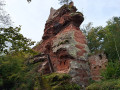
(2) Take the stony forest track on the right. Head uphill towards the Steinberg rocks. At the junction, turn sharply left to reach the circular path that loops around the summit.
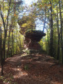
(3) Option 1 (route choice): head right and reach the southern end of the base of the rocky ridge. Climb the scree slope (challenging) and follow the ridge path that winds between the three enormous rocks, until you reach the junction with the circular path.
Option 2: proceed for about 40 m through the vegetation on the left, then turn right onto the grassy path and reach the ridge path (the return journey is easier than the circular route).
(4) Return along the same route to the multi-directional junction further down.
Red Ring markings
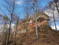
(2) Continue straight on, passing the magnificent sandstone rocks of the Windsteinerfels.
After the bend, climb the very steep forest track to reach the lovely “Bayerisch Windstein” rock (a stunning viewpoint).
Blue and White Rectangle Markings
(5) Continue straight ahead along the narrow path on the German side, signposted “Ludwigswinkel 6.6 km and Rumberg 4 km”. The narrow, downhill path winds through the forest until it reaches a wide forest track. Turn left and continue until you reach a clear, multi-directional junction.
Note: The entire section between the waypoints (5) and (7) is marked only by a few rare signs painted on the trees.
(6) Cross the junction and continue straight ahead along the forest path. It descends towards the border, passes the pond on the right, then runs in a straight line to the picnic area and its gazebo.
Markings: Yellow Ring and Green Ring
(7) Take the tarmac forest road on the left. Further on, turn sharply right (90°) onto the path leading to the Lutzelhardt ruins,GR®®532.
Yellow Rectangle signpostingGR®®532
Continue along the wide forest track until you reach the junction with the narrow path leading to the castle ruins.
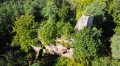
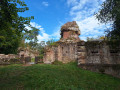
(8) Turn left at the fork, following the sign for “Lutzelhardt Ruins 2’”. Walk past the semi-troglodytic Lutzelhardt castle ruins, then retrace your steps.
(8) Continue to the left, towards the D3 county road.
Green Triangle signpost
At the car park on the side of this road, take the path opposite, running alongside the departmental road, towards the Schoeneck ruins.
(9) Leave the path just before the sharp bend in the D3 departmental road, cross it carefully, then, heading due south, take the third forest track on the right as you come out of the bend. This leads to Schoeneck Castle, crossing several paths and tracks; always follow the Green Triangle signposting.
(10) At Schoeneck Castle, continue following the “Wineckerthal 0h35” signpost along a narrow, downhill path until you reach the junction with the D53 departmental road. Cross it carefully to reach, on the opposite side, a narrow path signposted “Wineckerthal 35’”.
(11) Follow this path, which runs above the district road, until you reach the junction with the Yellow Disc path.
Yellow Disc signposting
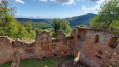
(12) Continue along the path, following the signposting for “Wineck Ruins”, until you reach the hamlet of Maison Forestière Herrenhof. Turn left and follow the narrow path on the left which climbs up to the Wineck Ruins,
signposted “Wineck Ruins – Langthal Pass”, until you reach a junction.
(13) Follow the narrow path which veers left and climbs in tight hairpin bends to reach the ruins of Wineck Castle. Continue along the wide forest track to reach the Wineck Pass. Carry on to a Fork in the road.
Yellow Triangle signposting
(14) Take the forest track on the right, signposted “Col du Wittschloessel”. Follow the wide forest track, then turn left towards “Col du Wittschloessel”. The path climbs to the Col du Wittschloessel.
Red Rectangle signpostGR®®53
(15) Go past the wide forest track and take the path opposite, signposted “Gabelfels ObersteinbachGR®®53”. The narrow path descends until it reaches a multi-way junction.
No signposting
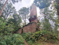
(16) Leave theGR®®53by taking the stony forest track to the left, signposted “Gabelfels 150 m”. After 150 m, turn right onto the path directly opposite the viewpoint; follow it for about a hundred metres to approach this magnificent twin rock formation of pink sandstone.
Retrace your steps and continue along the wide stony path. After about 800 m, pass thefirst path on the right; carry on for about 100 metres to find thesecond path.
(17) Turn right, continue straight on along this wide forest track, reach a clearing, and turn left towards a farm shed and the equestrian centre. Cross through the farm and equestrian centre to reach the main road to Obersteinbach.
Red Ring markings
(18) Cross the road, taking great care to watch out for traffic, and take Rue du Lisethal opposite. Walk up the street to reach the car park near the Chalet du Liesthal (S/E).

 Visorando Member
 Difficult

 Tourism professional

 Easy