Country:
 City:


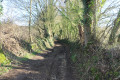
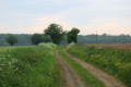
(S/E) Leave the stadium car park, passing by the village hall and joining the D10 road heading towards Saint-Maixent (the stadium is on your right). Turn immediately right onto a farm track that runs flat towards the north-east before beginning to descend slightly. There is a very beautiful and sweeping view over the Sèvre Niortaise plain.
Further on, the track crosses two other tracks, first to the left then to the right, in a sort of elongated ‘S’ shape: keep going straight on along the track that descends the most; the other two are level, at least initially. A little further on, carry straight on, pass under the high-voltage power line and reach almost the bottom of the valley where an intermittent stream flows from a pool fed by the Font Chérisse spring. You’ll come to a T-junction.
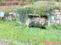
(1) Turn right, then 200 metres further on, turn left onto the next path (before passing under the high-voltage power line again). Cross the bottom of the valley at the pond on your right and continue for a few dozen metres until you see the Font Chérisse spring on your right.
(2) Return to the junction with the previous path, turn left, and pass under the high-voltage power line. Shortly afterwards, the path enters the Bois de la Cerisaie. You will see the chails there. At the junction of paths that comes up immediately, continue along the one on the left until you reach a small road.
(3) Cross the road carefully and take the path almost directly opposite, slightly lower down and on level ground, which runs alongside the Bois du Dac, which lines the side of the valley at this point. Carry on to a Y-junction. Turn left onto a path which, after about fifty metres, leads to the Fontaine de Glandune on your right. The name comes from ‘glandunus’, the Latin word for ‘acorns’.
(4) Return to the Y-junction and turn left. The path then climbs and joins a small road.
(5) Cross the road carefully and continue along the steeply ascending path which branches off opposite, slightly to the left. The path runs along the edge of the Bois du Couvent on your right. The path reaches a junction of five paths. Carry on straight ahead along the second path on the right, which climbs directly towards the plateau above the Bois du Couvent (the two paths furthest to the left lead to the hamlets of La Pierrière and Le Bois Bourdet). Continue climbing until you reach a small road. Turn right and follow the road with care. Pass a junction whilst continuing north-west.
(6) Shortly afterwards, turn left onto a track that leads straight towards the D10 road, which it joins to the north of the hamlet of La Garenne. Just before the road, you will see a family cemetery on your left. Turn left and follow the D10 road very carefully for about fifty metres. At La Garenne, cross the D10 road with care (it is a very busy road with poor visibility) and follow the road for about twenty metres to the left.
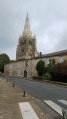
(7) Take the path that branches off to the right, running diagonally between open fields towards Souvigné. This is the path known as the ‘Chemin de la Cannetière’, offering a lovely view of Souvigné church.
(8) Further on, just before reaching a road running alongside Souvigné, turn left onto a path leading towards the village cemetery. The path soon joins the small road. Cross carefully and take the road opposite that runs alongside the cemetery. Continue straight on until the next junction. Turn right and follow the D103 for about thirty metres.
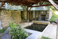
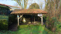
(9) Turn right onto a path leading towards the village. As you approach the houses, at a crossroads, carry on straight ahead along the path on the right for less than fifty metres to reach the Fontaine de Pissot and its washhouse on your right. You will see a Protestant cemetery on the left, near the crossroads.
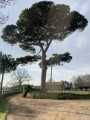
Return to the T-junction and turn right. Shortly afterwards, the path becomes Rue du Prieuré and passes close to a spring on your left. Continue to Rue du Temple, passing the Musée de la Ruralité et de la Coiffe. Turn right and then right again after twenty metres to take a footpath leading to the Temple de Souvigné, in front of which stands a magnificent umbrella pine (see the ‘During the walk’ section). Pass to the right of the Temple via a narrow passage to emerge into an open space and reach Souvigné Town Hall.
Turn left to walk past the town hall, then right into Rue de la Chapelle and, at the next junction, take the path between Rue de la Chapelle and Rue du Rompis. Follow it to the D10 road. Cross the busy D10 road with care (at the pedestrian crossing). Return to the car park opposite (S/E).

 Visorando Member

 Easy