Country:
 City:
City:



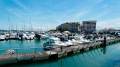

Park in one of the three car parks surrounding the Ancre de Marine roundabout.
(S/E) Join the footpath that runs alongside Baie de l’Orphelinat to start the route. Follow the bay until you reach Marina du Sud. Continue straight on until you reach a roundabout, then take Rue du Capitaine Desmier. Take thefirst left, Rue du Sergent Triquera, and thefirst right to reach Baie des Citrons.
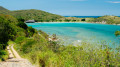
(1) Walk along the bay from north to south and enjoy the safe swimming area. For snorkelling enthusiasts, magnificent coral reefs can be found on the southern side of the bay. Continue along the coast until you reach the Rocher à la Voile, which offers a superb view of the sunsets.
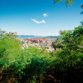
(2) Continue along the coast towards the east to reach the magnificent Anse Vata. Continue along the Promenade Roger Laroque until you reach Chateau Royal Beach. Continue on the same road, past the Hôtel Royal, then further up at the roundabout, take the Route du Ouen Toro which climbs to the left. At the car park, take the path leading into the Parc de l’Ancien Fare, and walk around it to reach a magnificent, almost 360° panorama.
(3) Return to the car park, then a little further up take the path that climbs to the right. From there, continue to follow the path furthest to the left (yellow markings) until you reach a second viewpoint at the top of Parc Ouen Toro, the panorama of the Canons de Ouen Toro.
(4) Walk down the concrete road until you reach a car park from which a path leads down towards the east.
(5) Take this path; an information sign indicates it. Atthe first junction, turn right, then at the next, turn left. Then continue straight on until you leave the park and reach the Promenade Pierre Vernier, which runs alongside the magnificent Baie des Pétroles, with views of the Îlot Sainte-Marie.
(6) Promenade Pierre Vernier – Baie des Pétroles. Continue to the junction, turn left onto Rue Gabriel Laroque, then take thefirst right onto Rue Michel Kauma. Admire the red roofs that are the hallmark of the Quartier Tuband.
(7) At the junction, turn left onto Rue Dick Elmour, then go straight on until you reach Rue James Colnett. Turn right. Unobstructed view of Lac de l'Hippodrome. Take thesecond left onto Rue Émile Legrand. Go straight on until you reach Rue de l'Anse Vata, then turn right onto it.
(8) Entrance to the Receiving Georges Brunelet Municipal Park. Take a stroll through the park, then return to this point and follow Route de l'Anse Vata northwards for approximately 1 km.
(9) At the junction, turn left onto Chemin Jean Perrier
(10) Entrance to the Mont Vénus dry forest park – panoramic view. Cross the park heading north, then take a path down towards Rue Émile Zola. From there, continue down towards Baie de l’Orphelinat, then head to the Rond-Point de l’Ancre de Marine car park (S/E).
 Visorando Member
 Easy
Easy