Sous Dîne, Col du Câble and Chalet de Balme circular loop

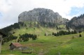
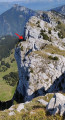
A very beautiful hike with a 360° view from the summit; a fairly long circular route that is technically very challenging. The route alternates between woodland and the sharp limestone pavement, followed by a fairly technical descent to the Col du Câble, featuring a very difficult section. This is followed by a fairly easy descent to the Chalet de Balme, then along a track suitable for vehicles, and through woodland.
Please note: an exposed section at the Col du Câble is reserved for experienced walkers who do not suffer from vertigo.

Details

22619241
Creation:
Last update:
Last review:
  • Walking
    Activity: Walking
  • ↔
    Distance: 7.54 mi
  • ◔
    Duration according to the author: 5 hrs 
  • ▲
    Difficulty: Very difficult

  • ⚐
    Back to start: Yes
  • ↗
    Ascent: + 3,307 ft
  • ↘
    Descent: - 3,291 ft

  • ▲
    Highest point: 6,552 ft
  • ▼
    Lowest point: 3,596 ft

Photos

Description of the walk

Park in the large car park at the end of the hamlet of Les Cheneviers

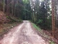
(S/E) From the Les Cheneviers car park, head due south along the track that climbs, following the sign. For nearly 2.5 km, the very wide track climbs at a fairly steep gradient, sheltered from the sun.
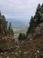
After a lovely view over Fillière, with the Salève in the distance, you’ll reach a junction (elevation 1583).

(1) Turn left, following the sign for Sous Dîne. Continue along a gentle climb on a narrower path for 1 km.

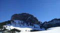
(2) When you reach this junction, turn left, still heading towards Sous Dîne, along a gentle, not very steep climb through the sharp limestone pavement to the summit – take care in wet weather. You’ll reach Sous Dîne.

(3) For the descent, take the small path heading east, which consists of a series of short ascents and descents through the sharp limestone pavement. There are numerous technical sections, two of which are even secured. The path is fairly well marked, but always look ahead to keep an eye on your route. Once you’ve left the sharp limestone pavement, enter the forest, continue straight on and ignore the paths to the right and left.

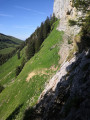
(4) When you reach the Col du Câble, take the small path on your left that leads downwards; after 50 metres you’ll reach the main difficulty of the hike, a challenging section where you must not fall under any circumstances; to help you, a flexible cable is provided to hold on to, as well as 7 or 8 stakes to place your feet on. Continue your descent until you reach the Chalet de Balme.

(5) You can enjoy a meal and some drinks here. There is also a water point available near the chalet. Continue westwards along the wide track for about 1.5 km. Then, keep an eye out on your left for a small path leading downwards.

(6) Leave the track. Continue straight on for 1 km.

(7) At the first junction (elevation 1206), leave the track on your right and turn left for a short climb; once at the top, you’ll reach another junction – take the track on the right. Continue westwards for about 700 m

(8) At the final junction, turn left once more onto the track which climbs slightly, then carry on straight ahead for the final kilometre to the Cheneviers car park (S/E).

Waypoints

  1. S/E : mi 0 - alt. 3,606 ft - Les Cheneviers car park
  2. 1 : mi 1.58 - alt. 5,197 ft - Turn left at the junction
  3. 2 : mi 2.2 - alt. 5,810 ft - Turn left at the junction towards the - Montagne de Sous-Dîne (1905m)
  4. 3 : mi 3.25 - alt. 6,483 ft - Sous Dîne
  5. 4 : mi 4.46 - alt. 5,597 ft - Col du Câble (1693m)
  6. 5 : mi 5 - alt. 4,882 ft - Chalet de Balme - Flan (cours d'eau) - Affluent de la Fillière
  7. 6 : mi 5.88 - alt. 4,370 ft - Turn left at the junction
  8. 7 : mi 6.45 - alt. 3,957 ft - Turn left at the junction
  9. 8 : mi 6.89 - alt. 3,914 ft - Turn left at the junction
  10. S/E : mi 7.54 - alt. 3,596 ft - Les Cheneviers car park

Notes

Water and food available at the Chalet de Balme.
A harness and lanyards may be advisable at the Col du Câble. If you do not feel comfortable crossing this pass, you can continue a little further and cross the Col du Freu instead.
Use the Visorando app for more accurate real-time location tracking; we recommend always downloading the map via Wi-Fi or 4G so you can access it offline.

This route passes through a protected area, which may be subject to special regulations:

Worth a visit

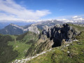
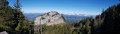
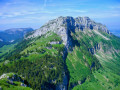
360° view from the summit over Le Môle, the Solaison plateau, Le Bargy, the Aravis, Mont Blanc, the Glières plateau, Le Parmelan, La Tournette, etc.
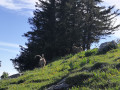
We came across two ibex on the sharp limestone pavement between waypoints (3) and (4).
Trou de la Pierre near the point (1).

Reviews and comments

4.4 / 5
Based on 3 reviews

Reliability of the description
4.3 / 5
Ease of following the route
4 / 5
Route interest
5 / 5
User 8117371

Overall rating : 4.3 / 5

Date of your route : Sep 08, 2025
Reliability of the description : ★★★★☆ Good
Ease of following the route : ★★★★☆ Good
Route interest : ★★★★★ Very good
Very busy route : No

Hike completed on 8 September in good weather
Easy hike to the cross at the top of the Sous Dine plateau... no difficulty and very pleasant
Magnificent view at the summit over the lake and Mont Blanc...
we continued the loop to the Col du Câble... more complicated and not always easy for someone who is not very comfortable on rocky terrain... the path is not very well marked and you have to be careful... it's not really easy to get to the Col du Câble... when you reach the Col du Câble sign, there is nothing to indicate the passage. You have to climb straight up 100 metres above the sign to reach it. There is no difficulty in descending this passage if you are not afraid of heights. It is very well secured with a cable and very wide steps. It has obviously just been redone.
arrival at the refuge: very nice terrace and friendly atmosphere. No more drinking water at the refuge, but they sell water for £2 per litre bottle.
the return to the car park is a bit long... not very interesting and not easy to find... luckily my GPS was working. It had been at least 20 years since I last did this hike, but it was really good: 17.8 km and 1,200 metres of elevation gain..

Machine-translated

Rosy in Divonne
Rosy in Divonne

Overall rating : 5 / 5

Date of your route : Aug 07, 2022
Reliability of the description : ★★★★★ Very good
Ease of following the route : ★★★★★ Very good
Route interest : ★★★★★ Very good
Very busy route : No

A very pleasant route, especially the views from the top of the mountain.
I didn’t complete the circular route by crossing the rock after the Col du Câble to reach the Chalet de Balme, as my husband couldn’t make the descent. He panicked and didn’t even try, so I had to turn back and climb the rock again, taking the farm track to return to the Col de l’Enclave. There is another interesting route to take if you want to avoid descending the rocky outcrop after the Col du Câble: whilst heading down towards the Pas de la Truie, as indicated in the instructions, continue on to the Col du Câble, turn left and descend to the farm track, then follow this track to the Chalet de Landron and the ‘Trou de la Pierre’ (#1). The view of the Montagne Sous Dine from this other side is equally impressive.

Machine-translated

mickou
mickou

Thank you, I’ve added the details.

Machine-translated

jourdeprintemps
jourdeprintemps

Overall rating : 4 / 5

Date of your route : Aug 05, 2022
Reliability of the description : ★★★★☆ Good
Ease of following the route : ★★★☆☆ Average
Route interest : ★★★★★ Very good
Very busy route : No

The final stretch, from point 6 to the car park, is very treacherous.
Forest workers have transformed the woodland; some paths have been destroyed or even wiped out by machinery.
I had no mobile signal, so I had to follow a wide track left by machinery which took me above Les Chenevriers (a half-hour walk along the road).
I’d add that from the summit of Sous-Dine to the Col du Cable, there are numerous technical sections.

Machine-translated

Other walks in the area

For more walks, use our search engine .

The GPS track and description are the property of this route's author. Please do not copy them without permission.