In the countryside around Asap-Arros

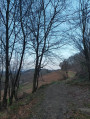
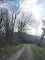
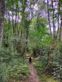
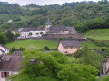
A lovely little walk to the north-east of the village of Asap-Arros, a few kilometres from the town of Oloron-Sainte-Marie. The route follows mainly a narrow country road, with a few kilometres on footpaths.

Details

5870978
Creation:
Last update:
Last review:
  • Walking
    Activity: Walking
  • ↔
    Distance: 4.69 mi
  • ◔
    Average duration: 2h 35 
  • ▲
    Difficulty: Easy

  • ⚐
    Back to start: Yes
  • ↗
    Ascent: + 515 ft
  • ↘
    Descent: - 525 ft

  • ▲
    Highest point: 1,453 ft
  • ▼
    Lowest point: 961 ft

Photos

Description of the walk

From the road (Chemin de Monlong), before the Lacanette Fountain, park at the entrance to the track on the right without turning onto it. Please note: do not obstruct the flow of other vehicles.

(S/E) Continue on foot along the road, leaving the track and your car on your right. Follow the road straight ahead.

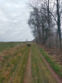
(1) The road turns into a track. Carry on straight ahead until you reach a large crossroads.

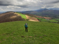
(2) Take the second track on the left. Pass a large gate (on your left) and follow the path along the hillside. Enjoy the lovely view on your left. Follow the main path without leaving it until you reach a hunter’s hut at the junction with a track suitable for vehicles.

(3) At this hunter’s hut, turn left. Follow the track until you reach a tarmac country road. Pass under the power line. Continue straight on along the road until you reach a junction where the road descends towards the village of Asasp-Arros.

(4) At the junction, head straight down, due south.
You can also take a detour to the left to walk up to Les Castets and back.
Follow the main road through the village until you reach a junction directly ahead of you.

(5) Take the road that climbs to the left and follow it until you reach your car (S/E).

Waypoints

  1. S/E : mi 0 - alt. 1,125 ft - Path
  2. 1 : mi 0.48 - alt. 1,175 ft - End of the route
  3. 2 : mi 0.65 - alt. 1,237 ft - Crossroads
  4. 3 : mi 1.65 - alt. 1,388 ft - Hunters’ hut
  5. 4 : mi 2.95 - alt. 1,119 ft - Junction towards Castets
  6. 5 : mi 3.81 - alt. 971 ft - Road leading uphill
  7. S/E : mi 4.69 - alt. 1,129 ft - Path

Notes

It may be better to park in the village of Asap-Arros.

Worth a visit

Make the most of this excursion to climb up to Castets (403 m), which offers superb views. There is an orientation map to help you find your way around.

Reviews and comments

4.7 / 5
Based on 2 reviews

Reliability of the description
5 / 5
Ease of following the route
5 / 5
Route interest
4 / 5
Milsou
Milsou
• Edited:

Overall rating : 4.7 / 5

Date of your route : May 17, 2021
Reliability of the description : ★★★★★ Very good
Ease of following the route : ★★★★★ Very good
Route interest : ★★★★☆ Good
Very busy route : No

Hello,
I agree with the previous comment; it’s better to stop at the stadium (just before point 5 on the walk) as there are parking spaces there, and it means you don’t have to walk the same route twice to get back to the start, as it’s actually part of the walk itself.
Kind regards,

Machine-translated

Philrug31
Philrug31

Overall rating : 4.7 / 5

Date of your route : Apr 15, 2021
Reliability of the description : ★★★★★ Very good
Ease of following the route : ★★★★★ Very good
Route interest : ★★★★☆ Good
Very busy route : No

Hello,

I think the starting point for the walk should be the car park at Asasp Stadium – which we pass on the way back – as it’s easy to park there and avoids having to walk back up at the end of the walk to get back to the current starting point.
Kind regards.

Machine-translated

Other walks in the area

For more walks, use our search engine .

The GPS track and description are the property of this route's author. Please do not copy them without permission.