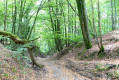
Saint-Germain-la-Ville circular walk

Starting from Saint-Germain-la-Ville, this circular route of almost 8 km is an easy walk on flat ground and takes around 2½ hours.

Details

n°2335920
Creation:
Last update:
Last review:
  • Walking
    Activity: Walking
  • ↔
    Distance: 4.83 mi
  • ◔
    Average duration: 2h 15 
  • ▲
    Difficulty: Easy

  • ⚐
    Back to start: Yes
  • ↗
    Ascent: + 16 ft
  • ↘
    Descent: - 13 ft

  • ▲
    Highest point: 295 ft
  • ▼
    Lowest point: 276 ft

Description of the walk

The circular walk follows, on the one hand, the towpath of the Marne side canal, and on the other, theGR®654.
You can park opposite the village exit sign on the D280 road towards Mairy-sur-Marne. There is space here for two or three cars.

(S/E) Head towards Châlons-en-Champagne along the towpath and follow the Marne side canal on your right.

(1) Pass the first bridge and continue along the towpath towards Châlons.

(2) At the second bridge, turn left and leave the towpath. Turn right and you’ll immediately come to a junction with threeGR® trails running alongside each other.

(3) Turn left here and follow theGR® trails alongside a pond on your right.

(4) Turn left to follow the Marne on your right. The route continues through a succession of fields and woods, and theGR® trails move away from the river before returning to it.

(5) Leave the banks of the Marne via the small road on the left.

(6) Take the first path on the right.

(7) Near some ponds, turn left. Join a path running parallel to the towpath and turn right. Follow this parallel path until you reach the D280 road.

(8) Then turn left towards Saint-Germain-la-Ville and you’ll immediately come back to the car park (S/E).

Waypoints

  1. S/E : mi 0 - alt. 289 ft - Towpath - Canal latéral à la Marne
  2. 1 : mi 1.21 - alt. 292 ft - Bridge near Chepy
  3. 2 : mi 1.88 - alt. 292 ft - Turn left at the second bridge
  4. 3 : mi 2.03 - alt. 279 ft - Junction with the GR
  5. 4 : mi 2.25 - alt. 276 ft - Edge of the - Marne (la)
  6. 5 : mi 3.08 - alt. 279 ft - Turn left
  7. 6 : mi 3.34 - alt. 279 ft - Junction
  8. 7 : mi 3.86 - alt. 279 ft - Ponds
  9. 8 : mi 4.75 - alt. 285 ft - D280
  10. S/E : mi 4.83 - alt. 292 ft - Towpath, near the - Moivre dérivée (rivière) - Affluent du Mau

Notes

- Park on the grass at the village exit heading towards Mairy-sur-Marne on the D280.
- Around mid-August, take a small bag to put the blackberries you’ll be picking along the way into.
- Take a pair of binoculars to spot the many herons that have made their home in the Pré Saint-Mange.

Worth a visit

- Pick blackberries when they’re in season.
- Watch the herons.

Always be cautious and plan ahead when you're outdoors. Visorando and the author of this route cannot be held responsible for any accidents occurring on this route.

The GR® and PR® markings are the intellectual property of the Fédération Française de Randonnée Pédestre.

Reviews and comments

4 / 5
Based on 2 reviews

Reliability of the description
4.5 / 5
Ease of following the route
4.5 / 5
Route interest
3 / 5
christian DUPIRE
christian DUPIRE
• Edited:

Overall rating : 5 / 5

Date of your route : Jun 08, 2020
Reliability of the description : ★★★★★ Very good
Ease of following the route : ★★★★★ Very good
Route interest : ★★★★★ Very good
Very busy route : No

Watch out for mosquitoes along the canal just before it turns into the fields

Machine-translated

Other walks in the area

For more walks, use our search engine .

The GPS track and description are the property of this route's author. Please do not copy them without permission.