Country:
 City:
City:


Start from the car park of the small shopping centre in Pogny.
(S/E) Head south-east along the road for about 300 metres.
(1) Cross the road and take Rue du Champ Melot opposite, then continue straight on along Rue de l’Église and Rue Puthaon.
(2) Turn right along the canal, leaving the bridge on your left, and carry on straight ahead along Rue du Port until you reach the silos.
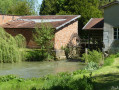
(3) Carry on straight ahead along the path that winds between the canal and the Moivre, pass the weir and carry on straight ahead to the bridge.
(4) Turn left onto the bridge and take the towpath on the left until you reach a path junction on the right.
(5) Leave the towpath and continue along the path on the right, keeping straight on until you reach the bridge.
(6) Turn right onto the Marne bridge, then immediately right again, and carry on straight ahead for 1,500 metres, ignoring the paths branching off to the left and right.
(7) Turn left, ignoring the path that continues straight on. Walk for about 250 metres, then turn left again; after 120 metres, turn right, then left after 200 metres. The path runs alongside the woodland and a field. Head for the south-east corner of the field.
(8) Turn left and follow the edge of the woodland. The path turns right and crosses through the woodland. Continue straight on, ignoring the path on the left. Follow the path that runs along the right-hand edge of the woodland until you reach the end of the woodland.
(9) Turn left for about 200 metres, then right between the fields. After crossing a woodland, you’ll reach a road (D54).
(10) Turn left along the D54 for about 150 metres and take the path on the right which rejoins the D54. Continue to the right and cross the bridge over the Marne only.
(6) Carry on to the right along the canal towpath and continue straight on to the Omey Water Station.
(11) At the left-hand bend in the towpath, take the path on the right, heading south-west, until you reach the railway line. Cross the line and carry on straight ahead until you reach the track. Turn right and walk round the pond, keeping it on your left, then carry on straight ahead alongside the sewage treatment works.
(12) Turn left to cross the canal bridge, then left again. Walk alongside the canal, passing the factory buildings on your right, and head to the next junction.
(13) Turn right and go up Rue de L’Ang-Perrière. Once you reach Rue Charles Lemaire, first turn left then right to take Ruelle des Vignes, which is almost directly opposite.
(14) At the end of the street, turn left, then right about 250 metres further on.
(1) Turn left to reach the car park (S/E).


 So we had to veer off the route three times. With a GPS, it’s easy to find your way back. Here are the three ‘critical’ spots:
 Visorando Member
 Easy
Easy