Bignicourt-sur-Marne via Neuville and Norrois

A walk taking in the banks of the Marne, parks and small villages.

Details

253297
Creation:
Last update:
Last review:
  • Walking
    Activity: Walking
  • ↔
    Distance: 6.42 mi
  • ◔
    Average duration: 3h 00 
  • ▲
    Difficulty: Easy

  • ⚐
    Back to start: Yes
  • ↗
    Ascent: + 20 ft
  • ↘
    Descent: - 20 ft

  • ▲
    Highest point: 367 ft
  • ▼
    Lowest point: 335 ft

Description of the walk

Car park at the Town Hall, Rue Jean-Marie Aubry in Bignicourt-sur-Marne.

(S/E) Turn right opposite the town hall, turn left onto Rue de l’Amiral Guepratte, then after 40 metres take the path on the right and continue for 200 metres.

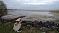
(1) Turn left between the large stones and cross the iron bridge over the Marne; immediately turn right onto the path that runs alongside the river for 1,300 metres.

(2) Turn left between the poplars and rejoin the riverbank path, then carry on straight ahead, crossing a bridge over the “Canal de la Blaise”.

(3) Turn left onto theGR®145–GR® 654, the Way of St James, towards Neuville-sous-Arzillères, and head for the junction on Rue Principale.

(4) At the junction, leave theGR® and turn left, cross the bridge over the Isson and continue along the small tarmac road.

(5) Leave the road and turn left onto the riverside path.

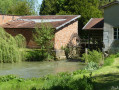
(6) At the crossroads, turn right, cross the small ‘Carpière’ bridge and the Marne bridge, then walk past the old wash house to reach Norrois.

(7) Turn left onto Rue de la Saint-Pierre, pass a second wash house and carry on until you reach the right-hand bend.

(8) At the bend, veer slightly to the left, still on Rue de la Saint-Pierre, and head towards the junction with Rue Jean Marie Aubry in Bignicourt-sur-Marne.

(9) Turn left towards the town hall car park, which is very close by (S/E).

Waypoints

  1. S/E : mi 0 - alt. 348 ft - Town hall car park
  2. 1 : mi 0.17 - alt. 338 ft - To the left between the stones - Marne (la)
  3. 2 : mi 0.99 - alt. 344 ft - Turn right between the poplars
  4. 3 : mi 1.42 - alt. 338 ft - On the left, the GR145 (Way of St James), after the - Isson (rivière) - Affluent de la Marne
  5. 4 : mi 3.47 - alt. 367 ft - To the left
  6. 5 : mi 3.89 - alt. 348 ft - Turn left onto the path
  7. 6 : mi 4.62 - alt. 344 ft - Turn right towards Norrois
  8. 7 : mi 5.31 - alt. 358 ft - Turn left onto Rue de la Saint-Pierre - Marne (la)
  9. 8 : mi 5.86 - alt. 358 ft - Turn left at the bend
  10. 9 : mi 6.35 - alt. 348 ft - Rue Jean Marie Aubry
  11. S/E : mi 6.42 - alt. 348 ft - Town hall car park

Notes

Bring water with you – there are no shops along the route – and wear sturdy footwear; the paths along the Marne can sometimes be slippery.
Do not undertake this walk in the event of flooding (paths along the Marne will be under water).
Shelters are available in Neuville-sous-Arzillères and Norrois.

Worth a visit

Visit Vitry-le-François; Villa Victoria Tourist Office, 8 Esplanade de Strasbourg.
Lac du Der is 25 km away.
Champagne des Coteaux Vitryats (vineyards and champagne) in Bassuet, 15 km away.

Always be cautious and plan ahead when you're outdoors. Visorando and the author of this route cannot be held responsible for any accidents occurring on this route.

The GR® and PR® markings are the intellectual property of the Fédération Française de Randonnée Pédestre.

Reviews and comments

4.3 / 5
Based on 3 reviews

Reliability of the description
4 / 5
Ease of following the route
4.7 / 5
Route interest
4.3 / 5
Julie3095
Julie3095
• Edited:

Overall rating : 4.7 / 5

Date of your route : Sep 28, 2024
Reliability of the description : ★★★★★ Very good
Ease of following the route : ★★★★★ Very good
Route interest : ★★★★☆ Good
Very busy route : No

The 1,300 metres from point 1 onwards are not maintained. You have to find your own way through the tall grass, brambles and fallen trees – it’s a bit like Koh Lanta
Otherwise, the walk is pleasant.
Thanks for the route.

Machine-translated

mad0
mad0

I can’t get the app to work on my phone, sorry, so 1,300 metres by eye isn’t easy!

Machine-translated

courjus52
courjus52

Hello,
yet it says earlier: “Cross the iron bridge over the Marne, then turn immediately right onto the path that runs alongside the river for 1,300 metres.” It’s not 500 metres, nor 1,000 metres.
If you use the Visorando app, you can see very clearly where to turn, as the GPS is accurate to within about 10 metres.
The ground is quite muddy at the moment, so you were right to turn back.
Kind regards.

Machine-translated

mad0
mad0

Overall rating : 3.7 / 5

Date of your route : Apr 13, 2021
Reliability of the description : ★★☆☆☆ Disappointing
Ease of following the route : ★★★★☆ Good
Route interest : ★★★★★ Very good
Very busy route : No

We got lost at the point where it said ‘after 1,300 metres, turn left under the poplars and rejoin the beach path’; I think we turned too early (and besides, I don’t know what a beach path is). We had to turn back

Machine-translated

Baladoderleader
Baladoderleader

Overall rating : 4.7 / 5

Date of your route : Apr 01, 2019
Reliability of the description : ★★★★★ Very good
Ease of following the route : ★★★★★ Very good
Route interest : ★★★★☆ Good

A pleasant and varied walk with 10 walkers from “Baladoder”
We covered 8 km by taking a shortcut via the Pré de Poste ford. (Turn left between points 3 and 4, before the right-left bend on the GR path at the crossing of the Ruisseau de la Fontaine l’Antoine. A 30 cm-deep ford through a scree slope...)
This alternative route joins point 6 without going through Neuville.
You can park at point 1 – it’s nicer that way.
Thanks for this route.

Machine-translated

Other walks in the area

For more walks, use our search engine .

The GPS track and description are the property of this route's author. Please do not copy them without permission.