Circular Roquefort to Petite-Sainte-Baume

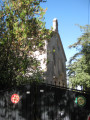
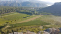
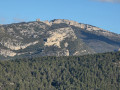
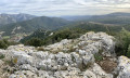
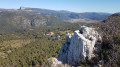
An easy walk to the beautiful cliffs of Petite-Sainte-Baume around the Grand Rouvière wine estate.

Details

n°31263971
Creation:
Last update:
Last review:
  • Walking
    Activity: Walking
  • ↔
    Distance: 7.01 mi
  • ◔
    Average duration: 4h 00 
  • ▲
    Difficulty: Moderate

  • ⚐
    Back to start: Yes
  • ↗
    Ascent: + 883 ft
  • ↘
    Descent: - 883 ft

  • ▲
    Highest point: 1,250 ft
  • ▼
    Lowest point: 879 ft

Photos

Description of the walk

The route starts from the car park at the cemetery in the hamlet of Roquefort, 2 km east of the village of Roquefort-la-Bédoule, on the Route du Col de l’Ange.

(S/E) Take the track heading east.

(1) After 400 m, follow the barely visible path which heads straight into the scrub. After about 300 m, the path seems to come to an end: do not persist, but turn left to join a better-marked track and follow it, still heading east. You will reach a track near the road; turn left. Keep to the right at each junction until you come out onto a track.

(2) Head straight south and cross the road with care. Reach the Bastides neighbourhood, turn left and go through the barrier.

(3) Head down to the right into the stream bed, follow the path southwards, then turn right towards the ruins of an old lime kiln. Turn left onto the track that leads uphill just before the ruins.

(4) Just as you come out of a bend, turn left onto a path leading downhill.

(5) After about 400 m, turn left. You’ll come to a large plain; head north-west to reach the road. Walk up the road on the left, taking care.

(6) Cross over to pass the barrier on the right-hand side of the road and take the track heading north. At the ‘roundabout’ with trees in the centre, carry on straight ahead, go round a wide bend to the left, then reach the exit on the left and find a path on the left.

(7) Take this path to the left and head uphill in an almost straight line. At the top, go down slightly, then go up again and descend steeply. Continue straight on until you reach a track suitable for vehicles.

(8) Follow it, veering slightly to the left, until you spot a path on the left (return route).

(9) Continue along the track until the next junction.

(10) Continue along the track to the left, then take the path on the left before rejoining the track.

(11) Turn onto the path on the left, between two rocks, clearly signposted “Gorges de la Petite-Sainte-Baume”. After about a hundred metres, head down to the left onto a small path and arrive at the gorges. Walk down them, turning left towards the east: watch out for the eroded path!

(12) After 200 metres, turn left onto a poorly maintained track and rejoin the track you passed earlier.

(9) Carry on to the right and retrace your steps until you reach the next junction.

(8) Carry on along the track to the right.

(13) At the junction, go straight on and you will reach a fork near the track you took on the way there.

(2) Take the track on the right and follow it for about 1.2 km until you reach a crossroads.

(14) Turn left – almost a hairpin bend – and follow the track back to the junction you passed on the way there.

(1) Carry on to the right and return to the car park (S/E).

Waypoints

  1. S/E : mi 0 - alt. 1,060 ft - Cemetery car park - Vieux Roquefort (Roquefort-la-Bédoule)
  2. 1 : mi 0.22 - alt. 1,155 ft - Path straight ahead
  3. 2 : mi 1.04 - alt. 1,089 ft - Route de Cuges-Les-Pins
  4. 3 : mi 1.32 - alt. 1,158 ft - Stream bed - Chapelle Saint-André (Roquefort-la-Bédoule)
  5. 4 : mi 2 - alt. 1,191 ft - Path on the left
  6. 5 : mi 2.28 - alt. 1,119 ft - Path to the left
  7. 6 : mi 2.61 - alt. 1,004 ft - Track on the right
  8. 7 : mi 3.15 - alt. 879 ft - Path on the left
  9. 8 : mi 3.52 - alt. 961 ft - Track
  10. 9 : mi 3.82 - alt. 1,014 ft - A/R junction
  11. 10 : mi 4 - alt. 1,070 ft - Track on the left
  12. 11 : mi 4.26 - alt. 1,181 ft - Path on the left
  13. 12 : mi 4.61 - alt. 932 ft - Path on the left
  14. 13 : mi 5.45 - alt. 968 ft - Crossroads
  15. 14 : mi 6.49 - alt. 1,145 ft - Track to the left
  16. S/E : mi 7.01 - alt. 1,056 ft - Cemetery car park

Reviews and comments

4.5 / 5
Based on 22 reviews

Reliability of the description
4.7 / 5
Ease of following the route
4.5 / 5
Route interest
4.4 / 5
User 31418861

Overall rating : 5 / 5

Date of your route : Oct 05, 2026
Reliability of the description : ★★★★★ Very good
Ease of following the route : ★★★★★ Very good
Route interest : ★★★★★ Very good
Very busy route : No

A lovely walk. Very detailed description.
Thank you!

Machine-translated

Denis26
Denis26 ★

Thank you for your comments; I’ve just amended the route to avoid the private property.

Machine-translated

Daniel Ganem
Daniel Ganem

Hello, and thank you for your review. Did you manage to visit Saint-André Chapel? Kind regards, Daniel

Machine-translated

quinqua.13
quinqua.13

Overall rating : 4.7 / 5

Date of your route : Sep 21, 2026
Reliability of the description : ★★★★★ Very good
Ease of following the route : ★★★★☆ Good
Route interest : ★★★★★ Very good
Very busy route : No

A lovely route; I modified it slightly to head up to Saint-André Chapel, which is honestly well worth the detour with its breathtaking views, and on the way back down, at the junction with the GR 98, turn left onto a steep path that rejoins the original route.
Please note that the path from point 7 is blocked by a ‘Private Road’ sign, but you can walk 400 metres before taking a path on the left which takes you back up to the return route; from there, turn right for 20 metres, then left to find yourself halfway to point 8 towards the Petite Sainte Baume Gorges.

Machine-translated

Bipbip13500
Bipbip13500

Overall rating : 3 / 5

Date of your route : Feb 28, 2026
Reliability of the description : ★★★☆☆ Average
Ease of following the route : ★★★☆☆ Average
Route interest : ★★★☆☆ Average
Very busy route : No

Hello,

First of all, no, a DFCI is not necessarily open to the public. Agreements are made between the state and landowners to ensure that various fire prevention and firefighting vehicles can travel freely on these roads. Most of the time, they are indeed public and freely accessible to all. However, if the land is private and the owner objects by reporting it, you do not have the right to drive on it. "These DFCI tracks have the status of specialised roads, not open to general traffic. They are reserved for use by the beneficiary services and the owners of the land and their beneficiaries." https://www.bouches-du-rhone.gouv.fr/Act....
There are numerous clear signs indicating "private road, no entry"; you are breaking the law if you use these roads. It is important to note that in France, more than 75% of forests are privately owned. If we do not want landowners to end up prohibiting access and/or fencing off their land, I think it is important to try to respect each other in order to limit the already complicated tensions over land sharing, particularly with hunters and mountain bikers.

We therefore stopped our progress at point 7, retraced our steps a little and then took a path to our right (not marked as private property) and reached point 11. On several occasions, particularly on our right, we saw signs prohibiting entry onto the vineyard land where the owner's house is located, but on that side, the path can be used as it is not private.

A pleasant hike with no particular difficulties.

Machine-translated

lombrequimarche
lombrequimarche

Overall rating : 5 / 5

Date of your route : Jan 29, 2026
Reliability of the description : ★★★★★ Very good
Ease of following the route : ★★★★★ Very good
Route interest : ★★★★★ Very good
Very busy route : No

A very pleasant hike with varied landscapes, easy access, impeccable signposting and marking, and no difficulties whatsoever. The section through the Petite Ste-Baume gorge is short but very enjoyable. The only downside was on the way back, when we were walking around the vineyards, we met a hunter who introduced himself as a "guard" and told us that we were on private property and that we were not allowed to walk through the vineyards and that we could be fined if we were caught by the forest rangers.
We pointed out that we were on a DFCI (firebreak) and continued on our way.
Thank you for this discovery hike.

Machine-translated

favery
favery

Overall rating : 4.3 / 5

Date of your route : Nov 24, 2025
Reliability of the description : ★★★★★ Very good
Ease of following the route : ★★★★☆ Good
Route interest : ★★★★☆ Good
Very busy route : No

A lovely, easy walk:
But I took a different route because the descent to the vineyards is difficult.
When I reached the two holes, I took the path down to the left, then at the bottom I went straight ahead and turned left to rejoin the morning's route.

Machine-translated

Aladeli
Aladeli

Overall rating : 4.7 / 5

Date of your route : Nov 17, 2025
Reliability of the description : ★★★★★ Very good
Ease of following the route : ★★★★★ Very good
Route interest : ★★★★☆ Good
Very busy route : No

Easy hike in dry weather. Please note that in wet weather, the return trip down the gorge can be slippery.

Machine-translated

gillou13
gillou13

Overall rating : 4.7 / 5

Date of your route : Oct 27, 2025
Reliability of the description : ★★★★★ Very good
Ease of following the route : ★★★★★ Very good
Route interest : ★★★★☆ Good
Very busy route : No

Petite Sainte Baume: A must-see!

Machine-translated

Daniel Ganem
Daniel Ganem

Overall rating : 5 / 5

Date of your route : Apr 25, 2025
Reliability of the description : ★★★★★ Very good
Ease of following the route : ★★★★★ Very good
Route interest : ★★★★★ Very good
Very busy route : No

a lovely walk for those with fragile knees and ankles. Recommended for groups of walkers over 50 years old. Partly in woodland, very pleasant to walk through. Gentle climb, wide paths, lots of flowers and beautiful views. I thoroughly enjoyed it

Machine-translated

plovier
plovier

Overall rating : 5 / 5

Date of your route : Apr 21, 2025
Reliability of the description : ★★★★★ Very good
Ease of following the route : ★★★★★ Very good
Route interest : ★★★★★ Very good
Very busy route : No

description consistent with the hike.
I'm not sure you need to go into the thicket at point 1, as you come to a path that may be the one on your left before going in. Otherwise, no difficulty
Thank you for this wonderful discovery

Machine-translated

MOICRI
MOICRI

Pleasant hike with views of the Sainte Baume mountain range.
Easy trails, mostly through the forest.
The Petite Sainte Baume gorges
are worth seeing.

Machine-translated

bernard coulomb
bernard coulomb

Overall rating : 4 / 5

Date of your route : Nov 10, 2024
Reliability of the description : Not used / Not applicable
Ease of following the route : ★★★★★ Very good
Route interest : ★★★☆☆ Average
Very busy route : No

A simple forest walk to get your legs back into shape before more strenuous adventures.

Machine-translated

Les fantastiques
Les fantastiques

Overall rating : 4 / 5

Date of your route : Oct 10, 2024
Reliability of the description : ★★★★☆ Good
Ease of following the route : ★★★★☆ Good
Route interest : ★★★★☆ Good
Very busy route : No

A very pleasant route with no difficulties whatsoever. I would classify this hike as easy rather than moderate. 👍

Machine-translated

Christell
Christell

Overall rating : 5 / 5

Date of your route : May 29, 2024
Reliability of the description : Not used / Not applicable
Ease of following the route : Not used / Not applicable
Route interest : ★★★★★ Very good
Very busy route : No

A superb discovery! The hike is only tracked by GPS because the beginning is quite difficult to follow.
The walk is easy, the views are superb, the trail is not very busy, and the landscapes are varied. I live not far from this place, and yet I knew absolutely nothing about these hills, which are really worth discovering. I highly recommend it!!!

Machine-translated

Other walks in the area

For more walks, use our search engine .

The GPS track and description are the property of this route's author. Please do not copy them without permission.