Country:
 City:
City:


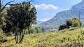
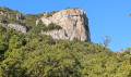
The route starts from the car park at Roquefort cemetery, on the D1 between La Bédoule and the Col de l’Ange.
(S/E) Head due east along the track leading from the car park.
(1) After 350 m, leave the track and follow a path marked by a cairn on the right.
(2) Turn left at this point: the path is blocked straight ahead. Join a track and continue to the right until you reach the D1.
(3) Cross with care and head straight on along a path after a slope, which heads eastwards. Continue for 600 m.
(4) After passing the last houses of Les Bastides, turn right, heading south, until you descend into a dry stream bed and then climb back up following the well-marked path.
(5) Take a path opposite, which joins a track, and continue to the left for about 900 m.
(6) Continue left along the main track and stay on it for 2 km. You’ll come to a cross track.
(7) Cross this track and take the path diagonally to the left. Follow this path, which leads out onto the D1; follow it to the left. Pass in front of Julhans Castle and the Notre-Dame des Pieds Noirs Chapel. Head down to a hunters’ car park.
(8) On your right, you’ll see the start of a path leading down towards a bridge. Go under the bridge and join a track; follow it in the same direction until you reach a right-hand bend.
(9) Leave the track and continue slightly to the left along a gently ascending path, then turn left 60 metres further on.
(10) At this fork in the road, take the track on the right and you’ll reach a crossroads of tracks.
(11) Turn left, then immediately right under a tree, and continue west, then south-west.
(12) Take the track slightly to the right, then 150 m further on, turn right and reach a three-way junction.
(13) Follow the track on the left for about 350 m.
(14) Turn left, walk for about 500 m and you’ll reach the car park (S/E).
 Visorando Member
 Moderate
 Association / Club / Walk leader
 Difficult