Gémenos – Julhans – Saint-André Chapel

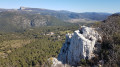
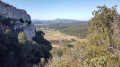
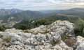
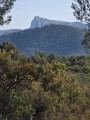
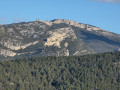
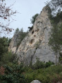
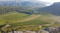
A walk to the well-known St-André de Julhans Chapel, offering beautiful views of Sainte-Baume and the Gémenos plain, with the Marseille region visible in the distance. The walk starts at the fork in the road where the Gémenos and Cuges-les-Pins roads meet, 4 km from the entrance to Aubagne; there are plenty of parking spaces available at this junction.

Details

69113273
Creation:
Last update:
Last review:
  • Walking
    Activity: Walking
  • ↔
    Distance: 6.98 mi
  • ◔
    Average duration: 4h 20 
  • ▲
    Difficulty: Moderate

  • ⚐
    Back to start: Yes
  • ↗
    Ascent: + 1,309 ft
  • ↘
    Descent: - 1,302 ft

  • ▲
    Highest point: 1,591 ft
  • ▼
    Lowest point: 407 ft

Photos

Description of the walk

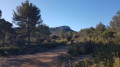
(S/E) Take the track heading south at the far end of the car park. Walk for about 200 m, thenturn left and begin the winding ascent.

(1) Look out for the return track on your right and carry on straight ahead. Navigate the hairpin bend to the right.

(2) At this fork in the road, turn left and follow the winding track for almost 2 km. 

(3) Take the track on the right at this junction: view of Julhans Castle. When you reach the road, turn leftand carefully make your way down it, crossing a small bridge.

(4) Turn into a hunters’ car park on the right and follow the path running alongside the road for just under a kilometre.

(5) Continue along the track on the right.

(6) Start the climb to the right and keep to the right at the three-way junction that appears shortly afterwards. Carry on until you reach a hairpin bend to the right. 

(7) Take the path on the left which climbs straight southwards.

(8) When you reach a track, turn right and you’ll come to a three-way junction. 

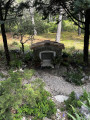
(9) Take the track on the right and you’ll reach the Chapelle Saint-André. Don’t miss the viewpoint behind it on the promontory overlooking the valley.

(10) Carefully make your way down the path below the chapel, as it is quite steep and slippery.At the bottom of the descent, turn right, passing an old lime kiln.

(11) Turn left onto a path that descends towards a stream. Climb back up the other side and turn left. Walk past the first two houses. 

(12) Take the track on the right and continue straight on after carefully crossing the Route de Cuges. 

(13) At the left-hand bend, go straight on along a forest clearing used for gas pipelines. Head downhill for about 600 metres, cutting across a track. 

(14) Turn right onto the track and rejoin the one you started on. 

(1) Turn left and head back to the car park(S/E).

Waypoints

  1. S/E : mi 0 - alt. 407 ft - Cuges Gémenos crossroads
  2. 1 : mi 0.45 - alt. 584 ft - Junction at the end of the circular loop
  3. 2 : mi 0.96 - alt. 807 ft - Junction. Hairpin bend to the left
  4. 3 : mi 1.78 - alt. 958 ft - Junction
  5. 4 : mi 2.16 - alt. 1,001 ft - Hunters’ car park
  6. 5 : mi 2.44 - alt. 1,014 ft - Path on the right
  7. 6 : mi 3.03 - alt. 1,030 ft - Junction
  8. 7 : mi 4.19 - alt. 1,194 ft - Uphill path
  9. 8 : mi 4.35 - alt. 1,421 ft - Junction. Track
  10. 9 : mi 4.65 - alt. 1,539 ft - Track on the right
  11. 10 : mi 4.83 - alt. 1,578 ft - Saint-André Chapel
  12. 11 : mi 5.08 - alt. 1,181 ft - Junction. Path
  13. 12 : mi 5.23 - alt. 1,181 ft - Track on the right
  14. 13 : mi 6.01 - alt. 961 ft - Gas pipeline clearing
  15. 14 : mi 6.4 - alt. 633 ft - Track on the right
  16. S/E : mi 6.98 - alt. 407 ft - Cuges Gémenos crossroads

Reviews and comments

4.8 / 5
Based on 3 reviews

Reliability of the description
5 / 5
Ease of following the route
5 / 5
Route interest
4.3 / 5
Gijean
Gijean

Overall rating : 5 / 5

Date of your route : Feb 24, 2025
Reliability of the description : ★★★★★ Very good
Ease of following the route : ★★★★★ Very good
Route interest : ★★★★★ Very good
Very busy route : No

A lovely hike with beautiful trails and a final descent where you need to be careful ⚠️
Took 3 hours

Machine-translated

robertrouen
robertrouen

Overall rating : 4.7 / 5

Date of your route : Mar 03, 2025
Reliability of the description : ★★★★★ Very good
Ease of following the route : ★★★★★ Very good
Route interest : ★★★★☆ Good
Very busy route : No

Hello,
Thank you to the visorandonneur for making this available to subscribers.

Machine-translated

lonesloane_13
lonesloane_13

Overall rating : 4.7 / 5

Date of your route : Mar 03, 2025
Reliability of the description : ★★★★★ Very good
Ease of following the route : ★★★★★ Very good
Route interest : ★★★★☆ Good
Very busy route : No

A lovely walk! We’d never reached the Chapelle Saint-André via this route before; there were beautiful views of Sainte-Baume and, in the distance, a glimpse of Sainte-Victoire and Le Ventoux, whose summit appeared to be covered in snow.
Most of the route follows tracks, but these aren’t too stony and are therefore pleasant to walk on.
A lovely walk that’s easy to do with children.

Machine-translated

Other walks in the area

For more walks, use our search engine .

The GPS track and description are the property of this route's author. Please do not copy them without permission.