Circular Roissard starting from the Col du Fau

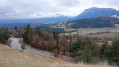
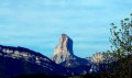
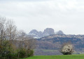
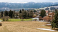
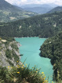
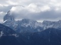
This short walk will allow you to enjoy views over the Trièves and the surrounding peaks, as well as the charming little village of Roissard, typical of this region.

Details

44408817
Creation:
Last update:
Last review:
  • Walking
    Activity: Walking
  • ↔
    Distance: 5.34 mi
  • ◔
    Average duration: 3h 05 
  • ▲
    Difficulty: Easy

  • ⚐
    Back to start: Yes
  • ↗
    Ascent: + 764 ft
  • ↘
    Descent: - 781 ft

  • ▲
    Highest point: 3,133 ft
  • ▼
    Lowest point: 2,395 ft

Photos

Description of the walk

Park in a small car park, situated not far from the Col du Fau, at the start of the D34 departmental road which leads to Mens via Roissard and the Brion bridge. There is a war memorial here.

(S/E) Leave the car park, walk about ten metres along the road towards Roissard, then turn left onto a track that climbs northwards before veering south-east. Follow this track to the Col de Fraisse.

(1) Head due south along the path on the right, descending through the forest to the D34 road. Follow it for a few metres to the left, then turn right off it at the crossroads marked by a cross. Immediately afterwards, you’ll reach a crossroads of footpaths at the entrance to the village of Roissard.

(2) Turn left here, then turn right onto Rue des Hauches to reach the crossroads by Roissard church.

(3) Turn right, walk past the town hall, cross the village and return to the crossroads you passed earlier.

(2) Turn left onto the small road, cross the Rif de Pierre Grosse, then the Rif des Ruches. You’ll reach the hamlet of l’Homme.

(4) Turn right onto the road and follow it slightly uphill to reach Les Peyrouses.

(5) Turn right, then left after the last houses. Follow this good track, heading north-west, then north. You’ll reach a crossroads with four perpendicular roads.

(6) Continue straight ahead, cross the Ruisseau des Côtes de Farceyre and, further on, cross the railway line with great care and complete the climb to the Col du Fau car park (S/E).

Waypoints

  1. S/E : mi 0 - alt. 2,946 ft - Car park at the
  2. 1 : mi 0.97 - alt. 3,100 ft - Col de Fraisse
  3. 2 : mi 1.97 - alt. 2,477 ft - Junction of the circular loop
  4. 3 : mi 2.4 - alt. 2,441 ft - Roissard Church
  5. 4 : mi 3.44 - alt. 2,510 ft - L’Homme
  6. 5 : mi 3.77 - alt. 2,516 ft - Les Peyrouses
  7. 6 : mi 4.52 - alt. 2,687 ft - Four-way junction
  8. S/E : mi 5.34 - alt. 2,936 ft - Car park at the

Notes

The paths are very well marked in yellow with directional signs. The route follows very good paths with a few short tarmac roads.
Between (6) and (S/E) Note the railway line linking Grenoble to Gap.

Reviews and comments

4.5 / 5
Based on 2 reviews

Reliability of the description
4.5 / 5
Ease of following the route
4.5 / 5
Route interest
4.5 / 5
rezzouqi
rezzouqi

Overall rating : 4.7 / 5

Date of your route : Oct 20, 2025
Reliability of the description : ★★★★★ Very good
Ease of following the route : ★★★★★ Very good
Route interest : ★★★★☆ Good
Very busy route : No

A lovely walk with beautiful views of Mont Aiguille. The village of Roissard is well preserved, with old houses, bread ovens, wash houses... and also benches for picnics and toilets. One small drawback: a bit too much walking on tarmac roads or very stony paths.

Machine-translated

martagon38
martagon38
• Edited:

Overall rating : 4.3 / 5

Date of your route : Mar 04, 2025
Reliability of the description : ★★★★☆ Good
Ease of following the route : ★★★★☆ Good
Route interest : ★★★★★ Very good
Very busy route : No

The group really enjoyed the hike; the weather was superb, with fantastic snow-covered views, including my favourite landmark, Mont Aiguille
I’d like to go back over a few points:
- When we arrived in the village of Roissard, we weren’t able to complete the circular route through the village (we either missed or didn’t understand the signs – so we went straight on to the church and turned back to stay on course!!!)
Everything else went smoothly.
However, as for crossing the railway line , we went through a small tunnel underneath it, so there was no danger.
Many thanks for this walk in the Trièves, which we love so much.

Machine-translated

Other walks in the area

For more walks, use our search engine .

The GPS track and description are the property of this route's author. Please do not copy them without permission.