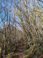
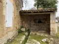
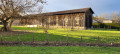
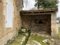
The River Louyre between Liorac-sur-Louyre and Saint-Félix-de-Villadeix

Starting from Liorac-sur-Louyre, the route crosses the Louyre valley, joins and follows the Roman road to reach Saint-Félix-de-Villadeix, passing by the feudal motte. The rest of the route crosses the valley and the River Louyre once more, then passes through the Barbeyrol Valley and the Sérouze Valley, both of which are tributaries of the River Louyre.

Details

29357283
Creation:
Last update:
Last review:
  • Walking
    Activity: Walking
  • ↔
    Distance: 10.11 mi
  • ◔
    Average duration: 5h 30 
  • ▲
    Difficulty: Moderate

  • ⚐
    Back to start: Yes
  • ↗
    Ascent: + 978 ft
  • ↘
    Descent: - 997 ft

  • ▲
    Highest point: 604 ft
  • ▼
    Lowest point: 230 ft

Photos

Description of the walk

Car park at the Liorac-sur-Louyre village hall.

(S/E) Return to the D32 and cross it carefully to head towards the town hall. Walk past the town hall and take the Chemin du Vieux Liorac on the left, signposted GR® de Pays in yellow and orange “Entre Dordogne Louyre et Lindois”®. Follow the path to La Roche, past the high-voltage power line.

(1) Turn right towards the bridge over the Louyre.

(2) Cross the Louyre and head due north to the hamlet of Le Sorbier.

(3) Turn right and continue to the junction with the road to Saint-Georges-de-Montclard.

(4) Carry on straight ahead and continue to the junction with the Palut.

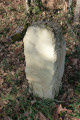
(5) Carry on straight ahead towards the feudal mound (oppidum); at the junction, a boundary stone marks the site of the ancient Roman road.

(6) Follow the road to the right for about fifty metres, then turn right again onto a path and continue until you reach a road.

(7) Turn left, then after 100 metres on the road, turn right and head down into the Red Cross valley. Follow it as far as Saint-Félix-de-Villadeix.

(8) Pass the 15th-century Saint-Nicolas Chapel next to the cemetery, follow the street alongside it, then turn left to head down towards the Louyre.

(9) Leave the GR® de Pays on your left and head towards the Moulin Bessou. Head back up to the left towards the D32.

(10) Cross the road with care, walk a few metres to the right, then take a path on the left. Head uphill through the forest towards Les Brandes, then descend towards the Barbeyrole Stream valley and cross it. Walk for about a hundred metres.

(11) Head right towards Font Sec. At the road, turn right, then keep right at the junction to reach Perrel.

(12) Leave the road and take the path heading south to reach the Sérouze valley.

(13) Cross the bridge over the stream and head up towards the plateau to join the GR® de Pays route.

(14) Turn right and follow the yellow and orange markings to Carrieux (castle).

(15) Continue straight on along the path which descends towards the Louyre valley until you reach the D32.

(16) Cross the road carefully, then follow it to the left for 100 m before taking the small road on the right for about 200 m.

(17) Take the path on the left which leads back up towards Liorac-sur-Louyre and joins the main road (D32). Turn right, cross at the pedestrian crossing to reach the Salle des Fêtes car park on the left (S/E).


Waypoints

  1. S/E : mi 0 - alt. 410 ft - Car park at the village hall
  2. 1 : mi 0.58 - alt. 436 ft - A place known as La Roche
  3. 2 : mi 1.07 - alt. 230 ft - Bridge over the - Louyre (ruisseau) - Affluent du Caudeau
  4. 3 : mi 1.62 - alt. 420 ft - The hamlet of Le Sorbier
  5. 4 : mi 2.16 - alt. 436 ft - Junction with the road to Saint-Georges-de-Montclard
  6. 5 : mi 3.32 - alt. 571 ft - La Palut crossroads
  7. 6 : mi 3.82 - alt. 568 ft - Crossroads
  8. 7 : mi 4.43 - alt. 495 ft - Turn left
  9. 8 : mi 4.9 - alt. 404 ft - Saint-Félix-de-Villadeix
  10. 9 : mi 5.1 - alt. 322 ft - Chemin du Moulin Bessou
  11. 10 : mi 5.36 - alt. 338 ft - D32 road
  12. 11 : mi 6.24 - alt. 354 ft - Perrel Path
  13. 12 : mi 7.02 - alt. 512 ft - Perrel
  14. 13 : mi 7.61 - alt. 335 ft - Bridge over the Sérouze
  15. 14 : mi 8.08 - alt. 410 ft - GRP Between Dordogne, Louyre and Lindois
  16. 15 : mi 9.17 - alt. 394 ft - Château de Carrieux
  17. 16 : mi 9.49 - alt. 282 ft - D32 road
  18. 17 : mi 9.72 - alt. 259 ft - Liorac-sur-Louyre path
  19. S/E : mi 10.11 - alt. 410 ft - Return to the village hall car park

Notes

Car park at the Liorac-sur-Louyre village hall or in front of the “Le Lieurac” bar and restaurant.
Picnic tables in Saint-Félix-de-Villadeix and at the oppidum.

Worth a visit

Places to visit:
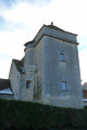
Liorac-sur-Louyre: the tower and turret of the Repaire de Liorac (17th century); Saint-Martin’s Church (12th century).

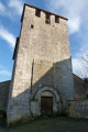
Saint-Félix-de-Villadeix: Saint-Félix Church, a 12th-century Romanesque building, altered in the 20th century; Saint-Nicolas Chapel (15th century) in the cemetery.

La Palut: feudal motte and oppidum.

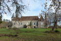
Carrieux: the castle.

Always be cautious and plan ahead when you're outdoors. Visorando and the author of this route cannot be held responsible for any accidents occurring on this route.

The GR® and PR® markings are the intellectual property of the Fédération Française de Randonnée Pédestre.

Reviews and comments

5 / 5
Based on 2 reviews

Reliability of the description
5 / 5
Ease of following the route
5 / 5
Route interest
5 / 5
Aperigord
Aperigord

Overall rating : 5 / 5

Date of your route : Nov 04, 2024
Reliability of the description : ★★★★★ Very good
Ease of following the route : ★★★★★ Very good
Route interest : ★★★★★ Very good
Very busy route : No

We’ve discovered an interesting and little-known site

Machine-translated

Aldan24
Aldan24
• Edited:

Overall rating : 5 / 5

Date of your route : Mar 21, 2023
Reliability of the description : ★★★★★ Very good
Ease of following the route : ★★★★★ Very good
Route interest : ★★★★★ Very good
Very busy route : No

Thank you for suggesting this walk – it’s a real treat to follow. I’ve also had the pleasure of doing it on a mountain bike – it’s quite a physical challenge! As a walk designer myself, I’d love to chat to you about local walks and also the Visorando app.

Machine-translated

Other walks in the area

For more walks, use our search engine .

The GPS track and description are the property of this route's author. Please do not copy them without permission.