Country:

 City:
City:


In St-Michel-de-Villadeix, park in the car park in front of the community hall, below the old school.
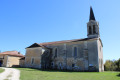
(S/E) At the information board for walking routes, head towards the main road, cross it and take the small street leading up towards the village centre. Walk past the town hall and the church. Take the road on the left at the war memorial, leaving a cul-de-sac opposite. Continue straight on, then walk over the cemetery.
(1) At the crossroads, turn right. At the Stop sign, turn right onto the D42 and follow it for 100 metres. Please take care: this is a busy road.
(2) Turn sharply left intoImpasse des Cerisiers, then immediately right intoImpasse du Manoir. At a cross, take the path leading first to the right and then to the left. At the junction with a limestone track, carry on straight ahead.
(3) When you reach a small road, ignore the signs for Vergt and St-Amand-de-Vergt ahead and turn right. At the ‘Give Way’ sign, take the D8 to the right for 200 metres. Caution: busy road.
(4) After the first bend to the left, take the path which starts on the left at the second bend and runs alongside the trees. At the T-junction, opposite a house, turn left.
(5) At the junction with the Route des Noyers, turn right. Walk through the hamlet of Laubarie Basse. Continue along the road for a short while after the last house.
(6) (You can shorten the route by continuing straight on to quickly reach the point (10).
Turn left onto the Chemin des Merles. Near a house, the limestone track turns into tarmac.
(7) At the junction with theRoute des Malavaux, turn right. At the T-junction, continue to the left.
(8) At the T-junction, turn right. Pass between the buildings. Shortly afterwards, take Chemin des Mésanges on the right. The tarmac ends: continue along the track.
(9) At the junction with Route des Noyers, follow the tarmac road to the right.
(10) At the next junction, in the hamlet of Laubarie Haute, turn left onto Chemin du Magnolia. The tarmac gives way to a track. At a junction with three paths, carry on to the right. Then, further on, carry on to the left. At the entrance to the hamlet of Labrousse, the tarmac reappears. At the next junction, carry on to the right and continue as far as the Stop sign. Follow the D42, heading left, for 100 m. Caution: busy road.
(11) Take the path that starts on the right, before entering the woods. Shortly afterwards, ignore a path branching off to the right and continue to the left. Then, very soon, when you reach a meadow, take the path on the right, ignoring the one that climbs up to the left.
(12) At the bottom of the woodland, at the junction with the Boucle du Caudeau, turn right towards Bourg de St-Michel-de-Villadeix.
(13) At the crossroads, turn right onto the path leading uphill. Then continue straight on along the tarmac road. Pass the Impasse de la Source on your right.
(14) At a cross, turn left onto the Route de l’École. Immediately afterwards, leave the road and take the path on the right which passes in front of the City Stade, returning to the starting car park (S/E).
 Visorando Member

 Easy
Easy