Papelissier circular route via Saint-Mamans and Le Goubet

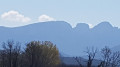
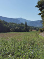
This lovely, open-country walk offers panoramic views of the surrounding ridges of the Vercors plateau, the Valence plain, the Ardèche mountains, Romans and the Drôme, and the surrounding hills.
Route updated on 1 March 2023.

Details

3985946
Creation:
Last update:
Last review:
  • Walking
    Activity: Walking
  • ↔
    Distance: 9.76 mi
  • ◔
    Average duration: 5h 10 
  • ▲
    Difficulty: Moderate

  • ⚐
    Back to start: Yes
  • ↗
    Ascent: + 810 ft
  • ↘
    Descent: - 794 ft

  • ▲
    Highest point: 1,171 ft
  • ▼
    Lowest point: 630 ft

Photos

Description of the walk

Start from the car park below the cobbled square or at the cemetery in the village of Papelissier.

(S/E) Walk through the village facing the Vercors and take the Route de Meymans on the left.

(1) At the end of the La Chaussonnière housing estate, take the road on the right, Chemin de la Béaure, then at the bend continue straight on along a path that runs alongside a fence on the left. Head down into the woods and wade across the Ruisseau de Béaure. Continue along the tarmac path which leads back up to the road. Turn right onto the road and head back up towards Meymans.

(2) At the bend, take the path on the right which descends towards the ruins of the Moulin Blanc. Cross the Ruisseau de Béaure via the small bridge on the right and climb up to the plateau along the track until you reach the D 124.

(3) Slightly to the right, take the Chemin de Crémoulin opposite and continue to the Route des Étangs.
Carry on straight ahead along the Chemin des Bernards. At the junction, take the road on the right as far as a house. Then head down the path, cross the valley, and climb back up a lovely track, continuing straight on until you reach a road, the Chemin de Fleurs. Take this to the right for 50 metres.

(4) Just before the house (La Motte), take the grassy path on the right. Follow the edge of the woodland and head up to the right into the woods. Continue along the track on the right, cross a road (elevation 333) and carry on straight ahead.

(5) After the farm buildings, take Route des Pinets on the right and join Chemin de La Cizeranne on the left. Follow this path to the end.

(6) At the junction, take the Chemin de Palassière (set back slightly) and carry on straight ahead. Cross the Route des Moulins and continue straight ahead along the Chemin de Péruzat. After about sixty metres, stay on the path to the right and continue until you reach a Fork in the road.

(7) Take the path on the left which descends through the woodland into a valley. Follow the path, which leads to a dog training ground; continue to the right. At the huts, the path turns right, climbing the embankment to cross the stream and reach the shooting range.

(8) Turn left and continue along the Chemin du Four à Chaux until you rejoin the D 124.

(9) Turn right and walk alongside the road for 70 metres until you reach a junction with paths on the left.

(10) Turn immediately right onto the Chemin des Malossannes, which runs alongside the road for a good hundred metres. At the Fork in the road, after the power line, turn left onto the Chemin de Pourcieux, then at the next crossroads (elevation 245), turn left and head uphill to a house on the left. Turn right onto the track, then take Chemin des Pins on the left and follow it down to the road.

(1) Turn right to return to the car park (S/E).

Waypoints

  1. S/E : mi 0 - alt. 810 ft - Car park cemetery
  2. 1 : mi 0.4 - alt. 827 ft - Chemin de la Béaure
  3. 2 : mi 1.21 - alt. 853 ft - Road, on the right
  4. 3 : mi 2.06 - alt. 932 ft - Chemin de Crémoulin
  5. 4 : mi 3.45 - alt. 1,066 ft - Maison la Motte
  6. 5 : mi 4.81 - alt. 1,007 ft - Route des Pinets
  7. 6 : mi 5.69 - alt. 866 ft - Chemin de Palassière
  8. 7 : mi 6.88 - alt. 735 ft - Junction, turn left
  9. 8 : mi 7.39 - alt. 633 ft - Shooting Range
  10. 9 : mi 7.62 - alt. 709 ft - D 124
  11. 10 : mi 7.7 - alt. 705 ft - Start of trails
  12. S/E : mi 9.76 - alt. 804 ft - Car park

Notes

Yellow markings.
Caution! Streams to wade across.

Reviews and comments

3.7 / 5
Based on 5 reviews

Reliability of the description
4 / 5
Ease of following the route
3.6 / 5
Route interest
3.4 / 5
User 155351

Overall rating : 4.7 / 5

Date of your route : Nov 10, 2025
Reliability of the description : ★★★★★ Very good
Ease of following the route : ★★★★★ Very good
Route interest : ★★★★☆ Good
Very busy route : No

Lovely walk. Just a small problem crossing the little stream. There are private property signs on the left, right and opposite, as described. We crossed quickly and quietly, feeling a little uneasy. Thank you for this walk.

Machine-translated

Runnerup
Runnerup
• Edited:

Overall rating : 4.3 / 5

Date of your route : Jun 27, 2022
Reliability of the description : ★★★★★ Very good
Ease of following the route : ★★★★☆ Good
Route interest : ★★★★☆ Good
Very busy route : No

As described by the author, there were issues with private land at two locations
At point 7, the area is overgrown and fenced off with wire. We turned back 200 metres before point 7, but after that we came across another private property… a sort of campsite…
At Chemin de Malossannes (9), turn left for a shortcut. Distance: 17 km.

Machine-translated

monierplantier
monierplantier

Good evening,

I’ve read your comment about the circular walk of Papelissier. Could you be a bit more specific about the ‘Private property’ sign? The section you describe near the stream is marked on the guidebook (Ref. P261) with yellow markings.
I walked it four weeks ago and didn’t notice anything else. Given that your comment was posted on 8 February, I think you may have been on the wrong path....
Kind regards,
MP

Machine-translated

APM26
APM26

Overall rating : 1.3 / 5

Date of your route : Apr 15, 2021
Reliability of the description : ★★☆☆☆ Disappointing
Ease of following the route : ★☆☆☆☆ Very disappointing
Route interest : ★☆☆☆☆ Very disappointing
Very busy route : No

No walking beyond Papelissier at the stream
by 5 ‘Private Property – No Entry’ signs
See my email sent on 16 April at 9.13 am with a photo
Best regards

Machine-translated

ma.ge.26.38
ma.ge.26.38

Overall rating : 4 / 5

Date of your route : Feb 08, 2021
Reliability of the description : ★★★★☆ Good
Ease of following the route : ★★★★☆ Good
Route interest : ★★★★☆ Good
Very busy route : No

It’s not very easy to find the spot where you need to climb up the embankment to reach the shooting range (after marker 7). This section through the valley and out again isn’t very pleasant or straightforward. But apart from that, it’s a lovely little walk with an interesting view of the Vercors.

Machine-translated

tronchenko
tronchenko

Overall rating : 4 / 5

Date of your route : Dec 22, 2020
Reliability of the description : ★★★★☆ Good
Ease of following the route : ★★★★☆ Good
Route interest : ★★★★☆ Good
Very busy route : No

The stretch between 7 and 9, near the road and the motorway, was a bit of a gamble: we didn’t pass the dog training centre, the shooting range and the outdoor activity centre in the right order…Could there have been roadworks since the route description was last updated? It must be said that we were in fog, which spoiled the end of the walk – which had otherwise been very pleasant and varied right up to the Château de la Cizeranne.

Machine-translated

Other walks in the area

For more walks, use our search engine .

The GPS track and description are the property of this route's author. Please do not copy them without permission.