Lézireur circular from Henvic

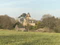
An easy route starting from the village of Henvic, taking in paths lined with crops and lovely wooded trails. Beautiful views over Morlaix Bay and the Trégor region of Finistère. The route is suitable for mountain bikes.

Details

67228373
Creation:
Last update:
Last review:
  • Walking
    Activity: Walking
  • ↔
    Distance: 4.32 mi
  • ◔
    Average duration: 2h 15 
  • ▲
    Difficulty: Easy

  • ⚐
    Back to start: Yes
  • ↗
    Ascent: + 269 ft
  • ↘
    Descent: - 253 ft

  • ▲
    Highest point: 272 ft
  • ▼
    Lowest point: 69 ft
  • ⚐ Country: France
  • ⚐ City: Henvic (29670)
  • ⚑
    Start/End: N 48.632535° / W 3.926499°
  • ❏
    IGN map(s): Ref. 0615ET
  • Hour-by-hour weather

Photos

Description of the walk

Starts at Place Alexis Gourvennec, at the foot of Henvic church. Easy parking.

(S/E) Turn left onto Rue de la Mairie, then take the second street on the left, running alongside a school. At the junction near the cemetery, turn left to cross the motorway bridge.

(1) Turn right after the bridge to follow a path that runs alongside the expressway for a short while, then turns left along an embankment bordering a field that is sometimes under cultivation.

(2) Take a path on the right that winds its way through a wood and leads to a small road, which it follows for a good hundred metres.

(3) Turn right at a 90° angle to cross the field along a straight path that leads out onto a road. Turn right, then left at the Toull al Lann junction.

(4) Turn left onto a path that heads into the woods, running alongside a small pond. This path takes you to Lézireur.

(5) Follow the road to your right as far as Le Pontic. Turn left onto the path that crosses the hamlet and leads to the Coatplohou crossroads.

(6) Take the grassy path on the left which climbs towards Keréver. At the crossroads, go straight on and pass Kersilly, leaving it on your right.

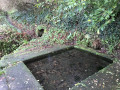
(7) Turn right as soon as you’ve passed the hamlet and follow the path leading to a small valley with a pretty wash house.

(8) At the end of this path, turn left. Join the access road to Kerilly and follow it to the right as far as Castellenec.

(9) Turn left towards the expressway.

(1) Carry straight on towards the motorway bridge and follow the outward route in the opposite direction to reach the church and the car park (S/E).

Waypoints

  1. S/E : mi 0 - alt. 233 ft - Church Square
  2. 1 : mi 0.43 - alt. 256 ft - Junction of the circular loop
  3. 2 : mi 0.78 - alt. 230 ft - Entrance to the woods
  4. 3 : mi 1.04 - alt. 240 ft - Turn right at the fork
  5. 4 : mi 1.43 - alt. 220 ft - Toull al Lann
  6. 5 : mi 1.76 - alt. 141 ft - Lézireur
  7. 6 : mi 2.39 - alt. 135 ft - Coatplohou
  8. 7 : mi 2.86 - alt. 223 ft - Kersilly
  9. 8 : mi 3.2 - alt. 190 ft - Turn left at the fork
  10. 9 : mi 3.65 - alt. 240 ft - Castellenec
  11. S/E : mi 4.32 - alt. 233 ft - Church Square

Notes

Green signposting.

Worth a visit

Reviews and comments

3.8 / 5
Based on 4 reviews

Reliability of the description
4.3 / 5
Ease of following the route
3.3 / 5
Route interest
3.8 / 5
Les pommiers
Les pommiers

Overall rating : 5 / 5

Date of your route : Feb 06, 2026
Reliability of the description : ★★★★★ Very good
Ease of following the route : ★★★★★ Very good
Route interest : ★★★★★ Very good
Very busy route : No

Beautiful route through the countryside

Machine-translated

tratracorp
tratracorp

THANK YOU, because it's been a great journey.

Machine-translated

PYL
PYL

Thank you for reporting this issue with the overgrown vegetation. A volunteer from the association has cleared the path. It is now passable again.

Machine-translated

tratracorp
tratracorp

Overall rating : 2 / 5

Date of your route : Jun 17, 2025
Reliability of the description : ★★★☆☆ Average
Ease of following the route : ★☆☆☆☆ Very disappointing
Route interest : ★★☆☆☆ Disappointing
Very busy route : No

The last few times we tried this route, we had to stop almost immediately because the field we had to walk along was cultivated right up to the edge of the embankment, making it impossible to pass without causing damage.
Previous times, there was a passage left open, and it was a beautiful, varied walk. It's a shame for the AMER association, which maintained this trail.

Machine-translated

User 338554
• Edited:

Overall rating : 4 / 5

Date of your route : Jun 17, 2025
Reliability of the description : Not used / Not applicable
Ease of following the route : Not used / Not applicable
Route interest : ★★★★☆ Good
Very busy route : No

Hello
After parking our car near the cemetery, we crossed the bridge over the four-lane road.
We took the path on the right and, to our surprise, the path had completely disappeared. We had to improvise our way through the tall grass to reach the road, which took several hundred metres.
We'll have to revisit this route.
We hope to avoid any further mishaps.
Thank you for your usual routes.

Machine-translated

tratracorp
tratracorp

Overall rating : 4.3 / 5

Date of your route : Dec 30, 2024
Reliability of the description : ★★★★★ Very good
Ease of following the route : ★★★★☆ Good
Route interest : ★★★★☆ Good
Very busy route : No

A pleasant, varied route
It isn’t always easy to walk along the edge of the field between points 1 and 2, depending on the season and what has been planted there

Machine-translated

Other walks in the area

For more walks, use our search engine .

The GPS track and description are the property of this route's author. Please do not copy them without permission.