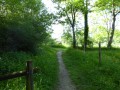
Barjouville Meadow Circular Walk

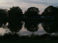
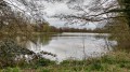
This route, starting from Barjouville, follows the paths around the ponds and through the meadow: a green oasis in the town.

Details

23084202
Creation:
Last update:
Last review:
  • Walking
    Activity: Walking
  • ↔
    Distance: 3.33 mi
  • ◔
    Average duration: 1h 35 
  • ▲
    Difficulty: Easy

  • ⚐
    Back to start: Yes
  • ↗
    Ascent: + 46 ft
  • ↘
    Descent: - 49 ft

  • ▲
    Highest point: 479 ft
  • ▼
    Lowest point: 410 ft
  • ⚐ Country: France
  • ⚐ City: Barjouville (28630)
  • ⚑
    Start/End: N 48.408627° / E 1.478373°
  • ❏
    IGN map(s): Ref. 2016SB, 2116O, 2117SB
  • Hour-by-hour weather

Description of the walk

Parking available at the Barjouville Cultural Centre

(S/E) Head towards Rue de Beauce and walk down it to the left. Turn left onto Rue Jean de la Fontaine, then right onto Rue des Pâtis.

(1) Keep to the left and cross the bridge over a branch of the River Eure. Then take the path that runs alongside the lake on the left and continues northwards. You will reach the junction with the return route.

(2) Turn left, continue through the woodland and cross a branch of the Eure via an old stone bridge.

(3) Turn left to cross the meadow alongside the bypass, take the road on the right and pass under the bypass bridge.

(4) Enter the car park on the right and go through the gate leading to the pond. Walk along the edge of the pond to its northern end. Cross thesecond footbridge on the left.

(5) Take the D105 on the right. After the bridge, turn into the lane on the right. At the entrance to the woods, climb the steep slope on the left, then, before the house, take the path on the right for a few metres. Climb up again to the left, then take the wide lane on the right, running alongside the houses, which leads to Impasse du Clos Thiron. Turn right and go under the ring road.

(6) Take the dead-end road on the right, continue straight on along the path and cross the River Eure via the footbridge. You’ll come back to the junction you passed on the way out.

(2) Turn left to walk alongside the River Eure, then veer right to go round the southern end of the pond. Next, cross the footbridge on the left, turn right and then left to return to the junction you passed on the way out.

(1) Go straight on and follow the original route back to the Foyer Culturel car park (S/E).

Waypoints

  1. S/E : mi 0 - alt. 433 ft - Cultural centre
  2. 1 : mi 0.18 - alt. 420 ft - Junction with the circular loop
  3. 2 : mi 0.66 - alt. 420 ft - Junction of the two circular loops - Eure (rivière)
  4. 3 : mi 0.76 - alt. 417 ft - Meadow
  5. 4 : mi 1.06 - alt. 417 ft - Car park
  6. 5 : mi 1.58 - alt. 420 ft - D105 road
  7. 6 : mi 2.4 - alt. 430 ft - Dead-end path
  8. S/E : mi 3.33 - alt. 430 ft - Cultural centre

Notes

This route was created in collaboration with the Eure-et-Loir Departmental Hiking Committee.
Follow the yellow markings.

Worth a visit

Things to do:
ClockWise escape game.
Escape Time.
The pleasure of tasting.

Franz Stock European Centre Museum, Séminaire des Barbelés.

Local produce.
Gamm Vert Chartres.
Moulins Viron.

Reviews and comments

4.7 / 5
Based on 2 reviews

Reliability of the description
5 / 5
Ease of following the route
5 / 5
Route interest
4 / 5
Marco Pagotto
Marco Pagotto

Overall rating : 4.7 / 5

Date of your route : Oct 07, 2025
Reliability of the description : ★★★★★ Very good
Ease of following the route : ★★★★★ Very good
Route interest : ★★★★☆ Good
Very busy route : Yes

Easy and pleasant route

Machine-translated

Anher
Anher

Overall rating : 4.7 / 5

Date of your route : Aug 05, 2025
Reliability of the description : ★★★★★ Very good
Ease of following the route : ★★★★★ Very good
Route interest : ★★★★☆ Good
Very busy route : Yes

a pleasant, easy and fairly varied hike.

Machine-translated

Other walks in the area

For more walks, use our search engine .

The GPS track and description are the property of this route's author. Please do not copy them without permission.