Between the Eure and Beauce

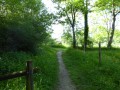
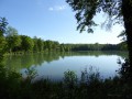
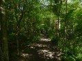
This walk combines the Beauce plain and its crops, a stretch through the forest and the ponds along the banks of the Eure, allowing you to enjoy a variety of landscapes. It is not difficult, and the elevation gain is minimal.

Details

120958
Creation:
Last update:
Last review:
  • Walking
    Activity: Walking
  • ↔
    Distance: 9.15 mi
  • ◔
    Average duration: 4h 15 
  • ▲
    Difficulty: Moderate

  • ⚐
    Back to start: Yes
  • ↗
    Ascent: + 72 ft
  • ↘
    Descent: - 69 ft

  • ▲
    Highest point: 531 ft
  • ▼
    Lowest point: 453 ft
  • ⚐ Country: France
  • ⚐ City: Nogent-sur-Eure (28120)
  • ⚑
    Start/End: N 48.400153° / E 1.384958°
  • ❏
    IGN map(s): Ref. 2016SB, 2017SB, 2117SB
  • Hour-by-hour weather

Photos

Description of the walk

Start at Pont Tranchefétu on the D921 (start on the bridge).

(S/E) Leave the bridge heading towards Chartres (north-east) and immediately turn left into the dead-end street. Take the path at the end of the street and follow the banks of the Eure. Continue straight on when the path becomes tarmac again. At the crossroads, turn left towards the station on the D343.

(1) Before the level crossing, take the path on the left running alongside the railway line for 800m.

(2) At the old level crossing (closed), turn left. 200m further on (marker 146), take the path on the right, before the woods. After 700m (marker 151), take the path on the left for 600m, then turn right towards the village of Nogent-sur-Eure. The path becomes a road as you enter the village.
At the T-junction, turn right, passing the town hall and then the church.

(3) Turn left onto the D123. Cross the D921 and pass through the hamlet of La Martinière. At the end of the road, turn onto the path on the left before the stream. After 700m, cross the D123.2 and continue straight on. You will rejoin theGR®655O, which you will follow for 300m.

(4) Continue straight on and leave theGR® which turns left. Carry on for about 1 km along the path beside the stream. The path then turns left. Follow it to the track at the edge of the woods.

(5) Turn right onto the path running alongside a woodland. After 400m, you’ll enter the undergrowth. Ignore the first path on the left and take the second one as you emerge from the undergrowth. After 400m, you’ll cross a path; continue straight ahead. This path is a little narrower. Cross the road and continue along the street opposite. After 100m, the street turns into a path and you continue through the woodland for 1.2km.

(6) Turn left onto theGR®655O. You can either continue on theGR® or take the parallel path running alongside the Eure below: this second option, not shown on the IGN map, is the one recommended and indicated on the route.

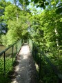
(7) In both cases, after 650m, take the small bridge crossing the Eure on the right (be careful not to miss it if you have stayed on theGR®; it is below). Follow the narrow path along the Eure through the tall grass to a footbridge on your left, which you should take, then turn right along the pond. You will reach the D149; turn left onto the cycle path running parallel to the road. Turn right onto the first track and follow it for about 700m.

(8) When you reach a stream on your right, turn right onto the path that crosses it. The stream passes through several concrete culverts beneath the path. Follow the path through the woodland for 300m. At the T-junction, turn left to rejoin the track between the ponds. Follow this track for 500m. When it turns left at a 90° angle (with a pond opposite), turn right after the fence and follow the track to the right past the two successive ponds. At the end of the second pond, you’ll join a track suitable for vehicles; take this by turning right. You’ll then rejoin the D921 at your starting point (S/E).

Waypoints

  1. S/E : mi 0 - alt. 459 ft - Tranchefétu Bridge
  2. 1 : mi 1.31 - alt. 479 ft - Level crossing
  3. 2 : mi 1.8 - alt. 489 ft - Former level crossing
  4. 3 : mi 3.2 - alt. 528 ft - Nogent-sur-Eure
  5. 4 : mi 4.11 - alt. 486 ft - Leave the GR655O
  6. 5 : mi 5.11 - alt. 518 ft - Bois des Tertres
  7. 6 : mi 6.65 - alt. 463 ft - GR655O
  8. 7 : mi 7.08 - alt. 453 ft - Bridge over the - Eure (rivière)
  9. 8 : mi 7.97 - alt. 459 ft - Stream
  10. S/E : mi 9.15 - alt. 469 ft - Tranchefétu Bridge

Worth a visit

Admire the banks of the Eure at the start of the walk. With a bit of luck and discretion, you might spot a heron.
The ponds are very popular with anglers in the summer months.

Always be cautious and plan ahead when you're outdoors. Visorando and the author of this route cannot be held responsible for any accidents occurring on this route.

The GR® and PR® markings are the intellectual property of the Fédération Française de Randonnée Pédestre.

Reviews and comments

4 / 5
Based on 7 reviews

Reliability of the description
4.1 / 5
Ease of following the route
4 / 5
Route interest
3.9 / 5
PhGa
PhGa

Overall rating : 3.7 / 5

Date of your route : Aug 13, 2023
Reliability of the description : ★★★★☆ Good
Ease of following the route : ★★★☆☆ Average
Route interest : ★★★★☆ Good
Very busy route : No

I would like to point out two problems we encountered that forced us to change our route:

1) At description No. 2 (“At the old level crossing, turn left”), it was impossible to turn as the path was blocked by a field of rapeseed. Presumably, the path was meant to run between two fields, but the farmer must have sown the whole area.

Instead of turning left, we continued along the railway line to cross the bridge over a deep ditch, then turned left immediately after the bridge to rejoin the route between points 146 and 151.

2) At the Moulin de Guervilliers, after description No. 8, we were unable to turn right facing the lake as the path was blocked by a barrier and someone made it clear to us that no one was allowed to use this path apart from the owner.

Instead of first turning right then left to walk along the lake on the right (north bank), we first turned left then right to walk along the lake on the left (south bank), then rejoined the hiking route at the end of the lake.

Machine-translated

Bernard Poitoux
Bernard Poitoux

Overall rating : 3.3 / 5

Date of your route : Jul 30, 2023
Reliability of the description : ★★★★☆ Good
Ease of following the route : ★★★☆☆ Average
Route interest : ★★★☆☆ Average
Very busy route : No

The first part was rather uninteresting, set amongst the cereal fields, with a path marked on the map but not visible on the ground...
Fortunately, the second part was more pleasant, with woods and ponds.
Overall, a very average hike.

Machine-translated

grandin
grandin ★

Thanks for letting me know; I’ll look into it as soon as possible

Machine-translated

papymooc
papymooc

Overall rating : 2.7 / 5

Date of your route : Apr 24, 2021
Reliability of the description : ★☆☆☆☆ Very disappointing
Ease of following the route : ★★★☆☆ Average
Route interest : ★★★★☆ Good
Very busy route : Yes

I couldn't make head nor tail of the instructions and I didn't have a satnav.
No wonder – there’s a discrepancy between the numbers in the instructions and the numbers on the map.
On the map:
mark 1 on point S/E
mark 2 on point 1
mark 3 on point 2
etc...
That’s pretty serious, isn’t it!!!!!

Machine-translated

pivi
pivi

Overall rating : 4.3 / 5

Date of your route : Mar 29, 2021
Reliability of the description : ★★★★★ Very good
Ease of following the route : ★★★★★ Very good
Route interest : ★★★☆☆ Average
Very busy route : No

A lovely 15 km walking route
The only downside is the two-kilometre stretch along the stream, which smells of urine mixed with the stench of carrion
Only to be done on a windy day
The company responsible for this pollution should take responsibility

Machine-translated

Joanna28
Joanna28

Overall rating : 5 / 5

Date of your route : Jan 10, 2021
Reliability of the description : ★★★★★ Very good
Ease of following the route : ★★★★★ Very good
Route interest : ★★★★★ Very good
Very busy route : No

A lovely walk through our countryside. Tried out on a lovely January afternoon.
The stretch from Beauce to Eure is particularly pleasant. In short, I recommend it as a different way to explore the area!

Machine-translated

Anne-Laure13
Anne-Laure13
• Edited:

Overall rating : 4.3 / 5

Date of your route : May 31, 2020
Reliability of the description : ★★★★★ Very good
Ease of following the route : ★★★★☆ Good
Route interest : ★★★★☆ Good
Very busy route : No

Hello,
A lovely and quite varied walk: through fields, woods and around ponds, not to mention the river.
At one point around the ponds, we had to go round the pond on the left rather than the right, as the owners of the path had more or less blocked access (because there was too much foot traffic, according to another local resident), but we went round the other side of the pond and then rejoined the trail without any trouble.

Machine-translated

cherisy
cherisy

Hello
The walks haven’t been done yet
They have been printed
I’ll be sure to give my opinion as soon as possible
See you soon

Pierre and Laurence

Machine-translated

vhl33
vhl33

Overall rating : 4.7 / 5

Date of your route : Aug 20, 2018
Reliability of the description : ★★★★★ Very good
Ease of following the route : ★★★★★ Very good
Route interest : ★★★★☆ Good

The start of the walk through the fields is a bit tedious! Fields as far as the eye can see; this is the Beauce region... The woodland and ponds; really lovely. Thanks, Visorando:

Machine-translated

Other walks in the area

For more walks, use our search engine .

The GPS track and description are the property of this route's author. Please do not copy them without permission.