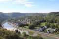
Circular route along the Meuse south of Anseremme

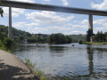
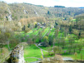
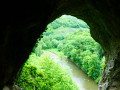
Starting from Place d’Anseremme, this walk takes you along wooded paths and a towpath beside the Meuse. Some notable viewpoints include: the ‘Tête du Lion’ and Freyr Castle. The route passes by the Anseremme dock.

Details

n°101645534
Creation:
Last update:
Last review:
–
  • Walking
    Activity: Walking
  • ↔
    Distance: 7.78 mi
  • ◔
    Average duration: 4h 10 
  • ▲
    Difficulty: Moderate

  • ⚐
    Back to start: Yes
  • ↗
    Ascent: + 709 ft
  • ↘
    Descent: - 696 ft

  • ▲
    Highest point: 741 ft
  • ▼
    Lowest point: 295 ft

Description of the walk

Start at Place d’Anseremme, following Rue du Vélodrome.

Another possible starting point: Anseremme railway station. On leaving the station, turn left onto Rue des Tilleuls. At the end of the street, first turn right then left to rejoin the main route.

Waypoints

  1. S/E : mi 0 - alt. 312 ft - Place – Rue du Vélodrome - Gare d'Anseremme
  2. 1 : mi 0.08 - alt. 315 ft - Église Sainte-Anne (Anseremme)
  3. 2 : mi 0.33 - alt. 344 ft - Junction of the circular loop
  4. 3 : mi 0.7 - alt. 430 ft - Junction
  5. 4 : mi 1.23 - alt. 617 ft - Start of the path
  6. 5 : mi 2.07 - alt. 692 ft - Cross the N95
  7. 6 : mi 2.32 - alt. 673 ft - A95
  8. 7 : mi 2.47 - alt. 676 ft - Junction
  9. 8 : mi 3.07 - alt. 620 ft - T-junction
  10. 9 : mi 4.03 - alt. 617 ft - T-junction
  11. 10 : mi 4.74 - alt. 312 ft - T-junction - Meuse (fleuve)
  12. 11 : mi 6.66 - alt. 335 ft - Junction
  13. 12 : mi 6.94 - alt. 299 ft - Port of Anseremme
  14. S/E : mi 7.78 - alt. 312 ft - Place – Rue du Vélodrome - Gare d'Anseremme

Other walks in the area

For more walks, use our search engine .

The GPS track and description are the property of this route's author. Please do not copy them without permission.