Gourteau circular loop

Hiking trail in the commune of Burlats, in the Sidobre & Vallées region of the Tarn – Occitanie.

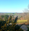
Starting from the medieval village of Burlats, via the ‘Chemin des Fontaines’, this walk allows you to appreciate the scale of the wide meander formed by the River Agout, and offers numerous views over the Sidobre and the Castraise plain.

In Burlats, the Counts of Trencavel built, away from the main roads, a sumptuous residence, hidden in a bend of the Agout valley. A true gem and a rare, perfectly preserved example of Romanesque civil architecture, this pavilion is named after Adélaïde, a countess with violet-coloured eyes who was celebrated in song and courted by the famous troubadours Arnaud de Mareuil and Alfonso II of Aragon.
Also worth seeing: the ruins of the12th-century Benedictine abbey and the Bistoure Tower.

Details

n°73022219
Creation:
Last update:
Last review:
  • Walking
    Activity: Walking
  • ↔
    Distance: 12.14 mi
  • ◔
    Average duration: 6h 50 
  • ▲
    Difficulty: Difficult

  • ⚐
    Back to start: Yes
  • ↗
    Ascent: + 1,424 ft
  • ↘
    Descent: - 1,417 ft

  • ▲
    Highest point: 1,447 ft
  • ▼
    Lowest point: 568 ft

Photos

Description of the walk

(S/E) From the car park, walk past the pavilion and turn left towards the bridge. Cross the bridge, then follow the left bank of the Agout along the ‘Chemin des Fontaines’ until you reach the first houses in Les Salvages. Continue along the road until you reach the D4.

(1) Turn right, cross the Salvages junction, then carry on straight ahead until you reach Rue du Fraysse.

(2) Turn right onto the street. At the stop sign, turn left, then right, towards the cemetery. The road becomes a track; follow it until it splits in a small valley.

(3) Take the track that climbs to the right through the forest, ignoring the other paths. Then follow the fence at the edge of the forest (view over the Castres plain). You’ll come to a tarmac road.

(4) Go round the large oak tree on the right, then follow the road to the left, which climbs towards the first junction.

(5) Keep going straight on. Leave the road 30 metres before the second junction and head down to the right into the forest. At the first hairpin bend, carry on straight ahead to descend towards the valley. After crossing a stream, go through a fence (please make sure you close it behind you) to reach the banks of the Agout.

(6) Follow the riverbank before heading uphill and turning right at a hairpin bend. The path now runs alongside an old railway line and soon crosses over it via a railway bridge. Pass through the hamlet of La Fargarié and follow the forest track which climbs to the left (view of Roquecourbe). Join a tarmac road and follow it to the crossroads (view of the Montagne Noire).

(7) Head downhill to the left, towards the Éclaireurs de France clubhouse. At the bend, turn left towards La Simonié.

(8) Carry on. Turn right, pass the pylon, and continue along the edge of the forest. At the crossroads, you’ll reach a tarmac road.

(9) Turn left onto it and carry on straight ahead until the descent into the valley begins. Pass the ruins of Gourteau and rejoin the Agout.

(10) Turn right, follow the river (with the hydroelectric power station on your left), and continue along the river. Enter Burlats through the old town gate. Head to the car park (S/E).

Waypoints

  1. S/E : mi 0 - alt. 636 ft - Adélaïde Pavilion car park - Agout (rivière)
  2. 1 : mi 2.63 - alt. 627 ft - D4, Salvages junction
  3. 2 : mi 3.02 - alt. 607 ft - Rue du Fraysse
  4. 3 : mi 3.6 - alt. 712 ft - Vallon
  5. 4 : mi 4.38 - alt. 1,047 ft - Tarmac track
  6. 5 : mi 5.13 - alt. 1,115 ft - Crossroads
  7. 6 : mi 6.36 - alt. 722 ft - By the river - Agout (rivière)
  8. 7 : mi 7.49 - alt. 1,217 ft - Crossroads
  9. 8 : mi 8.24 - alt. 1,112 ft - La Simonié
  10. 9 : mi 9.16 - alt. 1,407 ft - Tarmac road
  11. 10 : mi 10.76 - alt. 669 ft - Agout (rivière)
  12. S/E : mi 12.14 - alt. 636 ft - Adélaïde Pavilion car park - Agout (rivière)

Notes

Start: Pavillon d’Adélaïde

Finish: same location as the start

Towns: Burlats, Castres, Roquecourbe

Road access and car park: via the D58

Parking: car park next to the Pavillon d’Adélaïde – GPS: 43.693003, 2.425250

Transport: Bus route 769, Burlats Town Hall stop

Worth a visit

Café (in Burlats)

Restaurant 

Accommodation (in Burlats)

Reviews and comments

4.3 / 5
Based on 2 reviews

Reliability of the description
5 / 5
Ease of following the route
4 / 5
Route interest
4 / 5
Panipwoblem77
Panipwoblem77

Overall rating : 4.3 / 5

Date of your route : Oct 17, 2026
Reliability of the description : ★★★★★ Very good
Ease of following the route : ★★★★☆ Good
Route interest : ★★★★☆ Good
Very busy route : No

A route that can be done from various start and finish points. Very pleasant, though there aren’t any breathtaking views or ‘wow’ moments. Fairly straightforward, apart from the distance. We completed it in 4 hours 20 minutes, including a lunch break – so we were walking at a brisk pace. At over 6 hours, it’s a really leisurely walk. You can imagine that the route becomes more challenging on wet paths.
The advantage of starting from Burlats is that the village is pretty, and you can have a coffee there in the morning. Out of season, you can park right at the starting point – no need to go to the recommended car park (though it’s worth a try).
Other possible starting points include one of the car parks along the greenway or at La Bernadié. If you start from La Bernadié, you tackle the slopes sooner but finish with a very long flat stretch along the Agout.

Machine-translated

Marie-therese arsuffi

Overall rating : 4.3 / 5

Date of your route : Mar 01, 2026
Reliability of the description : ★★★★★ Very good
Ease of following the route : ★★★★☆ Good
Route interest : ★★★★☆ Good
Very busy route : No

A beautiful hike at the end of winter
Be careful, however, as heavy rain can make the route muddy and slippery.
After the storm, there are a few trees across the path.

Machine-translated

Other walks in the area

For more walks, use our search engine .

The GPS track and description are the property of this route's author. Please do not copy them without permission.