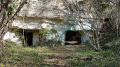
Circular route from Fléré-la-Rivière to Bridoré

This lovely, easy circular route starts at the Fléré-la-Rivière pond and takes you to Bridoré via the Fléré meadow along the River Indre, before heading back down to Fléré via theGR® 46. It offers magnificent views of Bridoré Castle as well as the village of Fléré-la-Rivière.

Details

n°20552607
Creation:
Last update:
Last review:
  • Walking
    Activity: Walking
  • ↔
    Distance: 5.89 mi
  • ◔
    Average duration: 2h 55 
  • ▲
    Difficulty: Easy

  • ⚐
    Back to start: Yes
  • ↗
    Ascent: + 279 ft
  • ↘
    Descent: - 253 ft

  • ▲
    Highest point: 440 ft
  • ▼
    Lowest point: 262 ft

Photos

Description of the walk

Starts from the car park at the Fléré-la-Rivière pond.

(S/E) Follow the D943 on the left along the path leading to the old wash house. Continue to the square and use the pedestrian crossing opposite the bakery to cross the D943. Take the road opposite. Walk past the church and continue straight on.

(1) At the level crossing, take the small path on the left which runs alongside the railway line and follow it to the next junction. Turn right onto the path which runs alongside the gardens and leads out onto the Fléré meadow. Turn left and follow the grassy path which runs alongside the River Indre.

(2) At the junction, turn left onto the poplar-lined path which leads back up to the D943.

(3) Use the pedestrian crossing next to the bus shelter to cross the D943 and continue along the D241 towards Bridoré. Head up to Bridoré via the footpath running alongside the D241 on the left. Continue straight on until you reach the bus shelter. Magnificent view of Bridoré Castle and the church.

(4) Turn onto the path that descends to the left and runs alongside the fences of the houses. Turn left and continue straight down the slope.

(5) At the Croix Saint-Marc, leave theGR®46on your left, pass La Vigéterie and arrive at the hamlet of La Fontaine.

(6) Turn right and head up to the castle. Continue straight on to the D241 and follow it to the left, descending to the ponds, which you pass by.

(7) Turn left onto the dirt track that runs alongside the Étang des Défends towards the hamlet of Les Défends . Magnificent view of Bridoré Castle high above. At Les Défends, turn left to rejoin the road that climbs and pass the hamlet of La Fontaine once more.

(6) Pass La Vigéterie and head towards the Croix Saint-Marc.

(5) Turn right to follow theGR®46along the dirt track that leads back towards Fléré-la-Rivière. Along this track, there are lovely views of Bridoré and Fléré.

(8) At the housing estates, carry on straight ahead along the road until the next junction.

(9) Turn right onto the Route de Saint-Flovier (D92) and walk a few metres before joining the path on the left between the house and the sheep field, which leads to the bridge. Cross the bridge to reach Fléré Pond. Walk round it on the right and head for the car park (S/E).

Waypoints

  1. S/E : mi 0 - alt. 276 ft - Car park at the Fléré-la-Rivière pond - Étang de la Reuille
  2. 1 : mi 0.29 - alt. 279 ft - Level crossing
  3. 2 : mi 1.59 - alt. 262 ft - Junction near a fish farm - L'Indre
  4. 3 : mi 2.09 - alt. 322 ft - Cross the D943 at the pedestrian crossing
  5. 4 : mi 2.67 - alt. 427 ft - Bus shelter
  6. 5 : mi 2.94 - alt. 371 ft - Saint-Marc Cross
  7. 6 : mi 3.1 - alt. 364 ft - A place known as La Fontaine - Vue sur le Château de Bridoré
  8. 7 : mi 3.68 - alt. 348 ft - Junction with the dirt track
  9. 8 : mi 5.33 - alt. 292 ft - Housing estates
  10. 9 : mi 5.47 - alt. 285 ft - Turn right at the junction
  11. S/E : mi 5.89 - alt. 276 ft - Car park at the Fléré-la-Rivière pond

Notes

Circular route on foot, by bike or on horseback.
Please use the pedestrian crossings to cross the D943.
Perfect for a picnic.

Worth a visit

In Fléré-la-Rivière: pond, old wash house, church.
The banks of the Indre through the meadow.
Bridoré Castle and ponds.

Always be cautious and plan ahead when you're outdoors. Visorando and the author of this route cannot be held responsible for any accidents occurring on this route.

The GR® and PR® markings are the intellectual property of the Fédération Française de Randonnée Pédestre.

Reviews and comments

5 / 5
Based on 1 review

Reliability of the description
5 / 5
Ease of following the route
5 / 5
Route interest
5 / 5
marco rando
marco rando

Overall rating : 5 / 5

Date of your route : Mar 03, 2025
Reliability of the description : ★★★★★ Very good
Ease of following the route : ★★★★★ Very good
Route interest : ★★★★★ Very good
Very busy route : No

a very pleasant walk

Machine-translated

Other walks in the area

For more walks, use our search engine .

The GPS track and description are the property of this route's author. Please do not copy them without permission.