Mont Bonneil and the Champagne vineyards

After climbing Mont Bonneil, which offers a beautiful view over the Marne, take a stroll through the Champagne vineyards to the Abbey Church of Essomes, then return to your starting point by following the bends of the Marne.

Details

498200
Creation:
Last update:
Last review:
  • Walking
    Activity: Walking
  • ↔
    Distance: 8.95 mi
  • ◔
    Average duration: 4h 35 
  • ▲
    Difficulty: Moderate

  • ⚐
    Back to start: Yes
  • ↗
    Ascent: + 499 ft
  • ↘
    Descent: - 512 ft

  • ▲
    Highest point: 541 ft
  • ▼
    Lowest point: 190 ft

Photos

Description of the walk

Azy-sur-Marne (Aisne) is approximately 7km from Château-Thierry and 2km from Chézy-sur-Marne station.

(S/E) From the church car park, head up towards the town hall and turn left onto Rue de Gramont.

(1) Turn left after the houses and follow the blue-and-yellow signposts. At the next junction, turn right and then left.

(2) After the second junction, turn right and follow Rue de Bonneil for about a hundred metres. Take the first path on the left and carry straight on. After the cemetery, turn right onto Rue de la Francotte. Walk past some underground cellars. At the T-junction, turn left onto Grande Rue. After the town hall, turn right onto Rue de Rullion.

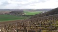
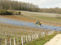
(3) At the end of the street, turn right and head up through the vineyards (steep slope).

(4) Halfway up the slope, follow the blue and yellow markings to the right (the slope remains steep).

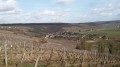
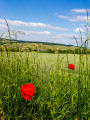
(5) At the next junction (a lovely viewpoint over the vineyards and the Marne Valley), turn sharply right, following the same markings.

No signposting

(6) At the crossroads, leave the signpostedPR® route and take the second path on the right, the Chemin des Madeleinettes. At the junction with the Route de la Vallée, turn right and continue for about 300 metres.

(7) Leave the road and turn left to reach the orientation board. Turn left onto the concrete path going uphill, then turn right at the first junction. Continue straight on and pass a crossroads. At the Y-junction, head downhill to the right.

(8) Shortly afterwards, turn left and continue straight ahead along the path.

(9) At the junction, rejoin theGR®11Aand turn left. Follow the red and white markings.

(10) At the junction, turn left and head uphill.

(11) At the edge of the woods, at the junction, turn right and head into the woods. Follow theGR®11Aand carry on straight ahead, passing under a power line.

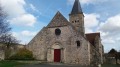
(12) When you reach the junction just past the viewpoint overlooking the abbey church and Château-Thierry on the outskirts of Essomes, turn right downhill and join the Chemin des Godaux. Turn left and continue along Rue de l’Observatoire. Cross the road and take Rue de l’Abbaye to reach Place de l’Abbaye.

(13) On your left, you’ll see the wash house; then leave theGR®11Aand join thePR® trail marked in blue and yellow. Walk past the Abbey, cross the D969 at the traffic lights, then turn right along the Ru des Rochers. Follow thePR® markings.

Off the marked trail

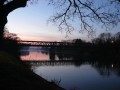
(14) Leave thePR®, turn right and follow the Marne along the towpath to reach the village of Azy. Pass under the Azy road bridge at Chèzy.

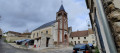
(15) At the picnic area, turn right onto Rue du Bac, then left onto the D969 and head for the church car park (S/E).

Waypoints

  1. S/E : mi 0 - alt. 213 ft - Church car park
  2. 1 : mi 0.14 - alt. 240 ft - Turn left, following the yellow and blue markings
  3. 2 : mi 0.69 - alt. 217 ft - Rue de Bonneil
  4. 3 : mi 1.41 - alt. 243 ft - Turn right as you go uphill
  5. 4 : mi 1.64 - alt. 361 ft - On the right: blue and yellow markings
  6. 5 : mi 1.83 - alt. 525 ft - Viewpoint
  7. 6 : mi 2.25 - alt. 522 ft - Take the second right to leave the PR
  8. 7 : mi 2.62 - alt. 476 ft - Towards the orientation table on the left
  9. 8 : mi 3.58 - alt. 387 ft - Path on the left
  10. 9 : mi 3.88 - alt. 351 ft - Return via the GR11A
  11. 10 : mi 4.48 - alt. 371 ft - Turn left
  12. 11 : mi 4.76 - alt. 479 ft - Viewpoint
  13. 12 : mi 5.56 - alt. 348 ft - Junction, turn right
  14. 13 : mi 5.84 - alt. 213 ft - Illustrated wash house and abbey church
  15. 14 : mi 6.24 - alt. 197 ft - Towpath - Marne (la)
  16. 15 : mi 8.87 - alt. 197 ft - Picnic area - Marne (la)
  17. S/E : mi 8.95 - alt. 213 ft - Church car park

Notes

If you’re travelling by train on the Paris-Est line to Château-Thierry (one train per hour), you’ll need to add an extra 4 km to the walk, which you’ll find at (15) by following the D151.

Make sure you wear good walking shoes; the paths can be muddy in wet weather.
This walk can be done by mountain bike; there is a steep gradient between points (3) and (5) (14%).
Picnic area (15).
You can shorten the walk by taking a shortcut from (8) to (1).

Worth a visit

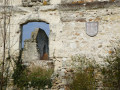
Essômes: the wash house featuring illustrations based on La Fontaine’s Fables.
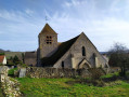
L’Abbaye: construction began in the 11th century and was completed in the 13th century.
Château-Thierry: the medieval town.
The Jean de La Fontaine Museum.

Always be cautious and plan ahead when you're outdoors. Visorando and the author of this route cannot be held responsible for any accidents occurring on this route.

The GR® and PR® markings are the intellectual property of the Fédération Française de Randonnée Pédestre.

Reviews and comments

4.7 / 5
Based on 2 reviews

Reliability of the description
4.5 / 5
Ease of following the route
4.5 / 5
Route interest
5 / 5
bcr
bcr

Overall rating : 4.7 / 5

Date of your route : Mar 30, 2021
Reliability of the description : ★★★★★ Very good
Ease of following the route : ★★★★☆ Good
Route interest : ★★★★★ Very good
Very busy route : No

Some lovely views,

Machine-translated

Penmarch77
Penmarch77

Overall rating : 4.7 / 5

Date of your route : May 27, 2019
Reliability of the description : ★★★★☆ Good
Ease of following the route : ★★★★★ Very good
Route interest : ★★★★★ Very good

A superb walk that takes in the hillsides of Champagne, historic sites, wooded areas and the banks of the Marne.
We completed it in 3 hours and 45 minutes.
There seem to be a few inaccuracies in the route description:
At point (2): “After the second junction, turn right and follow Rue de Bonneil for about a hundred metres.” As far as I can tell, there are three junctions.
At point (3): “At the end of the street, turn right and head up into the vineyards (steep slope).” I was a bit confused as, to me, it looks more like the road opposite. Unless I’ve made a mistake.
At the end, at point (15) “At the picnic area, turn right onto Rue du Bac”, you should be aware that Rue du Bac is quite a long way past the picnic area. You need to pass the lock and carry on.
But for the most part, the route description is accurate and very interesting.

Machine-translated

Other walks in the area

For more walks, use our search engine .

The GPS track and description are the property of this route's author. Please do not copy them without permission.