Charray to Sermérieu circular route

A short walk suitable for everyone. This walk partly follows the botanical trail in the commune of Vézeronce-Curtin.

Details

n°26442000
Creation:
Last update:
Last review:
  • Walking
    Activity: Walking
  • ↔
    Distance: 5.48 mi
  • ◔
    Average duration: 2h 50 
  • ▲
    Difficulty: Easy

  • ⚐
    Back to start: Yes
  • ↗
    Ascent: + 341 ft
  • ↘
    Descent: - 315 ft

  • ▲
    Highest point: 1,004 ft
  • ▼
    Lowest point: 751 ft

Description of the walk

Park in the Étang de Charray car park beside the RD19.

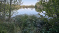
(S/E) To begin, take the path that climbs alongside the pond. Read the sign for the botanical trail, which starts here. Follow the path to the fork where the path becomes a trail on the left. Cross the sandy meadow and head into the marshes, walking along a boardwalk for several hundred metres. Then follow the edge of one of the Étangs de Charray to climb the hill.

(1) At the wider path, turn right and walk for about a hundred metres. Then turn left to continue along the botanical trail. Ignore the two paths branching off to the right and take the path that heads left to reach the viewpoint. Continue until you reach a junction with a wider path.

(2) Turn right onto it as it climbs. Carry on until you reach the road and the bus shelter.

(3) Take the road heading north-west, called Chemin Pinette. The road becomes a track: carry on straight ahead to reach the D244, Route de Morestel. Follow it to the left: this is the most challenging part of the route for 250 m.

(4) Then take the first road on the left, which leads downhill and becomes a track. Head slightly to the left and carry on for about 850 m until you reach a short descent with a hairpin bend.

(5) It’s barely visible and unmarked, so look out for a path that veers off to the right. If you reach an old fenced-in enclosure, you’ve missed it! Follow this track until you reach a field, which you go round to the left to find a path leading down towards the south. Carry on to the junction near the Route d’Olouise.

(6) Change direction and take the path on the left heading south-east. Continue to the houses and the tarmac road.

(7) In the hamlet, turn right then left onto a path that takes you back to the botanical trail, where you’ll see the signposts again. Carry on straight ahead to rejoin the route you started on.

(1) Go straight on, then turn right onto the path that goes downhill and leads directly to the car park (S/E).

Waypoints

  1. S/E : mi 0 - alt. 751 ft - Car park - Étangs de Charray
  2. 1 : mi 0.89 - alt. 814 ft - Junction of the circular loop
  3. 2 : mi 1.44 - alt. 938 ft - Junction
  4. 3 : mi 2.13 - alt. 909 ft - Crossroads and bus shelter
  5. 4 : mi 2.64 - alt. 961 ft - Junction
  6. 5 : mi 3.29 - alt. 955 ft - Chicane
  7. 6 : mi 3.64 - alt. 817 ft - Route d’Olouise
  8. 7 : mi 4 - alt. 833 ft - Hamlet
  9. S/E : mi 5.48 - alt. 751 ft - Car park - Étangs de Charray

Reviews and comments

4.7 / 5
Based on 1 review

Reliability of the description
5 / 5
Ease of following the route
5 / 5
Route interest
4 / 5
Héritier
Héritier

Overall rating : 4.7 / 5

Date of your route : Jun 22, 2026
Reliability of the description : ★★★★★ Very good
Ease of following the route : ★★★★★ Very good
Route interest : ★★★★☆ Good
Very busy route : Yes

If you’re not very experienced hikers and you fancy a leisurely stroll, this is the place to go – personally, I walk this route several times a year and in different seasons for birdwatching or nature walks; you can spot thrushes, the Eurasian jay, long-tailed tits and Eurasian jays stopping over during their migration in September – the site, designated as a Site d’Intérêt Spécial (ENS), is home to rare plants in areas of dry grassland, and you can also spot various butterflies, such as the Ascalaphus – for me, it’s a remarkable site, perfect for nature lovers and very well marked out

Machine-translated

aureliedebonnaire
aureliedebonnaire

Hello, I didn’t complete the whole circular route, but the section from the start to point 1 is virtually inaccessible; the botanical trail isn’t maintained at all: the vegetation has taken over, the wooden planks on the path are half-collapsed – it’s not at all pleasant...

Machine-translated

Other walks in the area

For more walks, use our search engine .

The GPS track and description are the property of this route's author. Please do not copy them without permission.