Circular walk from Boussières to Busy via the ‘4 chemins’, returning via the Roman road

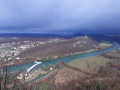
A long walk that will take you as far as Busy, returning via the Roman road and the ridge leading down to Boussières. There are several scenic viewpoints to enjoy, at Vorges, in the Bois de Gevrey or above Vorges. You may spot chamois if you keep quiet as you approach their resting area. On a very clear day, you can see the Vosges mountain range.

Details

n°1037705
Creation:
Last update:
Last review:
  • Walking
    Activity: Walking
  • ↔
    Distance: 10.02 mi
  • ◔
    Average duration: 5h 40 
  • ▲
    Difficulty: Moderate

  • ⚐
    Back to start: Yes
  • ↗
    Ascent: + 1,201 ft
  • ↘
    Descent: - 1,204 ft

  • ▲
    Highest point: 1,496 ft
  • ▼
    Lowest point: 748 ft
  • ⚐ Country: France
  • ⚐ City: Boussières (25320)
  • ⚑
    Start/End: N 47.158746° / E 5.900254°
  • ❏
    IGN map(s): Ref. 3323ET, 3323O, 3324ET
  • Hour-by-hour weather

Photos

Description of the walk

The route starts from the car park at the village hall.

(S/E) Head down Rue des Richets, then immediately take the D105 towards Besançon. Drive through the village and past the sawmill, then turn right towards the recycling centre.

(1) At the recycling centre, turn left onto the dirt track that leads into the woods and always keep left at the various junctions.

(2) When you reach the safety barriers at the entrance to the village, follow the D105 downhill.

(3) At the junction, take the cycle route on your right and ride carefully down between the rock faces to reach the canal roundabout and the entrance to the Canal Monsieur tunnel. Carry on and cross the canal to follow the left bank of the Doubs.

(4) At the end of the field and at the corner of an orchard, take the lovely path on the right towards the forest. Cross the Caillet Mill stream at a place known as ‘Pierre de Vorges’ via the new wooden bridge, as the stone bridge that used to span the stream has been destroyed.

(5) Walk up alongside the pasture and turn right at the three-way junction at the edge of the woods. Climb this short but steep slope to the top.

(6) At the crossroads, turn left onto Rue de Gevrey and enjoy the panoramic view over the Doubs valley. Continue through the woods until you reach a large crossroads.

(7) You are now at the four-way junction. Head straight on along the gently ascending path. As the descent begins, in a right-hand bend, a track emerges on the left, leading towards a clearly visible mound. Climb up to it.

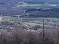
(8) At the Bois de Gevrey viewpoint, you’ll have a view of the ruins of the feudal castle of Montferrand, as well as the Doubs valley, which is very narrow at this point.
With a bit of luck, you may have spotted some chamois or their resting places at the foot of the rocks, marked by trails of droppings. You may also catch a glimpse of these agile creatures at least as far as the meadows, which you’ll reach via the path you’ve been following. As you leave the woods, walk alongside the bushes, cross the stream and head uphill past the shed.

(9) You’ll arrive at the edge of the hamlet of Moulinot. Turn right and head up towards Busy. When you reach the farm, turn right and walk through the village, using the left-hand pavement on Rue Principale

(10) At a wide bend to the right, carry on straight ahead along the Roman road and walk up past the houses. Continue in this way through woods and meadows. Ignore the side paths and walk past the farmhouse inn and the guesthouse.

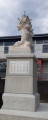
(11) At the next junction, keep left above the Courbey farm and walk straight through the woodland. You’ll emerge into meadows; turn right past the Vorges monument. Do not go past the bend to the left.

(12) Leave the Roman road at the entrance to the pasture and, at the corner by the bush, head up to the left, looking out for a gap in the foliage.

(13) You’ll soon reach the ridge, a well-marked path, which you’ll follow by turning right. You’re now at the highest point in the commune of Boussières. Follow this gently sloping path all the way along.

(14) When you reach the tarmac road, leave the woods on the right and join the D104. Then head towards Boussières on the left and walk through the village.

(15) At the Stop sign in front of the bakery, head uphill to the right, then immediately left into Rue des Richets. Walk uphill between some of the village’s oldest houses and return to your car park (S/E) .

Waypoints

  1. S/E : mi 0 - alt. 942 ft - Car park at the village hall
  2. 1 : mi 0.6 - alt. 1,037 ft - Recycling centre
  3. 2 : mi 0.99 - alt. 863 ft - Safety barriers on the D105
  4. 3 : mi 1.19 - alt. 807 ft - Cycle route in Thoraise - Doubs (rivière)
  5. 4 : mi 1.72 - alt. 761 ft - The Mill - Canal du Rhône au Rhin
  6. 5 : mi 2.48 - alt. 801 ft - Pierre de Vorges
  7. 6 : mi 2.96 - alt. 1,089 ft - Entrance to Vorges
  8. 7 : mi 3.61 - alt. 1,043 ft - The Four Paths
  9. 8 : mi 3.92 - alt. 1,106 ft - Bois de Gevrey viewpoint
  10. 9 : mi 4.56 - alt. 860 ft - Le Moulinot
  11. 10 : mi 5.31 - alt. 1,001 ft - Entrance to the Roman road
  12. 11 : mi 6.32 - alt. 1,280 ft - To the left, above the Courbey farm
  13. 12 : mi 7.75 - alt. 1,457 ft - Exit from the Roman road
  14. 13 : mi 7.85 - alt. 1,496 ft - Ridge line
  15. 14 : mi 9 - alt. 1,102 ft - Exit from the woods
  16. 15 : mi 9.85 - alt. 899 ft - Bakery
  17. S/E : mi 10.02 - alt. 942 ft - Car park at the village hall

Notes

There is a bakery in the village at the junction with the Route de Vorges.
Local grocery shop and adjoining bar serving light snacks.
A restaurant next to the bar, open for lunch every weekday.
Accommodation available at the Lodges of the Orée du Bois
You can cross the tunnel by using the stairs that span it.
On the other side, a sheltered picnic area has been set up along the lock.

Worth a visit

Boussières Church and its porch are listed as historic monuments.
Entrance to the canal tunnel.

Reviews and comments

4.7 / 5
Based on 1 review

Reliability of the description
5 / 5
Ease of following the route
5 / 5
Route interest
4 / 5
pnuninger
pnuninger

Hello.
Thank you very much for your very positive comments. It is true that the viewpoint is not protected, but as it is not signposted, few people go there.
Have a nice day.

Machine-translated

cuzcodom
cuzcodom

Overall rating : 4.7 / 5

Date of your route : Jan 18, 2026
Reliability of the description : ★★★★★ Very good
Ease of following the route : ★★★★★ Very good
Route interest : ★★★★☆ Good
Very busy route : No

A very beautiful hike: the first part allows you to discover the Doubs valley from a different angle than that of the N.D. du Mont chapel (notably at the Gevrey viewpoint, which is unfortunately very poorly maintained: it is true that it is a little dangerous for the unwary)...
Thanks to the creator.

Machine-translated

Other walks in the area

For more walks, use our search engine .

The GPS track and description are the property of this route's author. Please do not copy them without permission.