Blousson and Sembouès circular loop

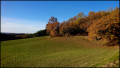
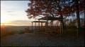
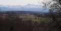
A lovely route starting and ending in Cazaux-Villecomtal, following the ridges with stunning views of varied landscapes. One slight drawback: most of the route follows a small, little-used tarmac road.

Details

27469047
Creation:
Last update:
Last review:
  • Walking
    Activity: Walking
  • ↔
    Distance: 7.38 mi
  • ◔
    Average duration: 3h 55 
  • ▲
    Difficulty: Moderate

  • ⚐
    Back to start: Yes
  • ↗
    Ascent: + 584 ft
  • ↘
    Descent: - 594 ft

  • ▲
    Highest point: 942 ft
  • ▼
    Lowest point: 568 ft

Photos

Description of the walk

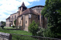
The walk starts and finishes in front of the church at Cazaux-Villecomtal. You can park below the church.

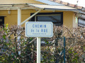
(S/E) With your back to the church and facing the Pyrenees, turn left. At the junction, follow the small road called Chemin de Crête. Walk past the town hall and keep to the right at the fork, staying on Chemin de Crête. Walk past the old school and carry on straight ahead. Stay on the same road and continue to the Tourmet fork.

(1) Take the road furthest to the left and join the D224. Continue to the left, passing a mobile phone mast and skirting the woods.

(2) At the hamlet of Jautou, at the fork, go straight on along the Chemin du Château d’Eau.

(3) Take the dirt track on the right: a pleasant stretch through the meadows with lovely views of the hillsides. Head towards the hamlet of Blousson.

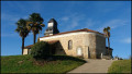
(4) When you reach a small church, turn left and walk alongside the cemetery. The view stretches far into the distance in the open areas. Pass the Chantre crossroads.

(5) Here you’ll find the lake and the pumping station on the left. To see it, leave the road and climb a little way up the hill. A lovely spot for a picnic. The lake is bordered by woodland. Once you’ve seen the lake, head back down and rejoin the road you left.

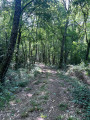
(6) At a place called Lagrange, atthe first junction after the lake, turn left onto the dirt track that climbs into the woods. At the top, you’ll reach a junction in open ground; go straight on. After the hamlet of Le Hournère, the track veers to the left and you’ll see the water tower in the distance. At the junction, turn left and join a tarmac road

(7) Turn left and keep left at the Fork in the road a few dozen metres further on.

(8) Near the water tower, head down to the right along the Chemin de Beoulaygue: I spotted two roe deer over there, in the meadows.

(9) Ignore the turn-off to the left for Béoulaygue and carry on straight on towards Sembouès. At the junction, turn left and walk past the church.

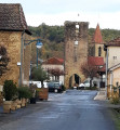
(10) When you reach the small roundabout in front of the town hall, turn left. Go straight on at the junction, taking the path that climbs up, called Côte de Larroque. This is the steepest part of the route, but there are some lovely houses along the way. You’ll reach the church at Cazaux-Villecomtal (S/E).

Waypoints

  1. S/E : mi 0 - alt. 804 ft - Église Saint-Martin (Cazaux-Villecomtal)
  2. 1 : mi 1.67 - alt. 889 ft - Crossroads
  3. 2 : mi 2.42 - alt. 843 ft - Jautou
  4. 3 : mi 3.34 - alt. 892 ft - Dirt track on the right
  5. 4 : mi 3.7 - alt. 768 ft - Église de l'Assomption (Blousson)
  6. 5 : mi 4.22 - alt. 676 ft - Lac de Le Chantre
  7. 6 : mi 4.44 - alt. 705 ft - Lagrange
  8. 7 : mi 5.09 - alt. 846 ft - Tarmac road
  9. 8 : mi 5.49 - alt. 843 ft - Béoulaygue Trail
  10. 9 : mi 6.34 - alt. 568 ft - Crossroads
  11. 10 : mi 6.75 - alt. 600 ft - Town Hall
  12. S/E : mi 7.37 - alt. 804 ft - Église Saint-Martin (Cazaux-Villecomtal)

Notes

No special equipment required. Remember to take water and a packed lunch. It took me 4 hours 30 minutes, including a stop at the lake.

Worth a visit

I didn’t go inside the church at Cazaux-Villecomtal, as I assumed it was closed.

Reviews and comments

4.2 / 5
Based on 3 reviews

Reliability of the description
4.3 / 5
Ease of following the route
4.3 / 5
Route interest
4 / 5
ritournelle
ritournelle

Hello, three-quarters of the route is on tarmac; the signposting is rather haphazard, so you’ll need to follow the route using your mobile phone. There’s plenty of shade, making it ideal for a morning walk in the summer.

Machine-translated

yannherbert
yannherbert

Overall rating : 4 / 5

Date of your route : Oct 24, 2023
Reliability of the description : ★★★★☆ Good
Ease of following the route : ★★★★☆ Good
Route interest : ★★★★☆ Good
Very busy route : No

There are certainly plenty of small tarmac roads, but they’re very quiet and offer stunning views of the surrounding valleys.
You can follow the route between ‘Berdot’ and point 8 via an unpaved track.
There are no signposts, so a map is required.

Machine-translated

D@niel
D@niel
• Edited:

Overall rating : 4.7 / 5

Date of your route : Dec 18, 2022
Reliability of the description : ★★★★★ Very good
Ease of following the route : ★★★★★ Very good
Route interest : ★★★★☆ Good
Very busy route : No

A pleasant and easy walk on this sunny autumn day in 2022 along a route that is, admittedly, very little used, although almost entirely tarmacked, with beautiful panoramic views of the Pyrenean mountains from the ridges in the first part of the route...

Machine-translated

berpyros
berpyros
• Edited:

Overall rating : 4 / 5

Date of your route : Nov 09, 2022
Reliability of the description : ★★★★☆ Good
Ease of following the route : ★★★★☆ Good
Route interest : ★★★★☆ Good
Very busy route : No

We followed the route partly in reverse the first time (which made it a bit tricky to find our way around) and then in full and the right way round the second time!
The walk mainly follows a quiet road with some stunning views of the Pyrenees and the hillsides of the Gers.
A real change of scenery is guaranteed amidst the meadows and farmland, with walks through villages featuring traditional houses and restored churches (Cazaux-Villecomtal Church).

Machine-translated

Other walks in the area

For more walks, use our search engine .

The GPS track and description are the property of this route's author. Please do not copy them without permission.